
Download
3D Flyover
Add to list
More
3.4 km
~56 min
159 m
Loop
“A compact volcanic loop above Porto Pim blends black-sand bay views, history, and punchy climbs.”
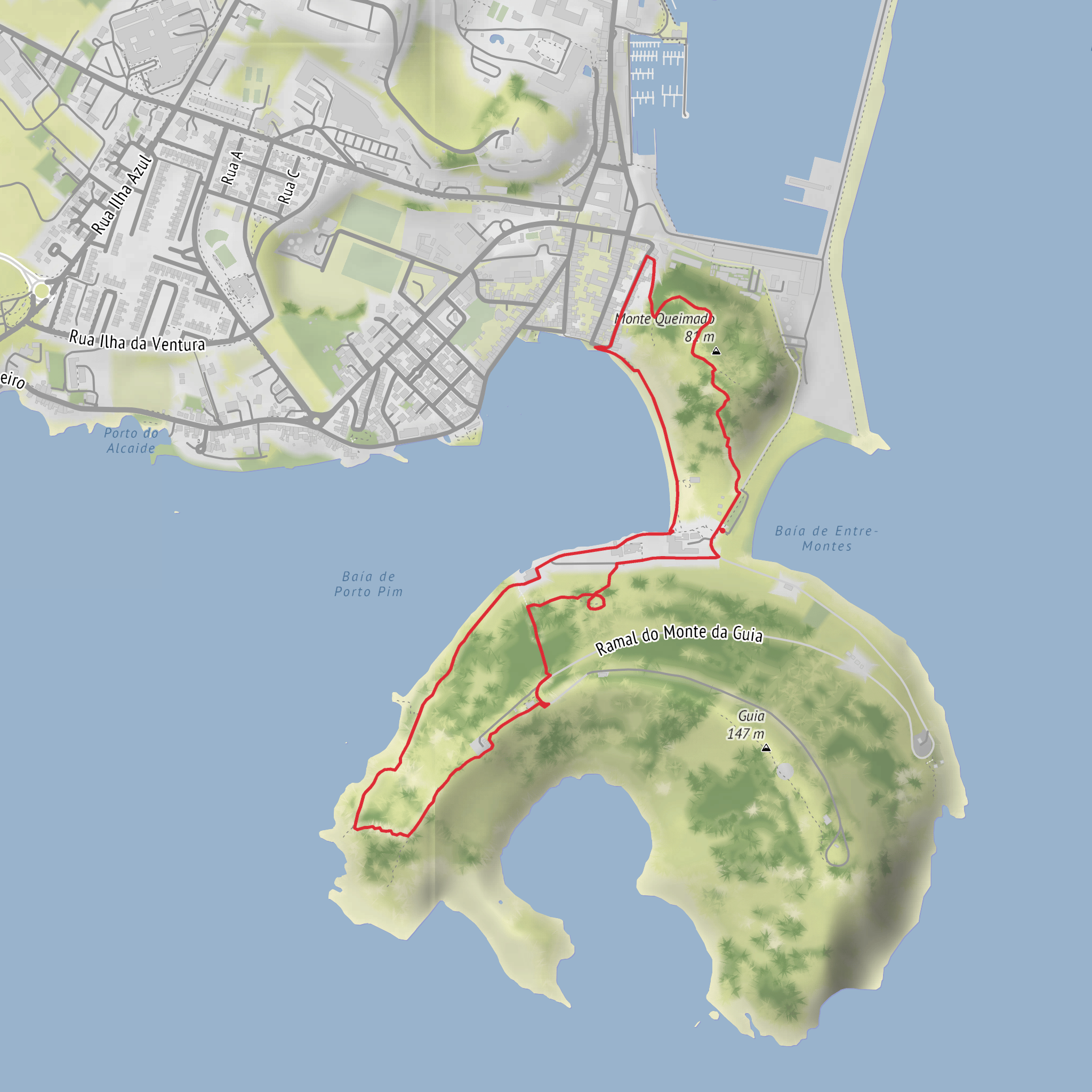
This short loop above and around Porto Pim packs a surprising amount into roughly 3 km / 1.9 miles, with about 200 m / 656 ft of climbing, so it feels more substantial than the distance suggests. The route sits on Faial Island’s south coast in Horta, weaving between Monte da Guia and Monte Queimado in the protected landscape above Porto Pim Bay. Official trail information for this area places the start and finish by the car park near Praia de Porto Pim, Horta, Faial, Azores, close to the Azores Sea Observatory (Observatório do Mar dos Açores) and the south end of Horta’s waterfront. (parquesnaturais.azores.gov.pt)
Expect a medium outing with short but punchy ascents, stone paths, steps, and some steeper sections where the elevation comes quickly. Although the mileage is modest, the route is not just a flat seaside stroll: the climb to the viewpoints and the rise onto Monte Queimado are what give it its medium rating. Good footwear is worthwhile, especially if the cobbles, dirt, or volcanic ground are damp. The route is best suited to hikers comfortable with uneven footing and repeated up-and-down terrain over a compact distance. The official trail guidance also emphasizes staying on the marked path and avoiding shortcuts. (parquesnaturais.azores.gov.pt)
The walk begins near Praia de Porto Pim, one of Horta’s best-known black-sand beaches, and quickly moves into a landscape where geology, sea views, and local history overlap. From the start area, the trail passes the Azores Sea Observatory, then climbs toward Lyre Viewpoint / Miradouro da Lira, a lookout named for the lyre-like shape formed by old stone vineyard walls in the protected landscape. From here, hikers can expect broad views over Porto Pim Bay, the town of Horta, the channel toward Pico, and on clear days São Jorge as well. (parquesnaturais.azores.gov.pt)
What to expect on the route
The first part of the loop is the most immediately scenic, with the bay below and the volcanic forms of Monte da Guia and Monte Queimado framing the coastline. This is an area of old cobbled access ways, stair sections, and short traverses that reveal different angles over the harbor and beach. Approximate distances can be thought of in thirds: the opening 1 km / 0.6 miles includes the initial climb toward the viewpoint; the middle section continues through the protected slopes and around the saddle between the two hills; the final 1 km / 0.6 miles returns by the beach and historic waterfront features. That pacing helps with planning breaks, especially if hiking with children or anyone who prefers frequent stops.
After the viewpoint, the route continues through the protected area between the two volcanic landforms. Monte Queimado is identified in official trail material as a terrestrial-genesis volcano, while Monte da Guia is described as a submarine surtseyan tuff cone, making this a particularly interesting walk for anyone curious about Faial’s volcanic origins. The terrain changes subtly as you move from built stone paths to more natural ground, and the higher points give excellent perspective on how these cones shape the bay and shelter Porto Pim. (parquesnaturais.azores.gov.pt)
Near the Monte Queimado side, the trail climbs again before reaching one of the best outlooks back toward Horta Marina. This second rise is where the route can feel steeper than expected for such a short loop. In windy or wet weather, take extra care here: exposed viewpoints and volcanic soils can make footing less secure, and the temptation to move quickly on the descent can lead to slips.
Landmarks, nature, and wildlife
Several notable landmarks sit along or beside the loop. The route passes the Azores Sea Observatory, the Porto Pim Aquarium, and the Dabney House, linked to the American Dabney family, who lived on Faial from 1806 to 1894 and left a major architectural and cultural legacy on the island. The area also includes the Chapel of Nossa Senhora da Guia on Monte da Guia, long associated with fishermen and sailors. These features give the walk a strong cultural layer in addition to its coastal scenery. (trails.visitazores.com)
Nature-wise, the route lies within the Monte da Guia Protected Landscape Area, and official tourism material highlights endemic Azorean flora along the trail. The protected setting also includes views toward the Caldeirinhas area and the wider coastal habitats around the bay. Seabirds are a reasonable expectation along the coast and cliffs, and the sheltered waters of Porto Pim often attract attention
Surfaces
Ground
Gravel
Unpaved
Cobblestone
Asphalt
Sand
Unknown
Concrete
Comments and Reviews
User comments, reviews and discussions about the Lyre Viewpoint, Praia de Porto Pim and Monte Queimado Loop, Portugal.
average rating out of 5
0 rating(s)
