
Download
3D Flyover
Add to list
More
36.8 km
2 days
1690 m
Multi Day
“Faial unfolds east to west in a windswept volcanic journey from green lanes to ash-grey drama.”
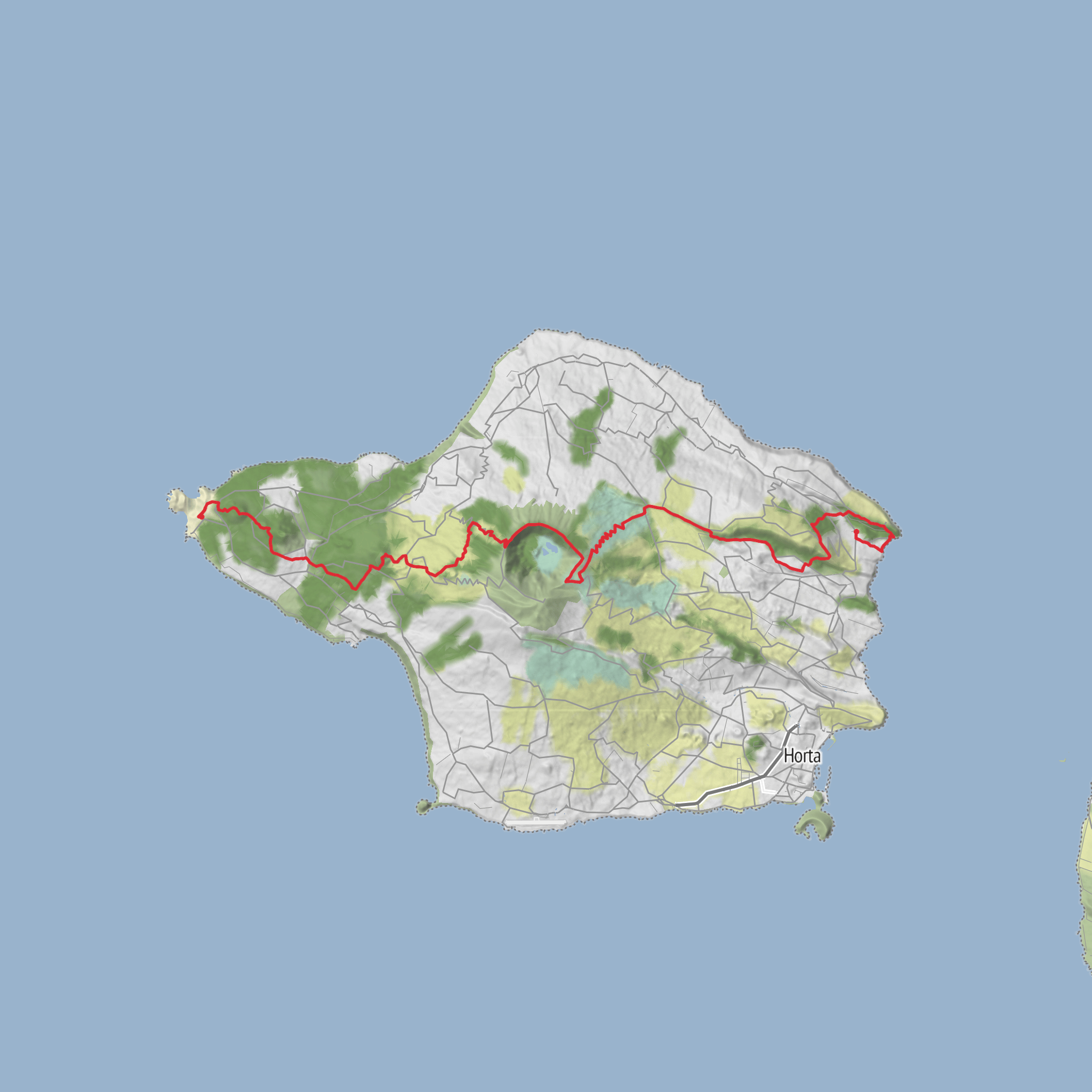
This coast-to-coast crossing of Faial is a full-island traverse of about 37 km / 23 miles with roughly 1,700 m / 5,575 ft of ascent, linking the island’s older eastern side near Ribeirinha to the stark volcanic west at Capelinhos. It is generally rated medium, but that can feel conservative because the route is long, often exposed, and includes repeated climbs and descents rather than one single sustained ascent. Expect a day that moves through farmland, hydrangea-lined lanes, volcanic ridges, native vegetation, crater country, and finally the ash-and-lava landscapes of Capelo and Capelinhos. Official Azores trail material describes this as Faial’s great route, beginning in Ribeirinha, passing the Caldeira, and ending at the Capelinhos volcano. (turismo.azores.gov.pt)
The start is best understood as Ribeirinha, Faial, Azores, on the island’s east side rather than an isolated trailhead in open country. The finish is at the Capelinhos Volcano / Capelinhos Volcano Interpretation Centre, a well-known landmark on the far west of Faial. If you are planning transport, that point-to-point layout matters: you will usually want to arrange a car shuttle, taxi, or pickup at the western end rather than expect to loop back easily. Public transport on Faial exists, but service is limited compared with mainland hiking destinations, so schedules should be checked locally in Horta before committing to a same-day return. The island’s main gateway is Horta, reached via Faial Airport or ferry connections, and from Horta you would typically drive or take local transport toward Ribeirinha to begin. (turismo.azores.gov.pt)
For drivers, the simplest plan is to leave one vehicle near Capelinhos Volcano Interpretation Centre, Capelo, Faial, then drive a second vehicle to Ribeirinha parish for the start. If using one car only, a taxi transfer to Ribeirinha before dawn or an arranged pickup from Capelinhos is usually more practical than trying to improvise at the end of a long day. Horta is the obvious base for the night before, with road access radiating across the island. Because this is a crossing rather than a circuit, build transport into the plan as carefully as food and weather.
What the route feels like
The eastern opening is greener, more settled, and more agricultural, with old lanes, pasture boundaries, and broad Atlantic views. As the route gains height toward the island’s center, the terrain becomes more volcanic and more dramatic. The middle section around the Caldeira is one of the defining parts of the walk: Faial’s great central crater is about 2 km / 1.2 miles wide and around 400 m / 1,312 ft deep, and the route gives a sense of crossing the island’s geological backbone. From there, the trail trends west through the chain of volcanic cones that built much of the island, before descending toward the Capelo peninsula and the extraordinary final approach to Capelinhos. (visitazores.com)
Although the total distance is moderate for a strong day hiker, the route is not especially quick. Mud, wind, rough volcanic footing, and exposed ridgelines can slow progress. In poor weather, the central high ground can feel much more serious than the “medium” label suggests. Allow a full day, and many hikers will be happier starting early enough to give themselves generous daylight.
Landmarks, terrain, and notable sections
In the first third, expect a transition from inhabited eastern Faial into higher, more open ground. This part helps tell the island’s story: the route is often described as a geological journey from the oldest eastern formations across the central volcano and onward to the youngest western landscapes. That progression is one of the walk’s biggest strengths, because the scenery changes in a way that feels coherent rather than random. (visitazores.com)
The Caldeira do Faial Nature Reserve is the visual and ecological centerpiece. This dormant volcanic crater dominates the island’s interior and contains one of the Azores’ most important native habitats. Around this section, weather can shift quickly; cloud can erase views in minutes, and wind exposure is often the main challenge. If visibility is good, this is where you get the broadest sense of Faial’s shape and the neighboring islands beyond. (parquesnaturais.azores.gov.pt)
Beyond the Caldeira, the route connects with the volcanic alignment often associated with the Dez Vulcões / Ten Volcanoes area. Here the walking becomes more obviously volcanic, with cones, rid
AI Planner
Days planned around your pace, with somewhere to stay each night.
Surfaces
Unknown
Unpaved
Asphalt
Dirt
Ground
Sand
Gravel
Paved
Grass
Cobblestone
Comments and Reviews
User comments, reviews and discussions about the Faial Coste a Coste, Portugal.
average rating out of 5
0 rating(s)



