
Download
3D Flyover
Add to list
More
7.8 km
~1 hrs 56 min
236 m
Point to Point
“A misty levada threads volcanic highlands, hidden crater greenery, and mossy laurel woods.”
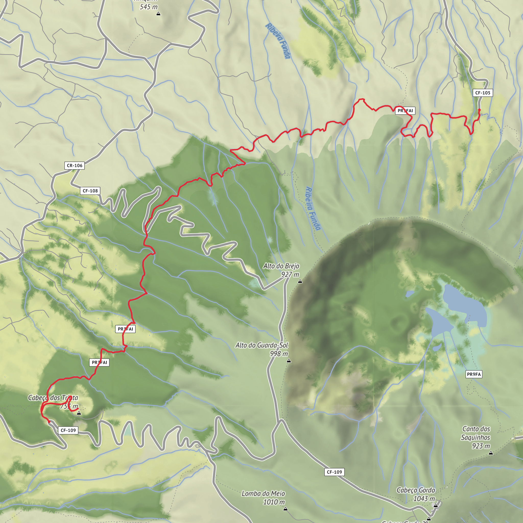
This roughly 8 km / 5 mile point-to-point walk on Faial follows one of the island’s most unusual upland routes: a historic levada threading between Cabeço dos Trinta, a volcanic cone in Capelo parish, and Alto do Chão, near the Cedros/Praia do Norte side of the island. Official sources describe the route at about 7.6 km to 10 km depending on whether the out-and-back detour to the cone tunnel is included, with the trail sitting mostly between 641 and 718 m elevation; for planning purposes, treating it as an around 8 km / 5 mile hike with about 200 m / 656 ft of cumulative ascent is sensible. (parquesnaturais.azores.gov.pt)
The character of the walk is less about steep climbing and more about atmosphere. This is a damp, high-country traverse through native vegetation, old waterworks, drainage crossings, and occasional openings toward the volcanic spine of western Faial. Although your difficulty estimate of Medium fits well for most hikers, that rating comes more from footing, exposure to weather, and the point-to-point logistics than from raw elevation gain. The ground can be muddy, slick, and rooty, and mist can reduce visibility quickly at this altitude. (acores9.com)
The start is best understood as being near Cabeço dos Trinta in Capelo parish, Faial Island, Azores, rather than at a street address. The finish is Alto do Chão, near Joana Alves/Ribeira Funda on the Cedros side of Faial. Those are the nearest named landmarks consistently associated with the route. (parquesnaturais.azores.gov.pt)
What the route is like
From the Cabeço dos Trinta side, the trail begins on a dirt road and quickly offers a worthwhile detour to the tunnel that leads into the volcanic cone. This is one of the defining features of the hike: instead of simply viewing the cone from outside, the route allows access through a tunnel into its interior, where the crater is filled with lush endemic vegetation. After returning to the main track, the route passes a water storage tank and then meets the levada itself. (parquesnaturais.azores.gov.pt)
Once on the levada, the walking becomes more rhythmic and nearly horizontal. The channel guides the route across the slope, with small drainage lines, damp crossings, and restored sections of the watercourse breaking up the flow. The trail is not especially technical, but it rewards steady attention underfoot, especially after rain. Waterproof footwear with reliable grip is a strong choice here. (acores9.com)
Clearings appear from time to time, and these are where the broader landscape reveals itself. You can expect views toward the alignment of volcanic cones in the Capelo Volcanic Complex, a reminder that this is a walk through terrain shaped by repeated eruptions rather than a simple forest ramble. The route sits in a transition zone between volcanic uplands and humid native woodland, so the scenery alternates between enclosed green corridors and more open volcanic panoramas. (parquesnaturais.azores.gov.pt)
Nature, terrain, and wildlife
One of the strongest natural features of the hike is the presence of Azorean endemic vegetation. Sources for the trail specifically note Laurus azorica (Azorean laurel), Frangula azorica (Azorean buckthorn), Ilex azorica (Azorean holly), and Erica azorica (Azorean heather). In wet weather these woods can feel almost cloud-forest-like, with dense greenery, mossy surfaces, and a cool, sheltered atmosphere. (parquesnaturais.azores.gov.pt)
Birdlife is another highlight if conditions are quiet. The trail area is noted for Azorean subspecies including the blackbird, goldcrest, and chaffinch. Hikers are more likely to hear them before seeing them, especially in the denser sections near the cone and along the wooded levada. (parquesnaturais.azores.gov.pt)
Because this is a wet upland route, hikers should also expect mud, slick stones, wet grass, and occasional standing water. Even on a relatively short outing, bring a waterproof layer, an insulating layer, and
Surfaces
Unknown
Ground
Gravel
Asphalt
Comments and Reviews
User comments, reviews and discussions about the Cabeco dos Trinta and Alto do Chao, Portugal.
average rating out of 5
0 rating(s)
