
Baleeiros, Porto do Caldeirao, Ribeira Funda, Porto da Faja and Ponta da Varadouro
Download
3D Flyover
Add to list
More
26.9 km
~6 hrs 36 min
744 m
Point to Point
“Faial’s wild whaling coast unfolds in windswept greens, black lava, and endless Atlantic horizons.”
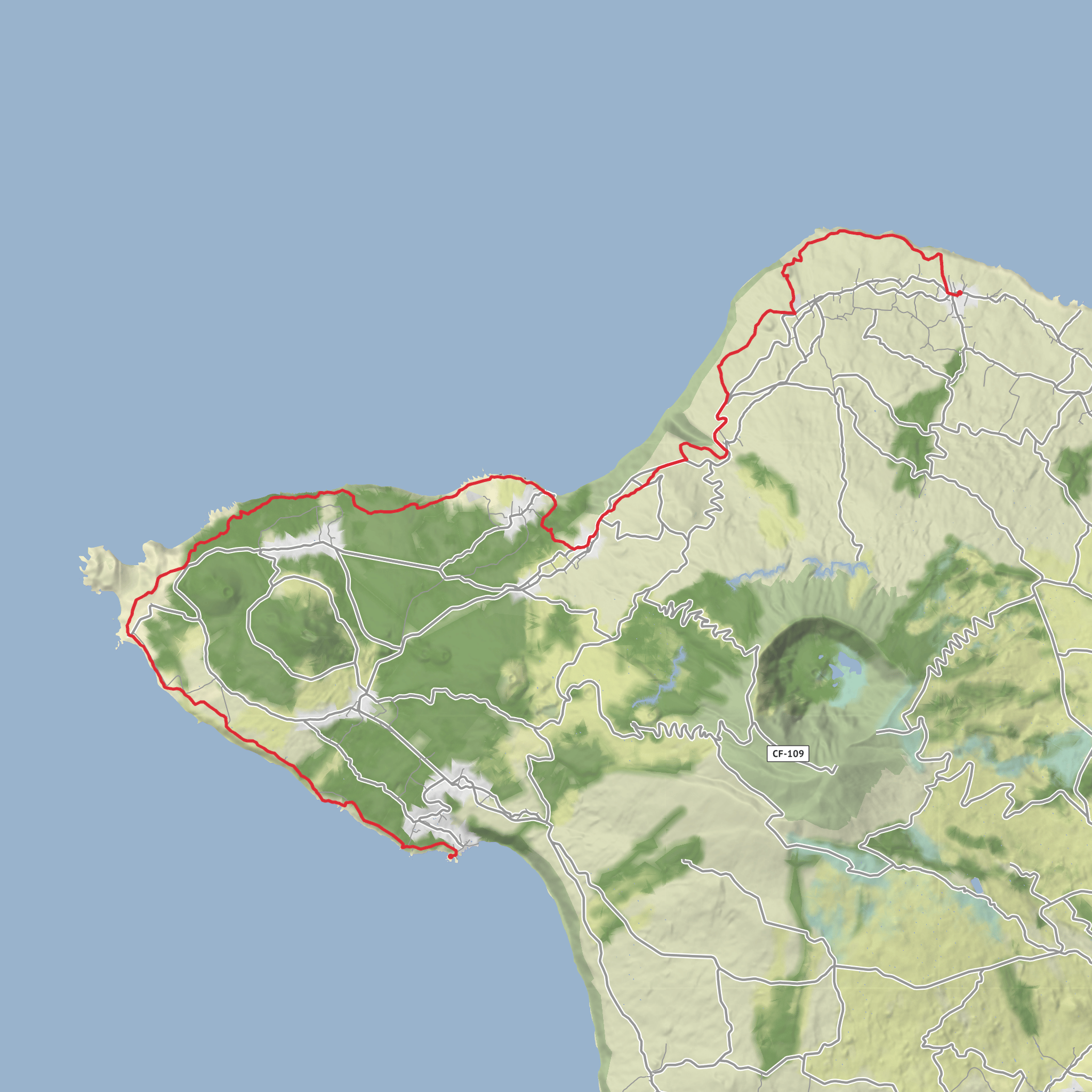
This is a long coastal crossing on Faial that links the parish of Cedros with Varadouro on the island’s northwest and west side, following old rural tracks, lanes, and sections near the sea for roughly 26–27 km / 16.2–16.8 miles with about 800 m / 2,625 ft of ascent. Although you’ve rated it as medium, it is officially listed as difficult on the Azores trail network, mainly because of its length rather than technical terrain, so it suits hikers who are comfortable being on foot for around 7 hours and managing a full-day point-to-point outing. (trails.visitazores.com)
The route begins near the Church of Santa Bárbara in Cedros, on or just off EN1-1A, Cedros, 9900-341 Faial, which is the clearest nearby landmark for the trailhead. It finishes at the former Whaling Station at Varadouro, beside the natural swimming area and harbor at Varadouro, Capelo, Faial, a well-known west-coast landmark rather than a formal street address. (trails.visitazores.com)
Expect a hike defined by exposure, big ocean views, pastoral landscapes, volcanic geology, and repeated reminders that this coast was shaped as much by whaling and eruptions as by wind and surf. The walking is not especially technical in the mountaineering sense, but the distance, rolling terrain, and occasional road or rough-track sections make pacing important. In wet weather, grassy and earthen stretches can become slick, and in exposed areas there is little shelter from sun, wind, or rain. The official trail guidance also stresses staying on the marked route, avoiding shortcuts, and closing gates behind you, which matters here because much of the route passes through working rural land and protected natural areas. (trails.visitazores.com)
What the route feels like
From Cedros, the trail heads west along old rural ways that once connected isolated coastal communities and working landscapes. Early on, the terrain is typically a mix of pasture edges, farm tracks, and open country, with the Atlantic constantly nearby even when it drops out of sight behind folds in the land. The first several kilometres are a good place to settle into rhythm rather than push pace, because the day is long and the route keeps adding small climbs that accumulate into the total elevation gain.
One of the first major scenic stops is Ribeira Funda, where the official route passes a viewpoint set within a picnic area. This section gives a strong sense of Faial’s north coast: steep ravines, abrupt green slopes, and a coastline broken by lava-built shelves and inlets. Ribeira Funda is also one of the places where the route’s isolation becomes clear; even when the footing is straightforward, the terrain around you feels cut off and elemental. (trails.visitazores.com)
Farther on, the trail reaches the area of Ribeira das Cabras viewpoint, another standout stop with views over the lava fajã of Praia do Norte and toward the Capelo Peninsula. A fajã is a flat coastal platform created by lava flows or landslides, and here that geology is central to the character of the walk: black basalt, abrupt cliffs, and low coastal shelves contrasting with green pasture above. This is one of the best stretches for understanding how volcanic Faial is, even away from the island’s most famous eruption sites. (trails.visitazores.com)
Landmarks, geology, and historical context
The name and spirit of the route are tied to Faial’s whaling history. Along the trail, references to whale lookouts and whaling stations are a recurring theme. The official trail information notes that a whale lookout once stood at the old port of Cedros but was destroyed in the July 9, 1998 earthquake, while the lookout at Costado da Nau in the Capelinhos area is now in ruins. Other lookouts, including Cabeço da Vigia and Alto das Concheiras, remain associated with cetacean observation. This gives the hike unusual historical depth: it is not just a scenic traverse, but a route through landscapes once used to spot and pursue sperm whales, an industry that was economically important to Faial from the 19th century into the late 20th century. (trails.visitazores.com
AI Planner
Days planned around your pace, with somewhere to stay each night.
Surfaces
Unknown
Unpaved
Asphalt
Ground
Gravel
Grass
Sand
Paved
Cobblestone
Comments and Reviews
User comments, reviews and discussions about the Baleeiros, Porto do Caldeirao, Ribeira Funda, Porto da Faja and Ponta da Varadouro, Portugal.
average rating out of 5
0 rating(s)
