
Download
3D Flyover
Add to list
More
14.8 km
~3 hrs 41 min
437 m
Loop
“Atlantic cliffs, wild coves, and rolling headlands make this Sintra circuit feel thrillingly untamed.”
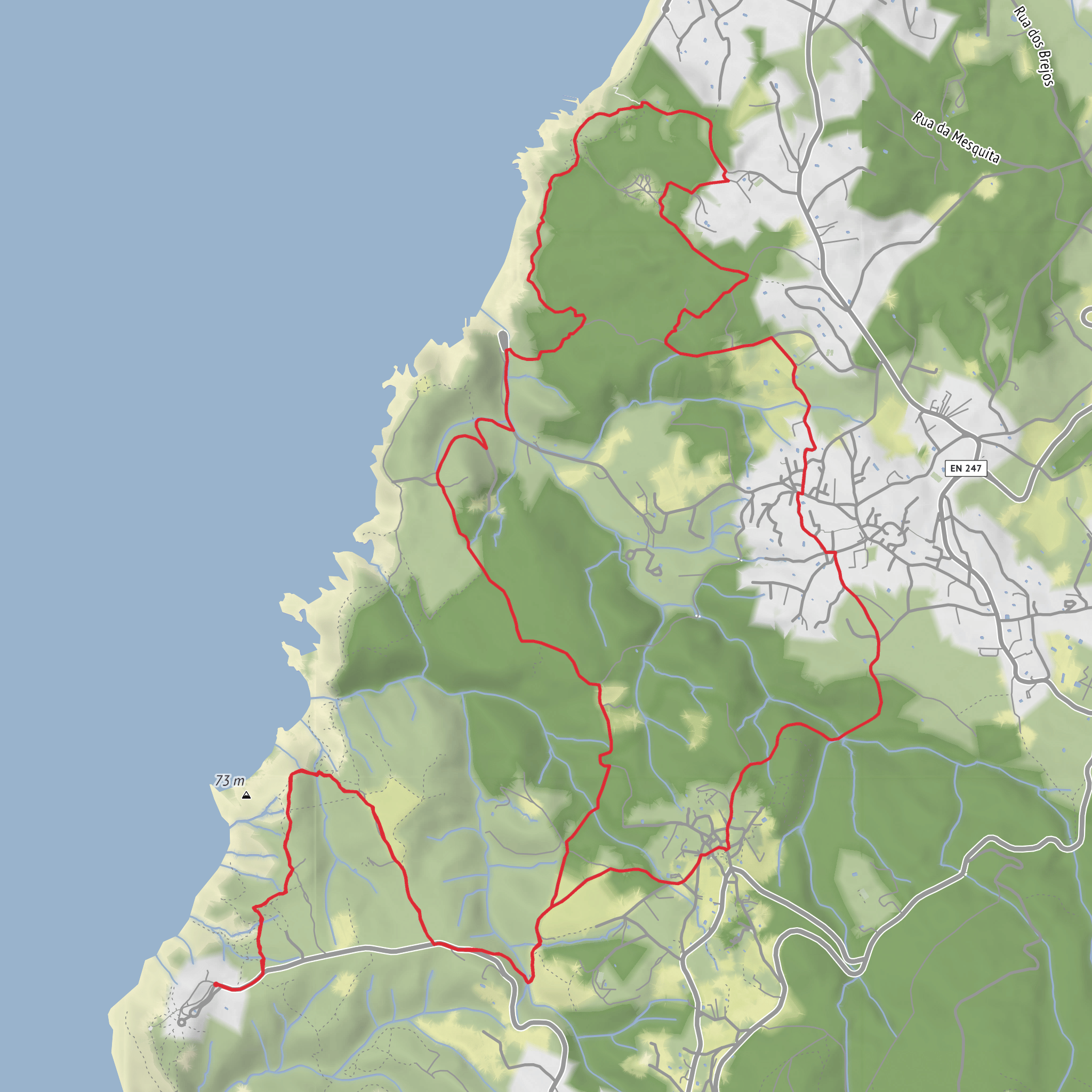
This coastal circuit in the Sintra-Cascais Natural Park packs a lot into a moderate outing: sea cliffs, exposed headlands, sandy coves, scrub-covered slopes, and long Atlantic views that can make a 15 km / 9.3 mi walk feel bigger than the numbers suggest. With around 400 m / 1,300 ft of elevation gain, the route is not especially high, but the repeated ups and downs, uneven ground, and wind exposure give it a solid medium feel. The usual start and finish is at the Cabo da Roca Tourist Office and lighthouse area, the well-known headland at Cabo da Roca, Colares, Sintra, Portugal. (cm-sintra.pt)
The opening stretch is dramatic from the outset. Cabo da Roca is the westernmost point of mainland Europe, and the setting is defined by sheer cliffs, open ocean, and a sense of standing at the edge of the continent. Expect broad, exposed walking early on, often with strong Atlantic wind. Even on a mild day, the combination of salt air, sun, and gusts can make conditions feel harsher than forecast, so a wind layer is worth carrying. The terrain is typically a mix of dirt path, rocky sections, and sandy or loose patches near the coast, with some short steeper descents and climbs as the trail works around ravines and cliff-backed beaches. (en.wikipedia.org)
What the route feels like
From the headland, the trail moves through a landscape shaped by Atlantic weather and the geology of the Serra de Sintra’s western edge. The walking alternates between open clifftop sections and more sheltered inland segments through low vegetation and rural pockets. Because the route is roughly 15 km / 9.3 mi, many hikers should allow about 4 to 5 hours of moving time, with extra time for viewpoints, beach detours, and weather delays. The elevation gain is spread across multiple rises rather than one single climb, so it often feels like a sequence of rolling efforts instead of a sustained ascent. (cm-sintra.pt)
One of the key things to prepare for is exposure. There is little protection from wind on the outer sections, and cliff edges demand care, especially after rain or in fog. The ground can become slippery where dust, sand, and worn rock combine. If visibility drops, route-finding becomes more important, so having the route loaded in HiiKER is a smart precaution. Water is also important, as services are concentrated near Cabo da Roca rather than spread evenly along the trail. (cm-sintra.pt)
Landmarks, coastline, and natural features
The standout landmark is the Cabo da Roca Lighthouse, a historic beacon on one of Portugal’s most iconic capes. The cape is also tied to the famous description by Luís de Camões of the place “where the land ends and the sea begins,” a line closely associated with Portugal’s maritime identity. This gives the walk a strong historical atmosphere even before reaching any built heritage: the landscape itself is part of the story of Atlantic navigation, exploration, and the long relationship between Portugal and the ocean. (trilhos.travelookapp.com)
As the route continues, hikers can expect views toward wild beaches and eroded cliff formations. Praia da Ursa, about 800 m / 0.5 mi down the road from Cabo da Roca, is one of the area’s best-known coastal landmarks, though access to the beach itself is much steeper and more demanding than the main PR7 walk. Near the Adraga side of the route, walkers may also encounter notable geological features such as Buraco do Fojo, a natural opening in the cliffs descending toward the sea. These features are part of what makes the route feel less like a simple coastal stroll and more like a tour through an active, weather-carved shoreline. (sintraportugaltourism.com)
The wider setting is the Sintra-Cascais Natural Park, a protected area that runs from the Serra de Sintra to the Atlantic coast. This protected status matters on the ground: the route passes through habitat shaped by maritime exposure, with hardy coastal vegetation, low scrub, grasses, and seasonal wildflowers rather than dense forest. Birdlife can be rewarding, especially seabirds and soaring species using the cliff winds. The park is also known for rich biodiversity and a long record of human occupation, including prehistoric remains elsewhere within its boundaries, which adds depth to the sense that this is both a natural and cultural landscape. (en.wikipedia.org)
Difficulty and what to watch for
Although rated medium, this hike can feel harder in poor weather. Wind is the biggest variable, followed by heat and footing
Surfaces
Unknown
Sand
Asphalt
Gravel
Dirt
Ground
Cobblestone
Unpaved
Paved
Comments and Reviews
User comments, reviews and discussions about the PR7 - SNT - Cabo da Roca, Portugal.
average rating out of 5
0 rating(s)
