
Download
3D Flyover
Add to list
More
14.9 km
~3 hrs 49 min
508 m
Point to Point
“A lush, tunnel-laced journey traces São Miguel’s hidden water heritage through volcanic slopes and spring-fed wonder.”
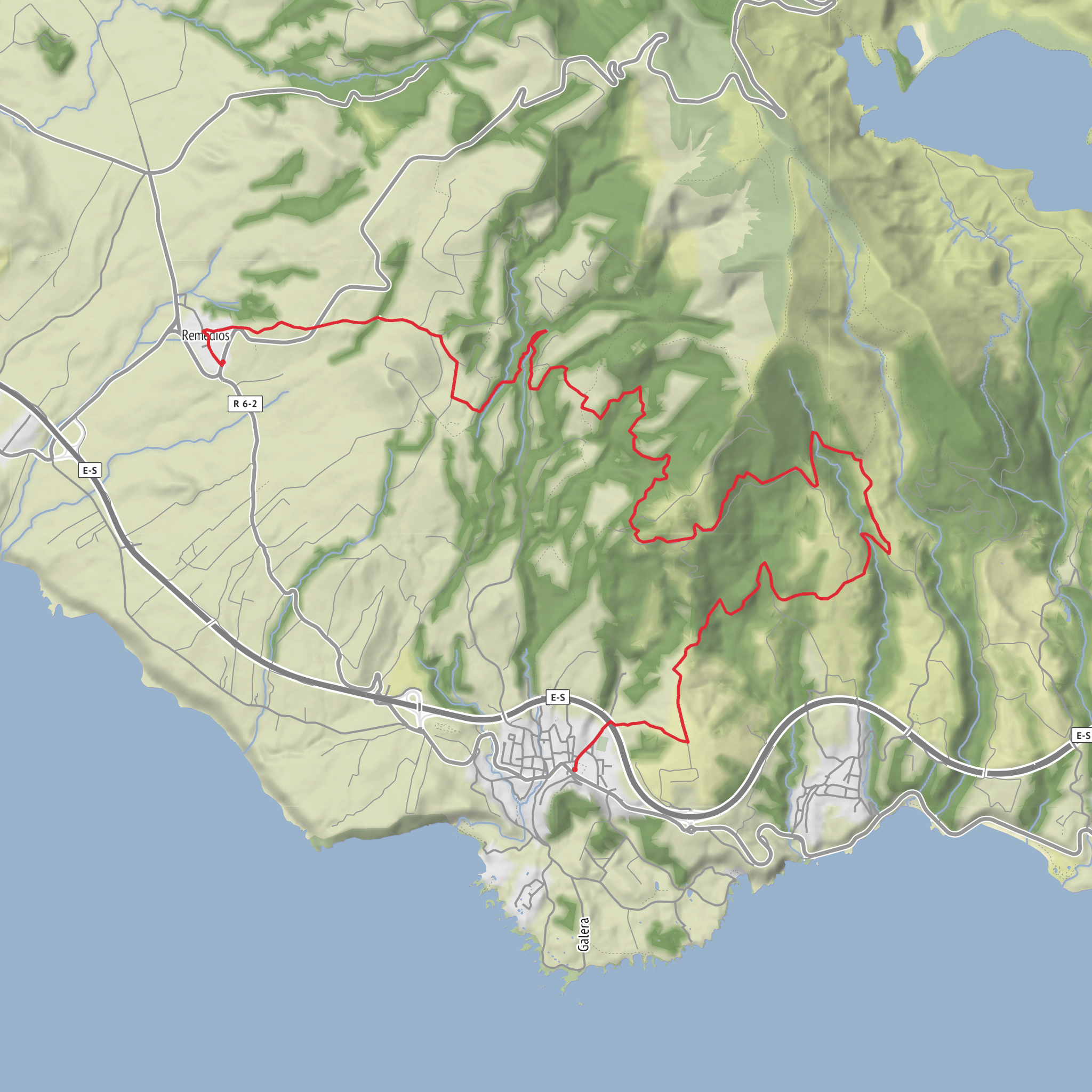
This 15.1 km / 9.4 mile linear walk on São Miguel links the hamlet of Remédios with the village of Água de Pau, following old service paths once used to capture, carry, and monitor water for the municipality of Lagoa. It is generally rated medium difficulty, with roughly 500 metres / 1,640 feet of elevation change across a route that ranges from about 111 to 502 metres above sea level. Expect around 5 hours of walking time, though tunnel crossings, photo stops, and wet footing can easily stretch the day. (trails.visitazores.com)
The start is at Casa da Água Trail Point, near Ermida de Nossa Senhora dos Remédios in the Remédios area of Lagoa, São Miguel. That trail point is a converted former milk station now used as a hiking support and environmental awareness center, and it sits just a short distance from the chapel. The finish is in the center of Água de Pau, so this is best planned as a one-way outing unless you arrange a return transfer. (trails.visitazores.com)
For hikers arriving by car, the simplest plan is usually to park near Casa da Água at Remédios and arrange pickup in Água de Pau, or reverse that logic and leave a second vehicle in Água de Pau before starting. If using public transport, the practical approach is to travel into the municipality of Lagoa and then connect locally by taxi or bus toward Remédios, with the return from Água de Pau generally easier because it is a larger village on the south side of the island. Because local schedules can change, it is worth checking same-day connections before setting out. (trails.visitazores.com)
What the route feels like
The character of this walk is defined less by summit drama and more by water engineering woven into a lush volcanic landscape. From the start near Remédios, the trail heads onto dirt farm access tracks and then into a sequence of old water-management corridors. You pass features tied to the work of the agueiros—the people responsible for directing and maintaining water supplies—including bridges, aqueducts, clay पाइप-style conduits, levadas, and inspection tunnels. This gives the route a very distinctive feel: part nature walk, part heritage trail, part hidden infrastructure tour. (trails.visitazores.com)
The first section gradually gains height as it moves inland along the southern slopes of the Água de Pau volcanic massif, often through pasture edges, damp vegetation, and forested stretches. The footing can vary from straightforward farm track to muddier, narrower sections where moisture lingers. Because the route shares some segments with other marked trails, careful attention to waymarking is important, especially at junctions. If carrying a navigation aid, use HiiKER alongside the official trail markings. (trails.visitazores.com)
Tunnels, springs, and key landmarks
One of the most memorable parts of the hike is the run of tunnels before reaching Janela do Inferno. These are not decorative features; they were cut to allow water conduits to pass through terrain that would otherwise block a direct line. A torch or headlamp is specifically recommended for this route, and that is one of the main preparation points hikers should take seriously. Tunnel interiors can be dark, damp, and slick underfoot, so shoes with dependable grip are important. (trails.visitazores.com)
At Janela do Inferno, the route reaches a vertical, spring-fed wall where water seeps through the rock and collects in a small pool. This is one of the signature natural landmarks of the wider Rota da Água network and a place where the volcanic geology and the island’s abundant freshwater become especially obvious. The area is also noted for sightings of newts, with the official trail description specifically mentioning them in different life stages. Wildlife should be observed quietly and not disturbed. (trails.visitazores.com)
After the split with the PRC37 Janela do Inferno route, this trail continues toward Água de Pau. Farther on, there is a viewpoint at Pico do Raposo, followed by old bridges and a fontanário (public fountain). These features break up the middle and later stages
Surfaces
Unknown
Ground
Concrete
Dirt
Asphalt
Grass
Comments and Reviews
User comments, reviews and discussions about the Rota da Água and Entre Túneis e Condutas, Portugal.
average rating out of 5
0 rating(s)
