
Download
3D Flyover
Add to list
More
7.3 km
~2 hrs 28 min
612 m
Out and Back
“A steep, mist-haunted climb through laurel wilds to São Miguel’s roof rewards the well-prepared.”
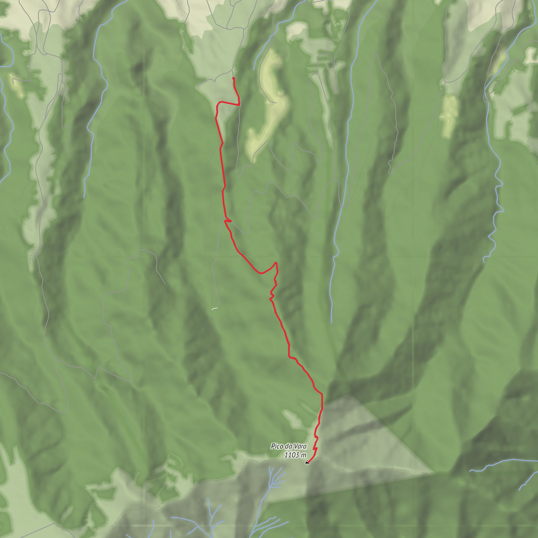
This is a short but demanding out-and-back climb to the highest point on São Miguel, rising to about 1,103–1,105 m / 3,619–3,625 ft inside one of the island’s most sensitive protected landscapes. Although the total distance is only around 7 km / 4.3 miles, the route gains roughly 600 m / 1,970 ft, so it feels much bigger than the mileage suggests. The trail is generally considered difficult because the climbing is sustained, the ground can be muddy and slick, and weather on the ridge can change quickly. Access is regulated, and the Azores Natural Parks note that hikers must arrange authorization before using the trail. (parquesnaturais.azores.gov.pt)
The usual start is reached by a secondary road from Algarvia toward the Pico Alto / Serra da Tronqueira area, where the official trail panel stands near the forest road access. If you are converting the trailhead description into a practical landmark, the nearest widely recognized reference is the Pico Alto / Serra da Tronqueira trail access above Algarvia, Nordeste, São Miguel rather than a street address in a town center. Official Azores trail material consistently describes the approach this way. (visitazores.com)
By car, the simplest approach is from Nordeste or Povoação, driving toward Algarvia and then following the mountain road toward Pico Alto / Serra da Tronqueira until the signed trail start. Roads are narrow and often misty at elevation, so allow extra time. Public transport is much less straightforward: buses can connect larger settlements on São Miguel with Nordeste/Algarvia, but the final mountain approach to the trailhead is remote and typically not served directly, so most hikers will need a taxi for the last section or a pre-arranged transfer. Because schedules can change and the access rules are controlled, it is wise to confirm both transport and permit logistics before setting out, and to load the route in HiiKER in advance. The official park information also notes that access to the trail is conditioned by prior application. (parquesnaturais.azores.gov.pt)
What the route is like
The path begins on a dirt and forest track and quickly makes it clear that this is not a casual stroll. Early on, the route climbs through managed woodland and then transitions into more natural vegetation as you move deeper into the protected uplands. The grade steepens in sections, and after rain the surface can be greasy underfoot, with mud, roots, and worn patches that demand careful foot placement. On a hike of only 7 km / 4.3 miles, that 600 m / 1,970 ft of ascent is concentrated enough to make pacing important from the start. (parquesnaturais.azores.gov.pt)
As you gain height, the landscape opens toward the Planalto dos Graminhais, one of the key upland features of this part of São Miguel. Near the upper section, a junction leads to the geodesic marker on the summit of Pico da Vara. From there, official descriptions highlight broad views over the Povoação crater to the south, Graminhais, Furnas and its lake to the west, and farther volcanic massifs including Fogo and Sete Cidades in clear weather. Cloud can erase those views in minutes, so hikers should be prepared for a summit that may be cold, wet, and wind-exposed even when the coast is mild. (parquesnaturais.azores.gov.pt)
The return follows the same route, which means the descent deserves as much respect as the climb. Steep muddy sections can be more awkward going down than up, especially if boots are caked and visibility drops. Trekking poles can help, but the bigger advantage is conservative timing: start early enough that you are not rushing the descent in deteriorating weather. Recent rehabilitation work on part of the route was carried out specifically to reduce visitor impact and improve sustainable use in this ecologically sensitive area, but that does not remove the mountain character of the hike. (portal.azores.gov.pt)
Nature, wildlife, and what to look out for
This hike passes through one of the most important conservation areas in the Azores. Pico da Vara lies within the Pico da Vara Nature Reserve and the protected Tronqueira and Planalto dos Graminhais habitat area, which preserves one of São Miguel’s most significant remnants of native laurel forest. The reserve is also part of the Natura 2000 network and is recognized as an important bird and biodiversity area. (turismo.azores.gov.pt)
The standout species here is the Azores bullfinch (Pyrrhula murina), known
Surfaces
Ground
Unknown
Gravel
Comments and Reviews
User comments, reviews and discussions about the Pico da Vara, Portugal.
average rating out of 5
0 rating(s)



