
Download
3D Flyover
Add to list
More
6.1 km
~1 hrs 39 min
266 m
Loop
“A compact Azorean loop weaving watermills, ravines, cliff views, and endemic flora into one vivid outing.”
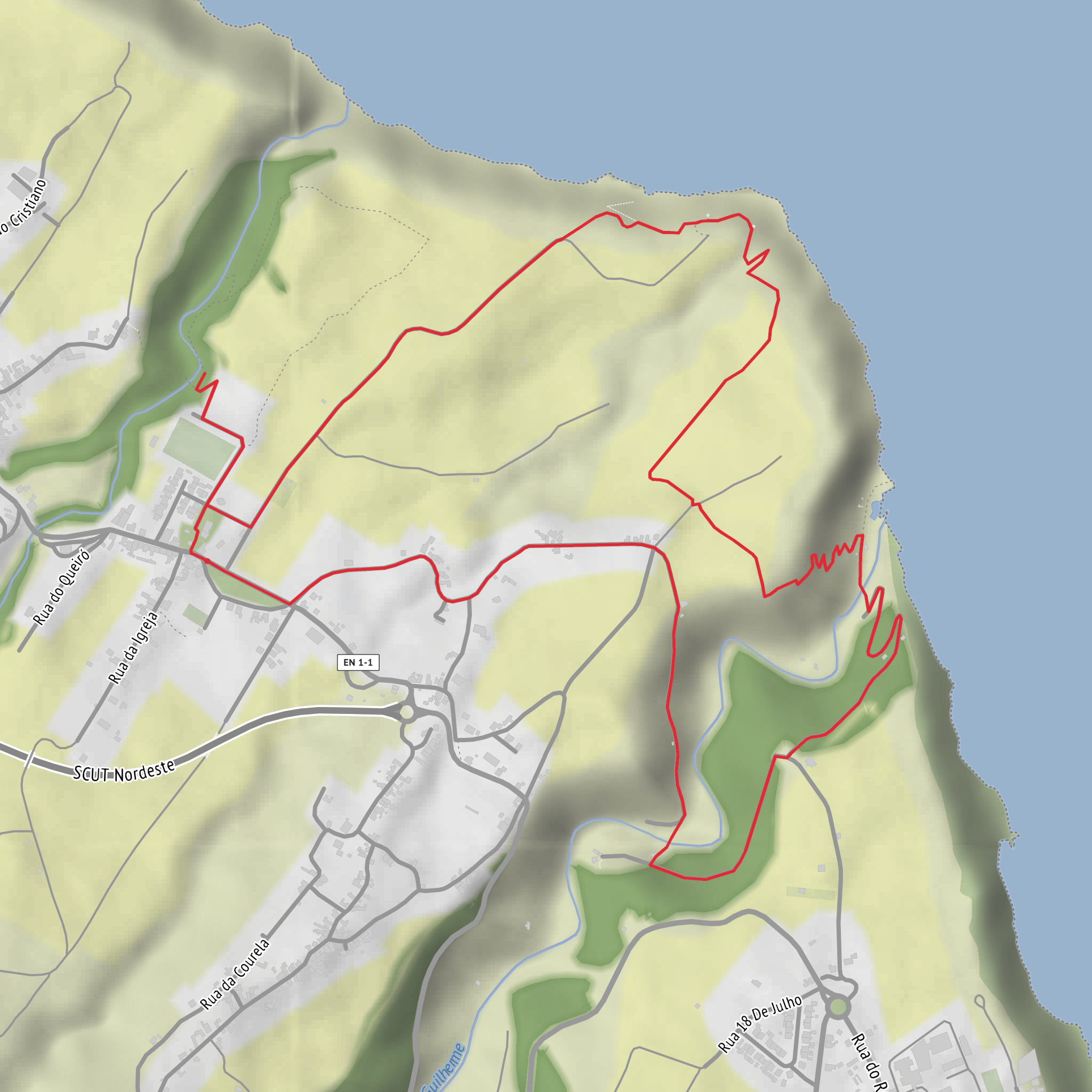
This medium circular walk on São Miguel’s northeast side packs a lot into roughly 6 km / 3.7 miles, with about 300 m / 985 ft of climbing. It starts beside the Igreja de Nossa Senhora da Conceição, Estrada Regional, Lomba da Fazenda, 9630-103 Nordeste, São Miguel, Azores, and follows a signed loop through village lanes, stream valleys, coastal viewpoints, bathing areas, pastureland, and small heritage sites before returning to the church square. Official trail information lists the route at about 2 hr 30 min and rates it medium, which fits well: the distance is modest, but the repeated ups and downs and a few steeper sections make it more than a casual stroll. (trails.visitazores.com)
The opening section is gentle and helps you settle into the landscape. From the church garden, the route heads left toward the campsite area, descending toward Ribeira do Guilherme. Early on, the trail passes old watermills and a 1982 fountain, reminders of how these steep Azorean valleys once supported small-scale rural life through water power and local agriculture. This part of the walk gives a strong sense of the parish’s traditional layout: homes and church on higher ground, productive land on the slopes, and watercourses cutting sharply toward the sea. (trails.visitazores.com)
Terrain, climbing, and what to expect
After crossing the stream, the route turns upward through a wooded section. Expect the first meaningful climb here, with the trail moving through stands of Cryptomeria japonica as well as areas with Pittosporum undulatum and Acacia melanoxylon noted in the official trail description. Underfoot, conditions can vary from paved village surfaces to dirt track and potentially slick ground after rain, especially near stream crossings and on steeper earthen sections. Good grip matters more than the raw distance suggests. (trails.visitazores.com)
At the top of this ascent, there is an optional detour toward Nordeste village; otherwise the main route drops toward Boca da Ribeira, where the coast suddenly opens up. This is one of the most scenic parts of the hike, with a mix of cliffside views, cultivated plots, and the Atlantic below. The Miradouro da Boca da Ribeira sits at about 92 m / 302 ft above sea level and overlooks the mouth of the stream and the bathing area below. There is parking here, and the viewpoint is reached from Caminho da Feira, 9630-179 Nordeste. (turismo.azores.gov.pt)
The route then climbs again on a dirt road up the cliff, passing fields and pasture before reaching the shoreline zone and the Parque de Endémicas do Pelado. This section can feel more exposed in wind and sun than the earlier wooded stretch. If the weather is unsettled, the northeast coast of São Miguel can be breezy, damp, and slippery in quick succession, so lightweight rain protection is worth carrying even on a short outing. Using HiiKER beforehand to check the route layout and keep track of junctions is a sensible way to stay oriented, especially where small detours branch toward viewpoints or the harbor.
Landmarks, nature, and wildlife
The standout landmarks are varied for such a short loop: the parish church at the start, the Ribeira do Guilherme crossing, the old watermills, the Boca da Ribeira bathing area, the Miradouro da Boca da Ribeira, the Parque de Endémicas do Pelado, the old harbor spur, and Parque da Morgada near the end. The official municipal guide also places the route through or past Miradouro dos Barreiros, adding another elevated look over the surrounding countryside and coast. (trails.visitazores.com)
The Parque de Endémicas do Pelado is especially useful for hikers who want more than scenery. Its name refers to the dry, open ground and the presence of low-growing endemic vegetation, identified along the park. This makes the area one of the better places on the route to notice native Azorean plant life rather than just the more widespread forestry and introduced species seen earlier in the walk. Along the coast and in the ravines, watch for seabirds and common island birdlife using the cliffs, pasture edges, and stream corridors. The mix of woodland, open grassland, and coastal habitat means the scenery changes quickly over short distances. �
Surfaces
Unknown
Asphalt
Ground
Dirt
Cobblestone
Concrete
Wood
Comments and Reviews
User comments, reviews and discussions about the Lomba da Fazenda - Miradouro da Boca da Ribeira, Portugal.
average rating out of 5
0 rating(s)

