
Download
3D Flyover
Add to list
More
4.4 km
~1 hrs 11 min
193 m
Loop
“A lush coastal loop weaving from village lanes to ferny ravines, sea views, and mill ruins.”
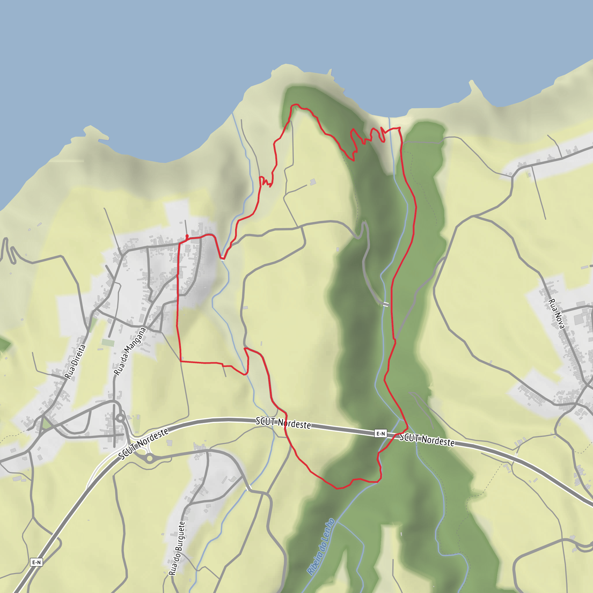
This short but rewarding loop on São Miguel’s northeast coast packs a surprising amount into roughly 4 km / 2.5 miles, with about 200 m / 656 ft of climbing, though some route records place the total a little longer and the ascent somewhat higher depending on exactly where you start and whether you include short detours. It is generally rated moderate, and that feels accurate: the distance is not long, but the route includes a steady climb, uneven ground, damp sections, and a descent that can be slippery after rain. The walk begins near the Igreja de Nossa Senhora do Rosário, Rua da Mangana, 9630-043 Achadinha, Nordeste, São Miguel, Azores, which is the most practical landmark for the trailhead and the usual reference point for parking and orientation. (freguesiaachadinha.com)
From the church, the route heads out through the village and quickly leaves the built-up area behind. Within the first few hundred metres, the trail starts to rise toward the hillside of Moio de Baixo, where the character of the walk changes from quiet rural lanes to a greener, more enclosed path. This opening section is a good place to settle into the hike: the gradient comes early, and although it is not extreme, it is enough to raise the effort level right away. Expect a mix of paved and unpaved surfaces, with some stretches feeling more like old access paths than engineered walking track. (turismo.azores.gov.pt)
Terrain and route character
One of the most distinctive features of this loop is how quickly it moves between landscapes. The climb passes through dense vegetation, including stands of giant reed, Morella faya, and Azorean heather, with some sections forming natural green tunnels overhead. These enclosed stretches can feel humid and shaded, especially in warm weather, and the ground may stay muddy longer than more exposed trails. Good grip matters here, particularly if there has been recent rain. (turismo.azores.gov.pt)
As you gain height, the route opens to broader views over the northeast coast. Higher up, there are outlooks toward Fenais da Ajuda to the west and Achada to the east, giving a strong sense of the broken volcanic coastline and the patchwork of pasture and cultivated land that defines this part of São Miguel. The elevation on paper is modest, but because the trail rises and falls over short distances, it feels more varied than a simple village stroll. (pt.wikiloc.com)
The descent leads toward the watercourses below, including the Ribeira do Lenho and the Ribeira dos Caldeirões area. This is where the route becomes especially atmospheric: ferns thicken, moisture increases, and the valley feels cooler and more sheltered. Near the confluence of the streams, hikers can see the ruins of an old watermill, a reminder of how these ravines once powered small-scale rural industry. The trail also passes beneath or beside major road infrastructure, including one of the high bridges of the Nordeste expressway, creating an unusual contrast between traditional agricultural landscape and modern access routes. (pt.wikiloc.com)
Landmarks, nature, and what to watch for
The watermill ruins are among the most significant landmarks on the loop, not because they are monumental, but because they speak directly to the history of settlement in this wetter part of São Miguel. Streams in the Azores were historically essential for milling grain and supporting small farming communities, and even modest remains like these help explain how people adapted to steep, water-rich terrain. The parish itself is old: Achadinha was already inhabited in the early 16th century, and the Church of Nossa Senhora do Rosário is tied to that early settlement history, with the parish established around the period following the 1522 earthquake and the church later rebuilt and altered over time. (pt.wikiloc.com)
Nature is a major part of the appeal here. Along the route, hikers can expect a blend of endemic and introduced vegetation. Endemic Azorean heather and faya appear alongside invasive or widespread species such as pittosporum and giant reed. In the wetter lower sections, ferns become more prominent, and the stream corridors support lush growth year-round. Birdlife can include common Azorean woodland and farmland species, and the sheltered ravines are often alive with insect activity and birdsong, especially in calmer weather. Because the route approaches streambeds and damp vegetation, it is worth watching for slick stones, muddy edges, and overgrown
Surfaces
Ground
Asphalt
Concrete
Unknown
Grass
Comments and Reviews
User comments, reviews and discussions about the Lomba d’El-Rei - Achadinga Loop, Portugal.
average rating out of 5
0 rating(s)
