
Download
3D Flyover
Add to list
More
10.2 km
~3 hrs 9 min
664 m
Out and Back
“A wild climb through misty volcanic slopes to Lagoa do Fogo rewards prepared hikers.”
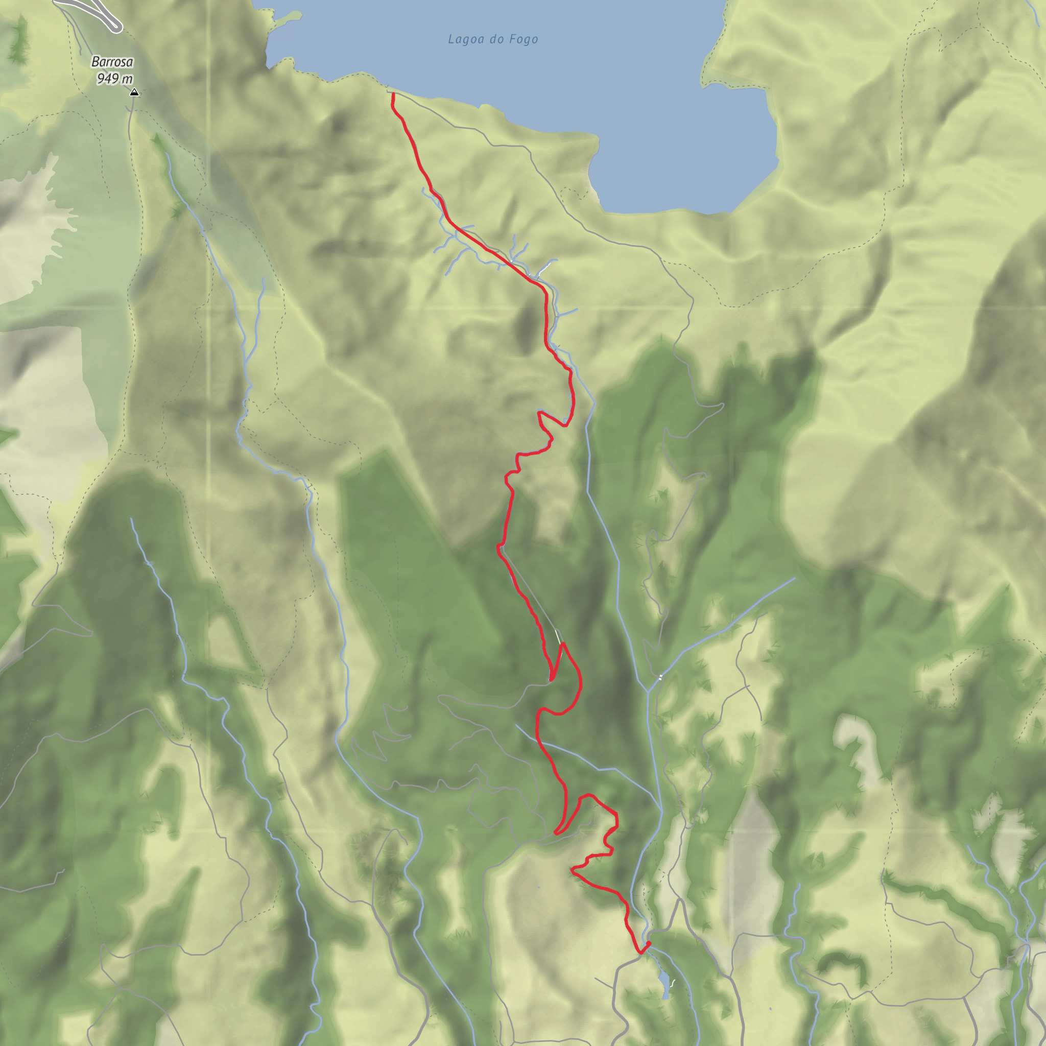
This out-and-back route climbs from the south side of São Miguel to the shoreline of Lagoa do Fogo, covering about 10.2 km / 6.3 miles in total. Although some listings rate the official trail as moderate, hikers should treat it as a difficult day hike if they are not used to sustained climbing, uneven ground, and a long return ascent from the lake. Expect roughly 700 m / 2,300 ft of elevation change overall, with the steepest effort concentrated on the way up from the trailhead and again on the return climb away from the lakeshore. The route begins near Parque Escutista dos Lagos, above Água de Alto on São Miguel, close to the Pico da Praia water reservoir and the hamlet known as Lugar da Praia. (trails.visitazores.com)
The setting is one of the most protected and visually striking volcanic landscapes in the Azores. Lagoa do Fogo sits inside the collapse caldera of Fogo Volcano, part of the Serra de Água de Pau volcanic massif, and the lake itself lies within the Lagoa do Fogo Nature Reserve, a protected area of about 506.82 hectares. This protected status is a good clue to what the walk feels like: wild, exposed, and ecologically sensitive rather than heavily developed. (parquesnaturais.azores.gov.pt)
Getting to the start
By car, the simplest approach is to drive to the upper part of Água de Alto and continue toward Parque Escutista dos Lagos, the recognized start point for the official PRC2SMI trail. Roads are narrow in places, so a small car is easier than a large one, and it is worth arriving early if you want a stress-free start. The trailhead is not at the main roadside viewpoints above Lagoa do Fogo; it is on the south side of the mountain near the scout park and water infrastructure. (trails.visitazores.com)
Public transport is less straightforward. Regular island bus services can get you closer to Água de Alto or nearby settlements on the south coast, but the final approach to the trailhead usually requires a taxi or a substantial road walk because the hike starts in the upper rural area rather than in a town center. In the main visitor season, the Azores Government has operated a Lagoa do Fogo shuttle serving the Fogo Volcano visitor area from June 15 to September 30, running daily from 9:00 a.m. to 7:00 p.m.; this is mainly intended to manage access to the reserve and viewpoints, so hikers should still verify whether it helps with their exact trail plan before relying on it. (portal.azores.gov.pt)
For navigation, use HiiKER and do not assume every junction or service road will be obvious in mist. Cloud can move in quickly on São Miguel, and this is one of those hikes where a clear day and a foggy day feel like completely different routes.
What the route is like
From the start, the trail heads inland on a dirt track and begins climbing through a landscape shaped by water. One of the defining features here is the network of levadas, water collection points, channels, and hydro-related infrastructure associated with Ribeira da Praia. These are not incidental details; they are part of the character of the walk and part of the reason the route matters historically. The island has long depended on this area for public water supply, and the valley also played a role in the history of hydroelectric power production on São Miguel. (trails.visitazores.com)
The first part of the hike is usually the most physically demanding. The gradient builds steadily, and the footing can vary between compact earth, rougher stony sections, and damp patches. After rain, expect mud and slick surfaces, especially where water crosses the path or where vegetation keeps the ground shaded. Trekking poles can be useful here, particularly for the descent.
As you gain height, the route opens up with broader views over the south coast of São Miguel. On clearer days, you can pick out Vila Franca do Campo and its offshore islet, one of the most recognizable coastal landmarks on the island. These views tend to appear and disappear as the trail bends around the slope, so the scenery unfolds gradually rather than all at
Comments and Reviews
User comments, reviews and discussions about the Lagoa do Fogo, Portugal.
average rating out of 5
0 rating(s)


