
Download
3D Flyover
Add to list
More
9.4 km
~2 hrs 15 min
227 m
Loop
“A shifting lagoon loop of breezy views, birdlife, and muddy surprises that can feel tougher than expected.”
This roughly 9 km (5.6 mile) loop with about 200 m (656 ft) of elevation gain sounds like a moderate outing that should suit hikers who are comfortable with a few undulating sections, changing ground conditions, and a couple of short climbs rather than sustained steep ascent. Expect a walk that feels varied rather than relentlessly hard: the distance is manageable for most regular walkers, but the combination of elevation change, exposed stretches, and potentially damp ground around the lagoon can make it feel more demanding than the numbers suggest.
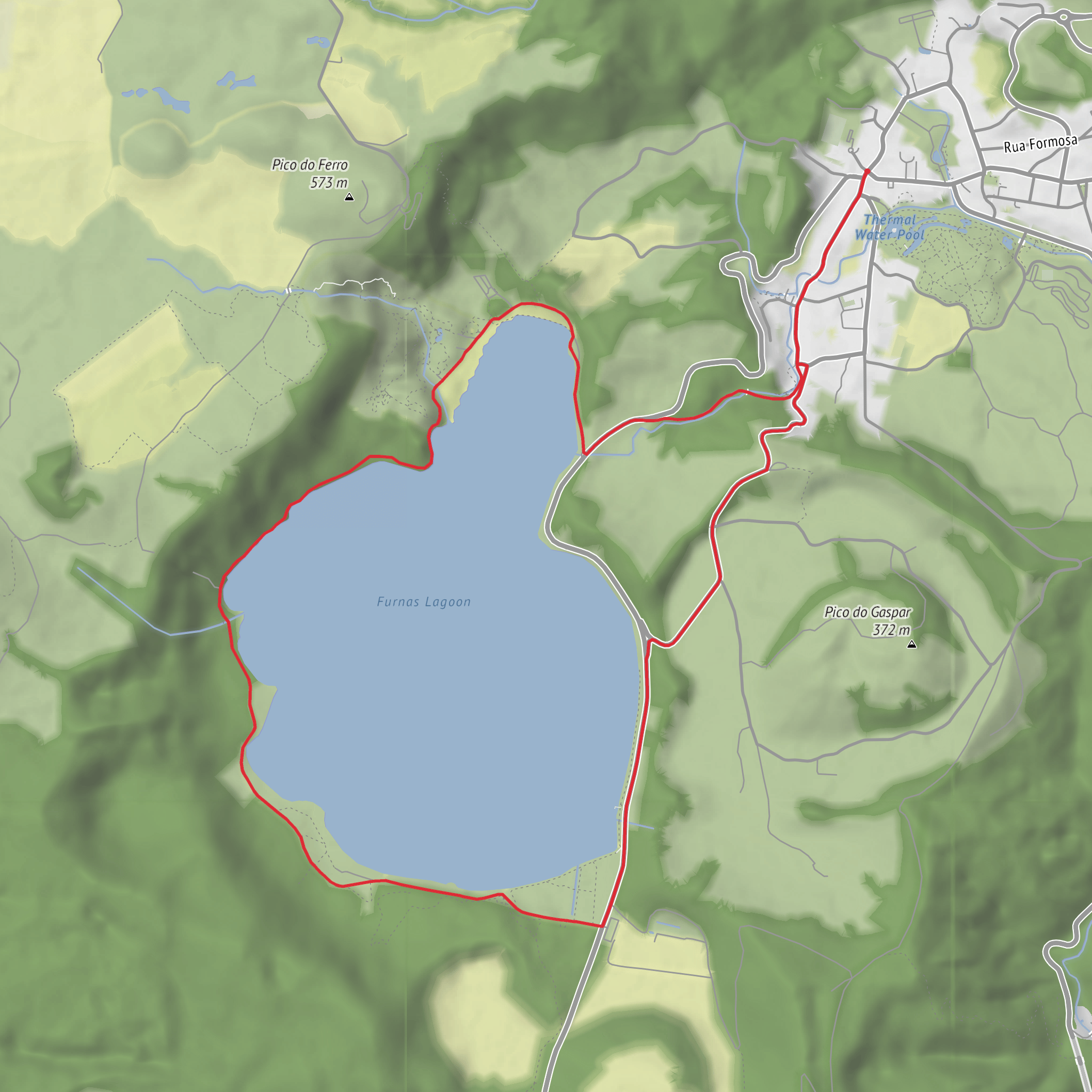
One important planning note: the available information for “Furnad Lagoon Loop” is extremely limited, and I could not verify a reliable trailhead location, official route description, or mapped access point from authoritative sources. Because of that, the best approach is to confirm the exact route line and start point in HiiKER before setting out, especially if you are relying on parking, public transport, or a precise navigation target.
What to expect on the route
A lagoon loop of this length typically combines shoreline walking, open views across still water, and slightly higher ground where the trail rises away from the water’s edge. With around 200 m of ascent, the route is likely to include gentle rollers, low ridgelines, or bluff-like sections rather than a flat waterside circuit. Hikers should be prepared for a mix of surfaces such as compacted path, sandy or gravelly sections, and softer ground near wetter margins.
The most memorable parts of a lagoon walk are usually the transitions in habitat. Near the water, expect reeds, rushes, marshy edges, and quieter birdlife zones. Slightly above the lagoon, the vegetation often changes to scrub, grassland, woodland, or low coastal cover depending on the region. These shifts can also affect footing and exposure: sheltered sections may feel humid or still, while open stretches can be windy and noticeably hotter under direct sun.
Because the route is rated medium, it is sensible to allow extra time for pauses, route-finding, and uneven terrain. Many hikers would want to budget around 2.5 to 4 hours, depending on conditions, fitness, and how often they stop for views or wildlife watching.
Terrain, weather, and preparation
The biggest variable on lagoon walks is often not steepness but ground condition. After rain, low-lying sections may become muddy, slick, or waterlogged. If the route passes close to the lagoon edge, there may also be narrow sections, roots, loose stones, or short sandy patches that slow progress. Footwear with decent grip is a better choice than lightweight city trainers, even on a relatively short loop.
Bring water even though the distance is modest. A 9 km route can feel much longer if there is little shade or if the air is warm and still. Sun protection is worth taking seriously on exposed lagoon terrain, and a light windproof layer is useful if the route crosses open ground. Insect repellent may also be helpful in wetter months or around still water.
If you are navigating independently, use HiiKER to confirm the loop direction, junctions, and any alternate spurs. That is especially important here because the trailhead details provided are incomplete.
Nature and wildlife
Lagoon environments are often among the richest areas for birdlife. Depending on season and region, hikers should watch for waders, ducks, herons, egrets, gulls, terns, raptors overhead, and smaller songbirds in surrounding scrub. Early morning and late afternoon are usually the best times for wildlife activity. Binoculars can add a lot to this kind of walk.
The plant life around lagoons can also be a highlight. Wetland margins often support dense aquatic or semi-aquatic vegetation, while slightly drier ground may hold wildflowers, salt-tolerant plants, grasses, or low shrubs. If the route lies in a coastal or estuarine setting, expect a strong contrast between sheltered wetland ecology and more exposed upland vegetation.
Wildlife precautions are mostly common-sense: keep a respectful distance from nesting birds, stay on the path through sensitive wetland areas, and avoid letting noise carry across quieter sections where animals are feeding or resting.
Landmarks and historical context
Without a verified location, it is not possible to identify the exact historical landmarks tied specifically to this loop. In many lagoon regions, however, the surrounding landscape often has a layered history shaped by traditional land use, fishing, seasonal grazing, transport routes, or wetland management. Lagoons have long been important as food sources, wildlife habitat, and natural barriers or meeting points, so there may be cultural or historical significance in the wider area even if it is not immediately obvious on the trail itself.
If the route is in a coastal setting, there may also be a history linked to maritime activity, dune stabilization, conservation work, or former agricultural use of nearby land. Checking local heritage information alongside HiiKER can help fill in that context before your walk.
Getting to the start
Because the hike head is listed only as “near” and no coordinates or place name were included, I could not convert the start point to a nearest known address or landmark with confidence. The most practical next step is to identify the mapped trailhead in HiiKER and then use that point to plan access.
For car access, look for the nearest signed parking area, reserve entrance, roadside lay-by, or visitor access
Surfaces
Asphalt
Cobblestone
Gravel
Unknown
Comments and Reviews
User comments, reviews and discussions about the Furnad Lagoon Loop, Portugal.
average rating out of 5
0 rating(s)
