
Download
3D Flyover
Add to list
More
5.6 km
~1 hrs 43 min
357 m
Loop
“A punchy São Miguel loop of mossy mills, birdsong ravines, and sweeping north-coast viewpoints.”
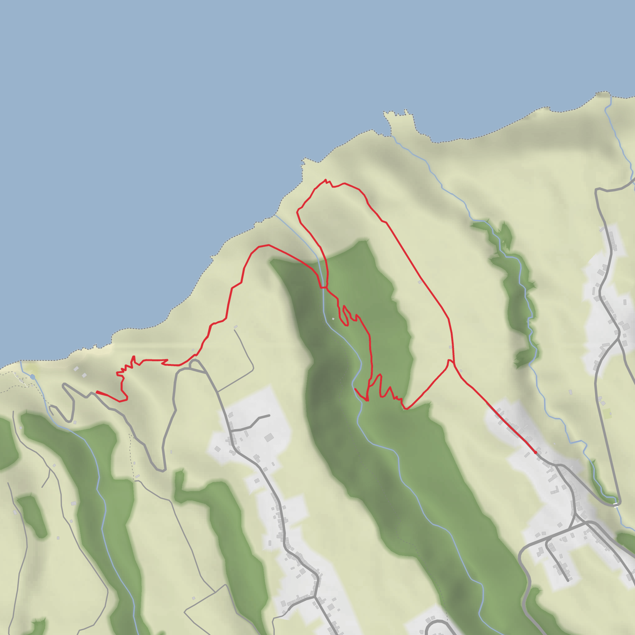
This is a short but demanding coastal-and-valley loop on São Miguel that packs a lot into roughly 6 km / 3.7 miles, with about 400 m / 1,312 ft of climbing. Expect a route that feels harder than the distance suggests: steep ups and downs, uneven ground, and sections where moisture, mud, loose soil, or overgrown vegetation can slow progress. The walk links old watermill country with two excellent viewpoints above the north coast, creating a route that is as much about landscape and rural history as it is about fitness. The area is associated with Ribeira Funda, Fenais da Ajuda, Maia, and Lomba da Maia on the island’s north coast. The historic PRC35 SMI Moinhos da Ribeira Funda trail begins near the Chapel of Nossa Senhora da Aflição in Ribeira Funda, Fenais da Ajuda, while Miradouro do Tio Domingos is on Canada do Rosário in Lomba da Maia. (trails.visitazores.com)
The opening part typically drops into the Ribeira Funda valley, where the terrain quickly shifts from settlement edge to a greener, more enclosed landscape. On the descent, hikers pass through woodland with Japanese cedar, Australian cheesewood, fayatree, and other introduced vegetation noted in the official trail guide. This is also one of the more atmospheric parts of the route, where the sound of running water becomes a constant companion and the path can feel slick after rain. The official Azores trail information specifically notes birdlife here, including buzzard, common blackbird, European robin, grey wagtail, and the Azorean wood pigeon, so it is worth moving quietly and scanning the canopy and stream corridor. (trails.visitazores.com)
Watermills and valley terrain
One of the defining landmarks is the cluster of old watermills known as Moinhos do Crim. The official route description says the track reaches the ruins of an ancient levada-like water channel and these watermills before continuing toward the stream and a small waterfall. This is the most historically evocative section of the hike: the mills are reminders of a time when waterpower was central to local agriculture and grain processing, and the surviving stonework helps explain how isolated north-coast communities once relied on steep ravines and perennial streams for everyday subsistence. (trails.visitazores.com)
The valley bottom and streamside sections are often the trickiest underfoot. Even on a relatively short outing, hikers should be ready for wet rock, muddy patches, and narrow footpaths where a slip could mean a hard fall. Trekking poles can help on the steeper transitions, especially on the climb back out. Because this route gains around 400 m / 1,312 ft in only about 6 km / 3.7 miles, the ascents are likely to feel sustained rather than gradual. Using HiiKER beforehand to study the elevation profile is a smart way to judge pacing and turnaround points.
Viewpoints and coastal outlooks
As the route climbs, the character changes from enclosed ravine to open north-coast panoramas. The official material for the Ribeira Funda trail notes views toward Maia, Ponta do Cintrão, and, in clear conditions, broader volcanic massifs to the west. The two named viewpoints on your route add the scenic payoff: Miradouro da Eira and Miradouro do Tio Domingos. Municipal trail information for nearby Lomba da Maia places both viewpoints on the uphill return section of a local circular walk, and the municipality describes Miradouro do Tio Domingos as offering a majestic panoramic view of the north coast and access toward the isolated Praia da Viola area. (trails.visitazores.com)
These miradouros are the places to pause for orientation. You are looking over one of São Miguel’s most dramatic coastal zones, where deep stream-cut valleys break through high green slopes before dropping to the Atlantic. In changeable weather, cloud can move in fast and reduce visibility, so even on a short loop it is worth carrying a light waterproof layer and checking HiiKER for route alignment before setting out. If the ground is wet, the descents from the viewpoints can be more awkward than the climbs.
Nature
Surfaces
Unknown
Asphalt
Dirt
Ground
Comments and Reviews
User comments, reviews and discussions about the Crim's Watermills, Miradouro do Eira and Miradouro Tio Domingos Loop, Portugal.
average rating out of 5
0 rating(s)

