
Download
3D Flyover
Add to list
More
4.3 km
~1 hrs 13 min
222 m
Point to Point
“A lush, history-touched coastal ramble threads waterfalls, a jewel-blue pool, and a cliff-hung finale.”
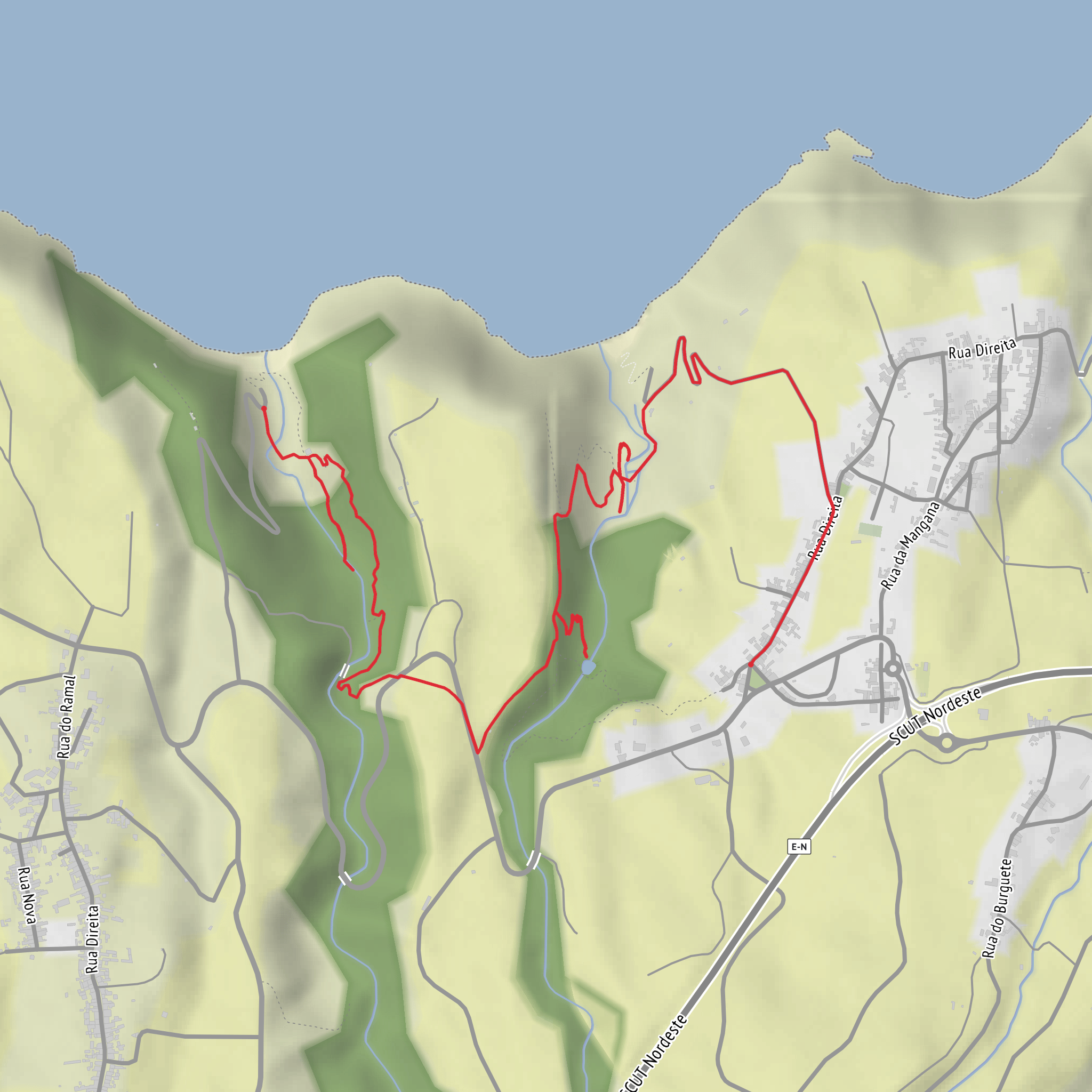
This short but varied walk on São Miguel’s northeast coast links three of the area’s best natural features in a compact outing: the waterfalls of Risco, the vivid pool at Poço Azul, and the dramatic coastal drop of Salto da Farinha. Expect roughly 4 km / 2.5 miles overall with about 200 m / 656 ft of ascent, which makes it a solid medium-rated route despite the modest distance. The terrain changes quickly—village lanes, old access tracks, damp riverside sections, and steeper uphill stretches—so it feels more substantial than the numbers suggest. The route is associated with the official PR21 SMI trail between Padrão das Alminhas and Salto da Farinha, beginning in Achadinha, in the municipality of Nordeste on São Miguel Island. (turismo.azores.gov.pt)
The nearest clear trailhead landmark is Jardim de Achadinha / Achadinha Garden, beside the Padrão das Alminhas commemorative obelisk in Achadinha, Nordeste, São Miguel, Azores. That monument is not just a meeting point: it marks the 1831 landing of Liberal troops, an event tied to the Portuguese Liberal Wars and the later establishment of constitutional monarchy in Portugal. If your mapping only shows coordinates or an incomplete “hike head,” this is the most useful landmark to navigate to. (turismo.azores.gov.pt)
By car, the simplest approach is to drive to Achadinha village from Nordeste or Ribeira Grande and park near Achadinha Garden, where the signed trail begins. Some walkers also use the parking area near the Salto da Farinha viewpoint as a logistical endpoint or alternative access point, but for a route that includes Cascata do Risco and Poço Azul in a coherent sequence, Achadinha is the more practical start. Roads in this part of São Miguel are generally paved but can be narrow and winding, especially on the final approach through the village and toward the coast. (turismo.azores.gov.pt)
Public transport is more limited in the Nordeste area than around Ponta Delgada, so hikers should check current island bus services before setting out. In practical terms, public transport may get you to Nordeste town or nearby settlements, but reaching Achadinha at a convenient hiking time can be difficult without a taxi or pre-arranged transfer. For planning the exact start point, route line, and any out-and-back adjustments, HiiKER is the best tool to use.
What the route feels like
From Achadinha, the trail heads toward the area known as Risco, following a watercourse and an old levada alignment that once supplied an old watermill. That detail gives the first part of the walk a strong cultural landscape feel: this is not just a nature trail, but a route through an older working countryside shaped by water management, milling, and small-scale agriculture. The path passes through a notably wet, green section with multiple cascades and dense vegetation, and this is where footing can become slick after rain. (turismo.azores.gov.pt)
Cascata do Risco is one of the first major highlights. Rather than a single isolated viewpoint, this section is better thought of as a waterfall zone, with flowing water, mossy rock, and a humid ravine atmosphere. The sound of water is a constant companion here, and the trail can feel enclosed by vegetation. Because of the moisture, roots, stones, and muddy patches are common, so shoes with reliable grip are more important than the short distance might suggest. (turismo.azores.gov.pt)
After the lower waterfall section, the route climbs the hillside. This is where most of the roughly 200 m / 656 ft of ascent is concentrated. The climb is not especially long, but it can feel punchy, particularly in humid weather. Partway up, a signed detour leads to Poço Azul, one of Achadinha’s best-known natural landmarks. (turismo.azores.gov.pt)
Poço Azul and the upper trail
Poço Azul is a small, sheltered pool with a striking blue-green tone when light conditions are favorable. It is one of those places where weather matters: after heavy rain the water may be more turbulent or less vividly colored, while in calmer, brighter conditions it tends to show its best character. The approach can be slippery, and official guidance emphasizes staying on marked spurs and avoiding wet edges near the stream and waterfall. (geoacores.com)
Back on the main route, the trail continues toward Fojo picnic area and then on toward Salto da Farinha. A short side trip leads down
Surfaces
Ground
Asphalt
Unknown
Dirt
Paved
Comments and Reviews
User comments, reviews and discussions about the Cascata do Risco, Paco Azul and Salto da Farinha, Portugal.
average rating out of 5
0 rating(s)


