Download
3D Flyover
Add to list
More
2.3 km
~28 min
12 m
Loop
“A gentle lakeside loop from breezy reeds to sheltered camp woods, with watchful birds overhead.”
I’m missing a few key pieces needed to make this accurate (especially the start location). Please paste either a HiiKER link or the trailhead coordinates (lat, lon) (or the park name + nearest town/state). Once I have that, I’ll convert the coordinates to the nearest known address/landmark and tailor the route description, landmarks, wildlife, and any local history.
In the meantime, here’s what you can generally expect from an easy, mostly level ~2 km / ~1.2 mi loop or lollipop that combines a lakefront segment with a camp/woods segment, plus how to plan for it:
Getting to the start (car + public transport)
- By car: These short lakefront systems almost always start from a day-use parking area near a beach, boat launch, nature center, or “Big Lake” picnic area. Aim to arrive early on weekends—parking fills quickly at waterfront access points.
- By public transport: If this is near a town, the most reliable approach is usually bus/train to the nearest downtown stop, then a short rideshare/taxi to the lake access point. Many lakefront trailheads are not directly served by transit, so the last mile is often the challenge.
- If you send the lat/lon, I’ll name the closest signed trailhead/parking lot and the nearest street address or landmark hikers can plug into navigation.
You’ll likely be on a mix of compacted gravel, boardwalk, or paved path along the water, then a short connector into the “Great Camp” area (often a historic or interpretive zone). With ~0 m / ~0 ft of gain overall, any “ups and downs” are usually just small rises over roots, drainage dips, or short ramps near bridges/boardwalk transitions.
What the route feels like (with approximate splits)
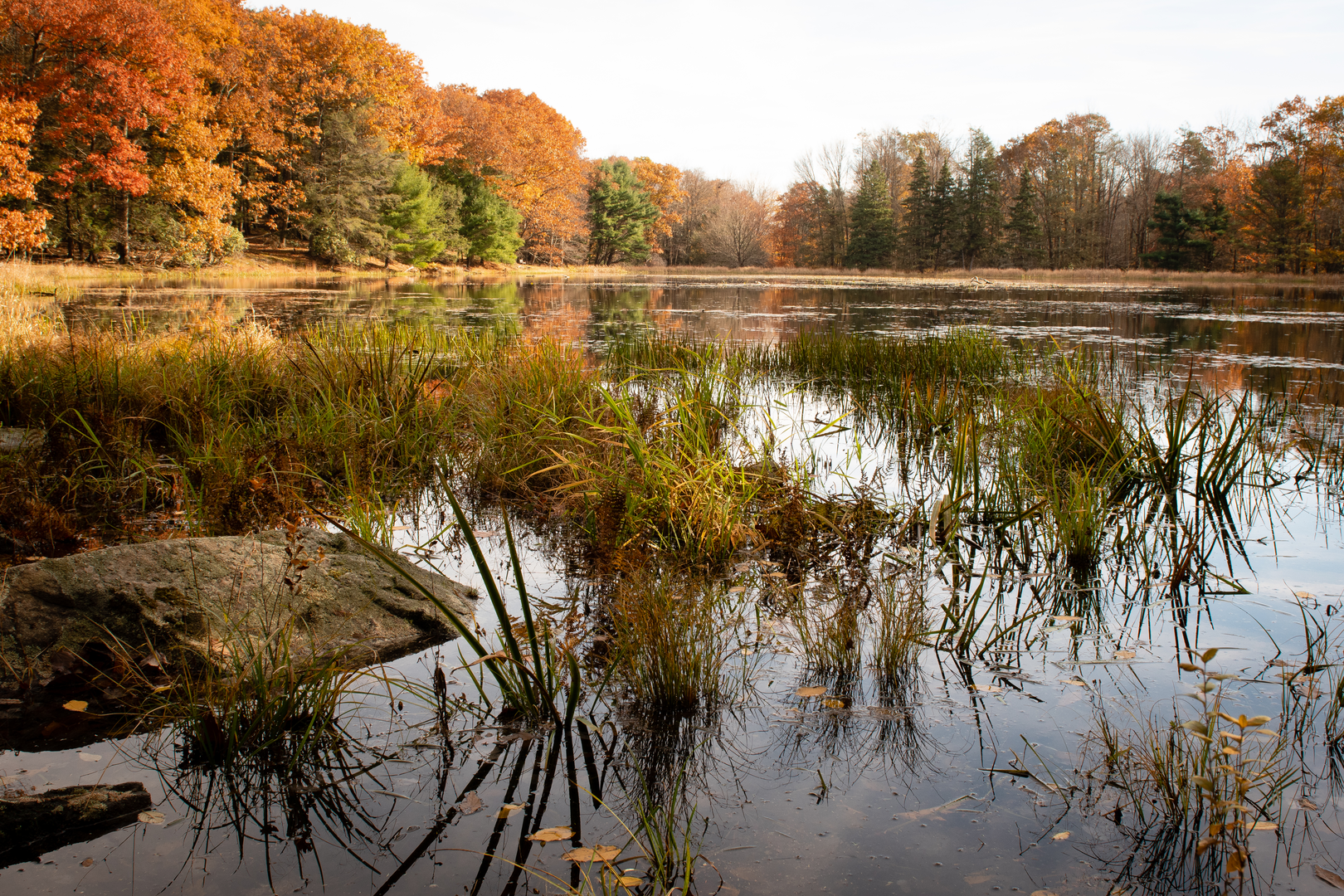
- 0.0–0.6 km (0.0–0.4 mi): Big Lake / lake access to shoreline path
Expect the widest tread here: families, strollers, anglers, and people heading to viewpoints. If there’s a boat launch, watch for vehicles backing trailers and for wet, algae-slick pavement near the waterline. - 0.6–1.4 km (0.4–0.9 mi): Lakefront Trail segment
This is usually the most scenic portion: open water views, reeds/cattails in the shallows, and frequent benches or small pullouts. Wind off the lake can make it feel cooler than the parking area, even on warm days. - 1.4–2.0 km (0.9–1.2 mi): Great Camp Trail return
Often slightly more sheltered—mixed woods, interpretive signs, and occasional historic structures or foundations depending on the site. Surfaces can shift to dirt/duff with roots, or remain gravel if it’s designed for universal access.
Landmarks, nature, and wildlife to look for
- Shoreline ecology: Look for emergent vegetation (cattails, sedges) and floating-leaf plants in calmer coves. These areas are nurseries for fish and amphibians, so they’re also prime hunting grounds for birds.
- Birdlife: Common lakefront sightings include ducks, geese, gulls/terns (where applicable), and wading birds like herons/egrets. Early morning and dusk are typically most active.
- Mammals: Squirrels and chipmunks are common; in many lake regions you may also see signs of beaver (chewed stumps, lodges) or muskrat along reedy edges.
- Insects: Expect mosquitoes and biting flies near still water in warm months; ticks are more likely where the Great Camp segment passes through brushy edges or tall grass.
- Seasonal footing:
- Spring: muddy edges, soft shoulders, and occasional flooded low spots.
- Summer: hard-packed tread but more crowds and sun exposure on open shoreline.
- Fall: wet leaves can be slick on boardwalks/bridges.
- Winter (if applicable): packed snow/ice on shaded sections; traction can be helpful even on “flat” trails.
- Spring: muddy edges, soft shoulders, and occasional flooded low spots.
Navigation and on-trail logistics (HiiKER)
Even on short systems, junctions can be surprisingly easy to miss—especially where multiple spurs head to picnic areas, docks, or camps. Use HiiKER to: - confirm you’re on the correct connector between the lakefront segment and the Great Camp segment, - spot short side paths to viewpoints (and decide if they’re worth the extra 0.1–0.3 km / 0.1–0.2 mi), - avoid accidentally taking a maintenance road or private drive if the camp area borders residences or facilities.
Hazards and what to watch out for
- Water-edge slips: Rocks, algae, and wet boardwalk planks can be slick. Keep a little distance from the edge if you’re photographing wildlife.
- Shared-use traffic: Many lakefront trails are multi-use. Listen for bikes and keep dogs close where sightlines are limited.
- Sun and wind exposure: Open shoreline can mean stronger sun and gusts; bring a light layer even for a short walk.
- Wildlife etiquette: Give nesting birds space; don’t feed waterfowl (it’s harmful and attracts aggressive behavior).
Planning: time, gear, and accessibility
- Time needed: Most hikers will cover 2 km / 1.2 mi in 30–60 minutes, depending on stops for views, photos, or interpretive signs.
- Footwear: Comfortable walking shoes

Surfaces
Unknown
Gravel
Ground
Comments and Reviews
User comments, reviews and discussions about the Big Lake Trail, Lakefront Trail and Great Camp Trail, Pennsylvania.
average rating out of 5
0 rating(s)