Download
3D Flyover
Add to list
More
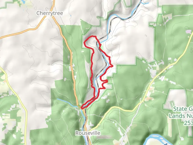
43.5 km
~2 days
122 m
Point-to-Point
“Explore serene river views, vibrant wildlife, and rich history on Pennsylvania's picturesque Allegheny River trail.”
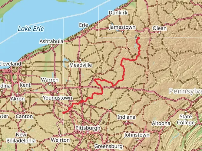
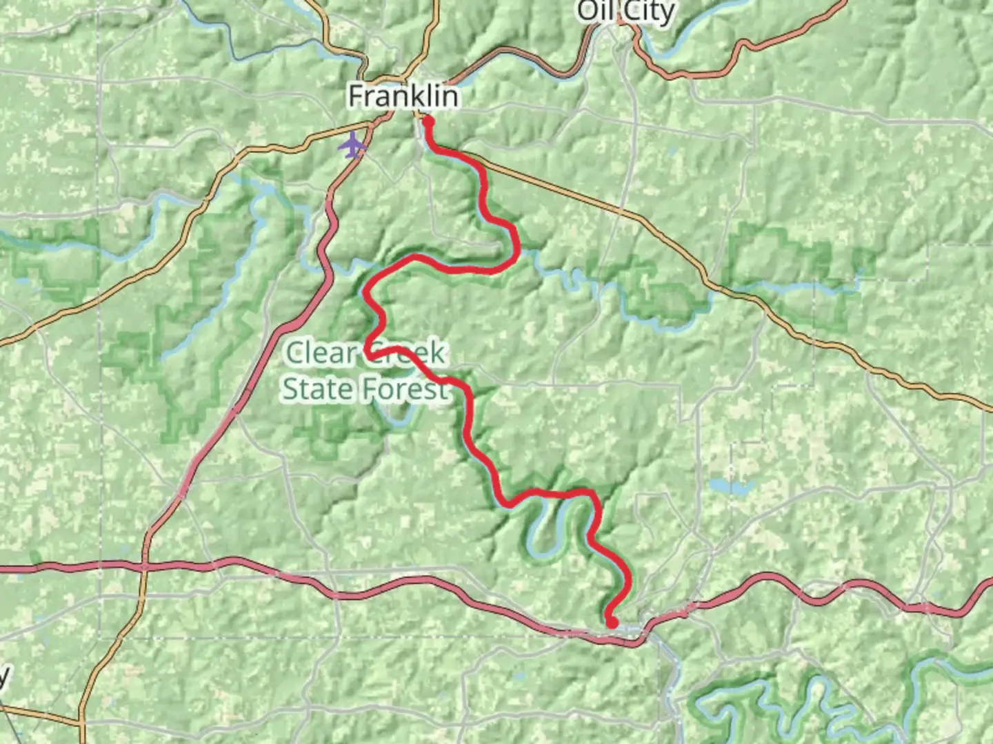
Nestled in the picturesque landscapes of Pennsylvania, the trail along the Allegheny River via the North Country Trail (NCT) offers a serene hiking experience. Spanning approximately 43 kilometers (about 27 miles) with a gentle elevation gain of around 100 meters (328 feet), this point-to-point trail is ideal for those seeking an easy yet rewarding adventure. The journey begins near Venango County, a region rich in history and natural beauty.
Getting There
To reach the trailhead, travelers can drive to Venango County, Pennsylvania. If you're using public transport, the nearest major city is Pittsburgh. From Pittsburgh, you can take a bus or train to Oil City, which is close to the trailhead. From Oil City, a short taxi ride or local bus can bring you to the starting point of the trail.
Trail Highlights
Scenic River Views
As you embark on this journey, the Allegheny River will be your constant companion. The trail meanders alongside the river, offering breathtaking views of the water and the surrounding forested hills. The gentle flow of the river and the rustling leaves create a tranquil atmosphere, perfect for reflection and relaxation.
Flora and Fauna
The trail is home to a diverse array of plant and animal life. Keep an eye out for white-tailed deer, red foxes, and a variety of bird species, including bald eagles and ospreys. The forest is predominantly composed of hardwood trees such as oak, maple, and hickory, which provide a vibrant display of colors in the fall.
Historical Significance
The Allegheny River region is steeped in history. This area was once a vital transportation route for Native American tribes and later for European settlers. The river played a crucial role during the oil boom of the 19th century, with Venango County being one of the first places where oil was commercially drilled. As you hike, you may come across remnants of old oil derricks and other historical artifacts that tell the story of the region's industrial past.
Navigation and Safety
For navigation, the HiiKER app is an excellent tool to ensure you stay on track. The trail is well-marked, but having a digital map can provide additional peace of mind. The terrain is relatively flat, making it accessible for hikers of all skill levels. However, it's always wise to carry sufficient water, snacks, and a basic first-aid kit.
Points of Interest
- Kennerdell Overlook: Approximately 10 kilometers (6.2 miles) into the hike, this viewpoint offers a stunning panorama of the river valley.
- Freedom Falls: Around 20 kilometers (12.4 miles) from the start, this picturesque waterfall is a perfect spot for a rest and photo opportunity.
- Rockland Tunnel: Near the 30-kilometer (18.6-mile) mark, this historic railroad tunnel is a fascinating feature that adds a touch of adventure to the hike.
Final Stretch
As you approach the end of the trail, the landscape opens up, providing expansive views of the Allegheny River. The trail concludes near the town of Emlenton, where you can explore local eateries and shops to celebrate the completion of your hike.

What to expect?
Activity types
Comments and Reviews
User comments, reviews and discussions about the Along Allegheny River via NCT, Pennsylvania.
average rating out of 5
0 rating(s)