Download
3D Flyover
Add to list
More
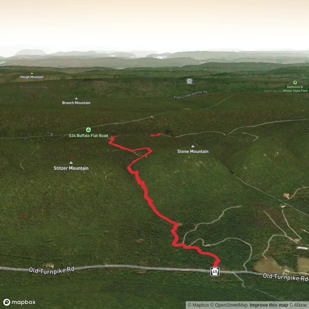
4.7 km
~1 hrs 24 min
285 m
Point-to-Point
“Share a trailhead anchor, and I’ll paint a season-aware Stitzer Gap story with mindful cautions.”
I’m missing a few key pieces of information needed to describe this route accurately and convert the start location to a nearby address/landmark.
Please send one of the following so I can anchor “near …” and tailor the directions, landmarks, hazards, and historical context:
1) The start point coordinates (lat, lon) for the trailhead (and ideally the end point if different), or
2) A HiiKER link to the Stitzer Gap Trail, or
3) The nearest town/park/road name where you plan to start.
Also, if you know them, tell me:
- State/country (there are often multiple “Stitzer Gap” references)
- Hike type (loop / out-and-back / point-to-point)
- Any season you’re hiking (spring/summer/fall/winter), since conditions and hazards can change a lot.
Once I have the trailhead location, I’ll provide: - Turn-by-turn style expectations with distance + elevation in km/mi and m/ft - What to watch for (surface, steep sections, exposure, water crossings, weather) - Notable natural features + likely wildlife - Any relevant local history - How to get there by car and public transport - Navigation guidance referencing HiiKER only

Surfaces
Ground
Unknown
Asphalt
Comments and Reviews
User comments, reviews and discussions about the Stitzer Gap Trail, Pennsylvania.
average rating out of 5
0 rating(s)