Download
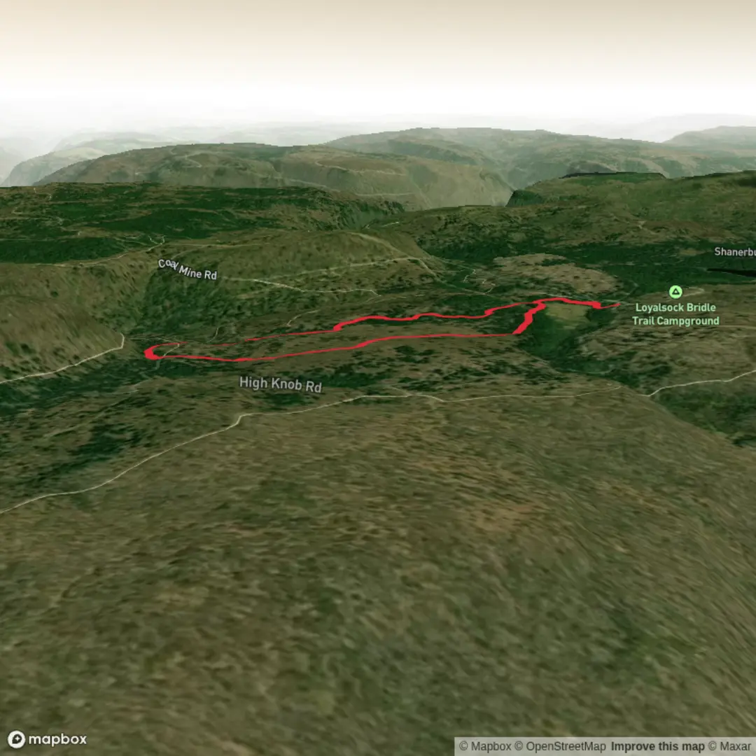
3D Flyover
Add to list
More
3.8 km
~48 min
38 m
Loop
“Wander a mostly level woodland loop where ferns, mossy rock, and birdsong reward an unhurried pace.”
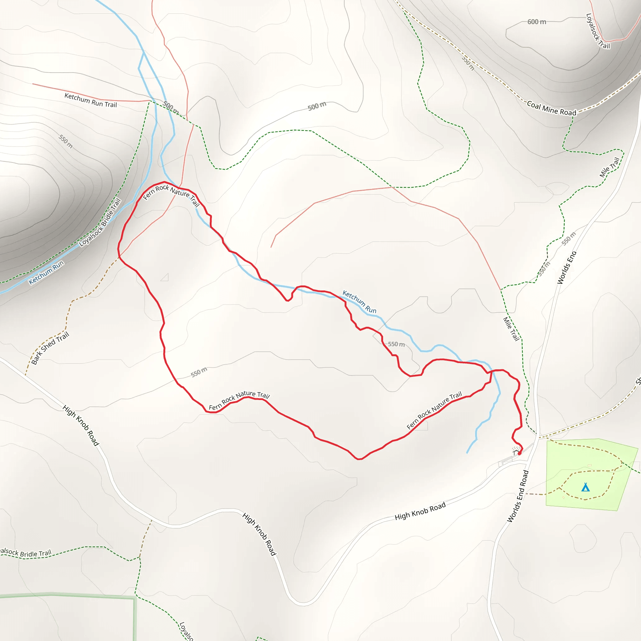
A gentle, mostly level nature walk of about 4 km (2.5 mi) with ~0 m / ~0 ft of climbing, this route is ideal for families, birders, and anyone wanting an unhurried loop or out-and-back through a protected-feeling patch of woodland and rock features. Expect a well-used path with short spur-like moments where you’ll want to confirm you’re on the main tread—easy to manage, but worth having HiiKER ready so you can stay on the intended line if the trail braids around wet spots or viewpoints.
Getting to the trailhead (car + public transport)
Because the hike details don’t include coordinates (the “Hike head: near …” field is incomplete), I can’t reliably convert a lon/lat to the nearest address or landmark yet. If you share the trailhead coordinates (or the park/road name), I can pinpoint the closest known address and the most practical transit stop.
In the meantime, here’s the typical approach for a short nature trail like this in the U.S.:
- By car: Aim for the signed nature trail parking area (often labeled “Nature Trail,” “Fern Rock,” or a preserve/park lot). Arrive early on weekends—small lots fill quickly. If there’s overflow parking, it’s usually along the park access road; park only where signage allows.
- By public transport: The most workable pattern is bus to the nearest town center/park-and-ride, then a short rideshare or bike to the trailhead. If you tell me the nearest town/city (or coordinates), I can identify the closest stop and a realistic walking connection.
What the walk feels like underfoot
With essentially no elevation gain, the challenge here isn’t steepness—it’s surface conditions. Plan for: - Packed dirt, fine gravel, and leaf litter, with occasional roots. - Short damp sections where the trail skirts low ground; after rain, expect shallow puddles and slick mud. - Rocky edges near any “fern rock” feature—watch for smooth stone that can be slippery when shaded or wet.
Light hiking shoes are usually enough; after wet weather, waterproof footwear makes the stroll more comfortable.
Route flow and approximate distances
On a ~4 km (2.5 mi) easy nature trail, the experience often breaks into a few distinct segments. Use these distances as planning anchors (your exact mileage may vary depending on whether the route is a loop or an out-and-back with small spurs):
0.0–0.8 km (0.0–0.5 mi): Settling in You’ll typically start on the widest, most obvious tread near the parking area or kiosk. This is where you’ll often find interpretive signs (flora, geology, local habitat). If there are multiple paths, the main nature trail usually keeps a consistent width and shows the most foot traffic—confirm with HiiKER if junction signage is minimal.
0.8–2.0 km (0.5–1.25 mi): Fern-and-rock corridor This is usually the “feature” portion: shaded woodland, cooler air, and the kind of micro-habitat where ferns thrive—north-facing slopes, rock outcrops, or moisture-retaining hollows. If the trail passes close to rock, expect:
- Mosses and lichens on stone surfaces
- Ferns concentrated in pockets where water seeps or where shade persists
- Occasional short side paths to a rock face or viewing nook (easy to accidentally follow if you’re chatting—again, HiiKER helps keep you on the intended route)
2.0–4.0 km (1.25–2.5 mi): Return leg / completing the loop The latter half often opens slightly—either a more mixed forest edge or a straighter connector back toward the trailhead. This is where you may encounter the most casual traffic (families, dog walkers). If it’s a loop, you’ll likely rejoin a broader path near the end.
Landmarks, nature, and what to look for
Even on a short, flat trail, there’s a lot to notice if you slow down:
- Fern communities: Look for differences between delicate, lacy fronds in moist shade versus tougher, more leathery species in brighter patches. Ferns often indicate stable moisture and reduced disturbance.
- Rock features: “Fern Rock” trails commonly highlight an outcrop, boulder field, or low cliff. These areas can host:
- Lichens (crusty, leafy, or branching forms) that signal clean air and slow-growing ecosystems
- Small crevices where cool air and moisture persist—prime fern habitat
- Seasonal wildflowers: In spring, you may see early woodland blooms before the canopy fully leafs out. In summer, the understory becomes greener and more uniform; in fall, leaf color and forest floor texture become the main show.
Wildlife you might encounter (and how to hike responsibly)
On an easy nature trail, wildlife sightings are often subtle rather than dramatic:
- Birdlife: Expect songbirds in the canopy and along edges; early morning is best. Listen for repeated calls rather than scanning constantly.
- Small mammals: Squirrels and chipmunks are common; they’re quick and often heard before seen.
- Amphibians near damp spots: After rain, watch the trail margins for small frogs or salamanders—step carefully around puddle edges.
- Ticks and mosquitoes (seasonal): In many U.S. regions, ticks are the main concern in warm months. Wear
Surfaces
Dirt
Unknown
Comments and Reviews
User comments, reviews and discussions about the Fern Rock Nature Trail, Pennsylvania.
5.0
average rating out of 5
1 rating(s)
