Download
3D Flyover
Add to list
More
53.9 km
~3 days
1570 m
Multi-Day
“Embark on the Bucktail Path's scenic, historical trek through Potter County's diverse wilderness, prepared for a moderate challenge.”
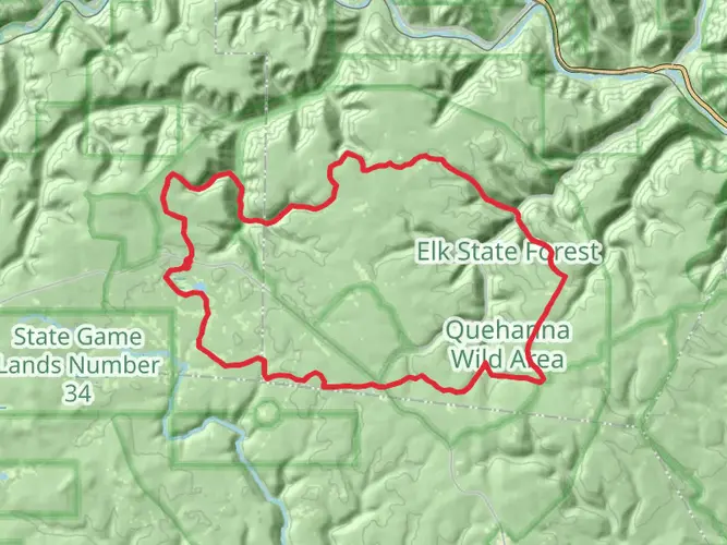
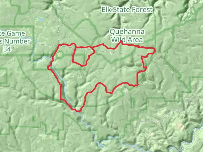
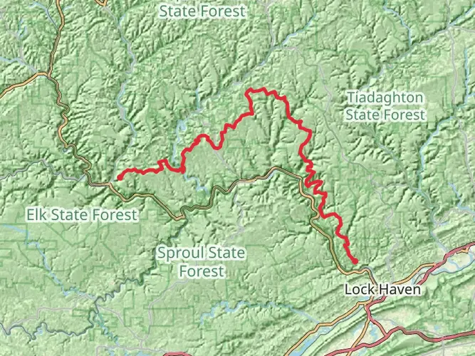
The Bucktail Path, winding through the rugged wilderness of Potter County, Pennsylvania, offers an immersive 54-kilometer (approximately 33.5 miles) journey from trailhead to end. With an elevation gain of around 1500 meters (nearly 4921 feet), hikers can expect a moderately challenging trek that traverses a variety of terrains.
Getting to the Trailhead
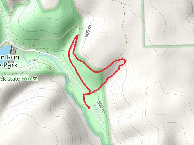
To reach the starting point of the Bucktail Path, hikers can drive to the trailhead located near Sizerville State Park. For those relying on public transportation, options may be limited due to the remote nature of the area, so it's advisable to check local resources for the latest information on available services. Once at Sizerville State Park, the trailhead is accessible by following the park's signage.
Navigating the Trail
Hikers should prepare for a point-to-point hike, which means arranging transportation back from the end of the trail unless planning to return on the same route. It's recommended to use a reliable navigation tool like HiiKER to track progress and ensure you remain on the correct path.
Landmarks and Scenery
As you embark on the Bucktail Path, you'll be greeted by dense forests that are home to a diverse array of flora and fauna. The trail is known for its serene streams and the occasional waterfall, providing a picturesque backdrop for your hike. Keep an eye out for wildlife such as white-tailed deer, black bears, and a variety of bird species.
Historical Significance
The region holds historical significance, with the trail itself named after the Bucktail Regiment from the Civil War, which was composed of woodsmen and hunters from the area. As you hike, you may come across remnants of the past, including old logging roads and traces of the once-thriving timber industry.
Preparation and Safety
Given the trail's length and remote nature, it's crucial to be well-prepared with enough food, water, and appropriate gear for changing weather conditions. Ensure you have a first-aid kit, and be aware that cell phone service may be unreliable in certain sections of the trail. Always let someone know your itinerary and expected return time.
Seasonal Considerations
The Bucktail Path can be hiked year-round, but each season offers a different experience. Spring and summer provide lush greenery and blooming wildflowers, while fall brings a spectacular display of autumn colors. Winter hiking is possible but requires preparation for snow and colder temperatures.
Remember, the Bucktail Path is a backcountry trail that offers a true escape into nature. Respect the environment by practicing Leave No Trace principles, and enjoy the tranquility and beauty of this Pennsylvania gem.

What to expect?
Activity types
Frequently asked questions
How long does it take to hike the Bucktail Path in Pennsylvania?
The Bucktail Path is about 53.94 km, or roughly 33.5 miles, with around 1,570 meters of climbing. Most backpackers take 2 to 4 days, depending on pace, weather, and how much time is spent on the longer ridge and forest sections between Sizerville State Park and Sinnemahoning.
Where are the trailheads for the Bucktail Path and where can hikers park?
The Bucktail Path is a point-to-point route with its north end at Sizerville State Park near Emporium and its south end at Sinnemahoning. Parking is typically available at the state park end, and the route is commonly described as running from Sizerville State Park to Sinnemahoning, so a shuttle or second vehicle is usually needed.
Is the Bucktail Path a loop or a point-to-point hike?
The Bucktail Path is a point-to-point trail, not a loop. It runs for about 34 miles between Sizerville State Park and Sinnemahoning through Elk State Forest, so finishing the hike usually requires advance transportation planning unless the route is being retraced back to the start.
Can you camp along the Bucktail Path?
Camping is a normal way to complete the Bucktail Path because the route is a multi-day trail through Pennsylvania state forest land. Pennsylvania DCNR allows backpacking and primitive trailside camping on state forest hiking trails, which makes overnight trips on the Bucktail Path feasible when standard state forest camping rules are followed.
Is the Bucktail Path difficult?
The Bucktail Path is generally considered a moderate backpacking route, but the numbers make it a serious outing: about 53.94 km in length with roughly 1,570 meters of elevation gain. The trail is better suited to hikers comfortable with long days, uneven terrain, and the logistics of a remote point-to-point route in north-central Pennsylvania.
What is the best time of year to hike the Bucktail Path?
Late spring through fall is usually the most practical season for the Bucktail Path. Summer and early fall tend to offer the most reliable backpacking conditions in Potter and Cameron County forest terrain, while winter can add snow, cold, and more demanding navigation on this remote 34-mile route.
Comments and Reviews
User comments, reviews and discussions about the Bucktail Path, Pennsylvania.
4.83
average rating out of 5
12 rating(s)