Download
3D Flyover
Add to list
More
956 m
~15 min
43 m
Out and Back
“Slip into a hemlock-cooled ravine where Hornbecks Creek sparkles toward cascading upper falls.”
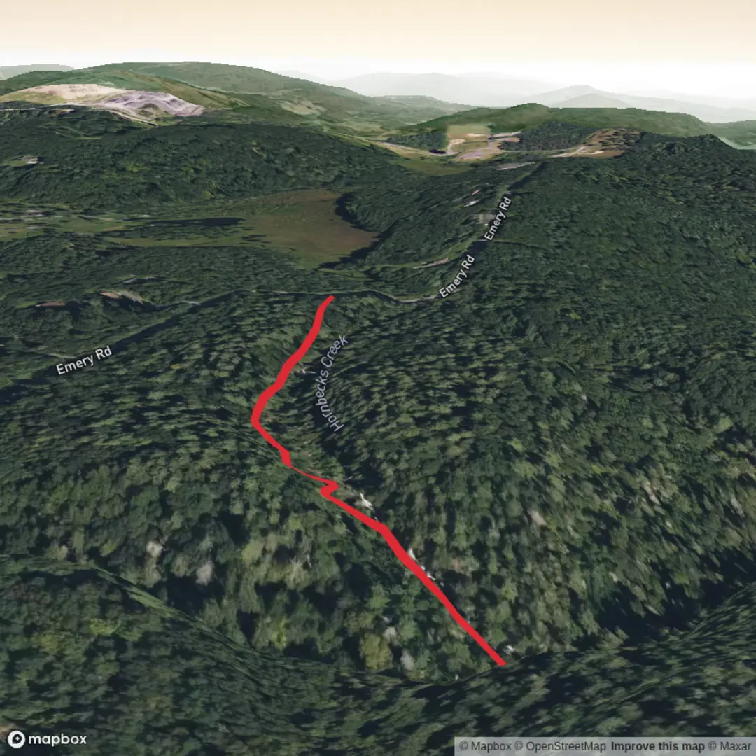
This is a short, waterfall-focused out-and-back in the Delaware Water Gap National Recreation Area, dropping into a cool, shaded hemlock ravine where Hornbecks Creek tumbles over a series of cascades before you reach the upper falls. Although the total distance is only about 1 km / 0.6 mi round trip (the NPS lists 0.8 mi / 1.3 km one-way to the falls from the upper trailhead), it earns a Medium / moderately difficult feel because the path is steep in spots, often damp, and can be slick on roots and rock. (nps.gov)
Where the hike starts (nearest known address / landmark)
The upper access is off Emery Road near the Pocono Environmental Education Center (PEEC). The closest reliable address landmark to plug into directions is: Pocono Environmental Education Center, 538 Emery Road, Dingmans Ferry, PA 18328. From there, you’re close to the signed/known access for the Upper Hornbecks Creek Trailhead off Emery Road. (peec.sandbox1.nikijones.com)
Getting there (car and public transport)
- By car: Aim for PEEC (538 Emery Road, Dingmans Ferry), then follow Emery Road access for the Upper Hornbecks Creek Trailhead. Parking is limited and can feel “unmarked” in places, so confirm the exact pull-off and trail start on HiiKER before you arrive. (peec.sandbox1.nikijones.com)
- By public transport: This corner of Pike County is rural; there typically isn’t convenient, frequent transit to the trailhead itself. The most workable approach is usually bus/train to the Stroudsburg/East Stroudsburg area, then a taxi/rideshare the rest of the way to Dingmans Ferry/Emery Road. Plan for spotty cell coverage and limited rideshare availability—pre-scheduling a pickup is wise.
Distance, elevation, and pacing
From the upper trailhead, you’ll hike to the falls and return the same way. Expect roughly:
- Distance: about 1 km / 0.6 mi (short outing)
- Elevation change: the NPS lists about 332 ft / 101 m of elevation change on the upper trail segment, which is why it can feel “medium” despite the short mileage. (nps.gov)
What the trail is like underfoot
You’ll start on a narrow forest path that quickly commits to the ravine. The character is classic “Pocono creek gorge”: packed dirt, leaf litter, exposed roots, and rock ledges that hold moisture. After rain (or during spring snowmelt), the trail can be muddy and slick, and the sound of moving water tends to follow you most of the way.
As you descend, the air often cools noticeably—hemlock shade and the creek’s spray can make this feel several degrees colder than the parking area. Bring a light layer even on warm days if you tend to chill when you stop.
Waterfalls, landmarks, and the best viewing behavior
The reward comes in stages: small cascades and slides build anticipation before the main upper falls area. The most photogenic views are usually from stable rock or established tread near the creek—avoid stepping onto algae-coated stone at the waterline, which can be surprisingly slippery.
Important regulation to plan around: swimming and wading are not permitted within 50 feet (15 m) upstream of waterfalls and the waterfalls themselves. Treat this as both a safety and resource-protection rule—fast water, undercut rock, and slick surfaces make accidents more likely here. (nps.gov)
Navigation and current access notes (read before you go)
Use HiiKER to confirm you’re on the Upper Hornbecks Creek Trail and to avoid accidentally aiming for the lower trailhead on Route 209. A key planning detail: the upper and lower falls sections do not connect because the slope between them has been destabilized; you must return the way you came from the upper falls. (nps.gov)
What to look for in nature and wildlife This ravine environment favors moisture-loving plants—expect **mossy rock, f

Comments and Reviews
User comments, reviews and discussions about the Upper Hornbecks Falls, Pennsylvania.
average rating out of 5
0 rating(s)