Download
3D Flyover
Add to list
More
49.1 km
~2 days
318 m
Multi-Day
“Embark on the McDade Trail for a historic, wildlife-rich hike through diverse landscapes of the Delaware Water Gap.”
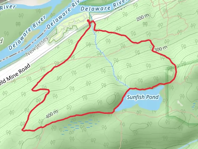
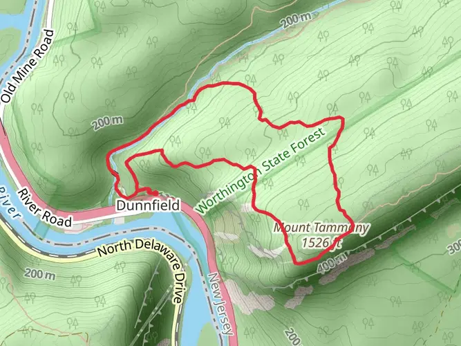
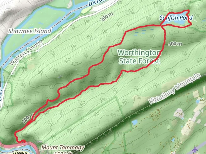
The McDade Recreational Trail offers a scenic journey through the Delaware Water Gap National Recreation Area, stretching approximately 49 kilometers (30 miles) from near Monroe County, Pennsylvania, to the southern end of the park. With an elevation gain of around 300 meters (984 feet), the trail provides a moderately challenging experience that is accessible to hikers of various skill levels.
Getting to the Trailhead
To reach the starting point of the McDade Recreational Trail, hikers can drive to the trailhead located near the Hialeah Picnic Area, just off of River Road, close to Monroe County. For those relying on public transportation, options may be limited, and it is advisable to check the latest schedules and routes for any available services that get close to the Delaware Water Gap area. From there, a taxi or ride-sharing service could be used to reach the trailhead.
Navigating the Trail
Hikers can utilize the HiiKER app to navigate the trail, ensuring they stay on the correct path and can anticipate what's ahead. The trail is well-marked, but having a digital tool can provide additional peace of mind and information about specific segments of the hike.
Trail Experience
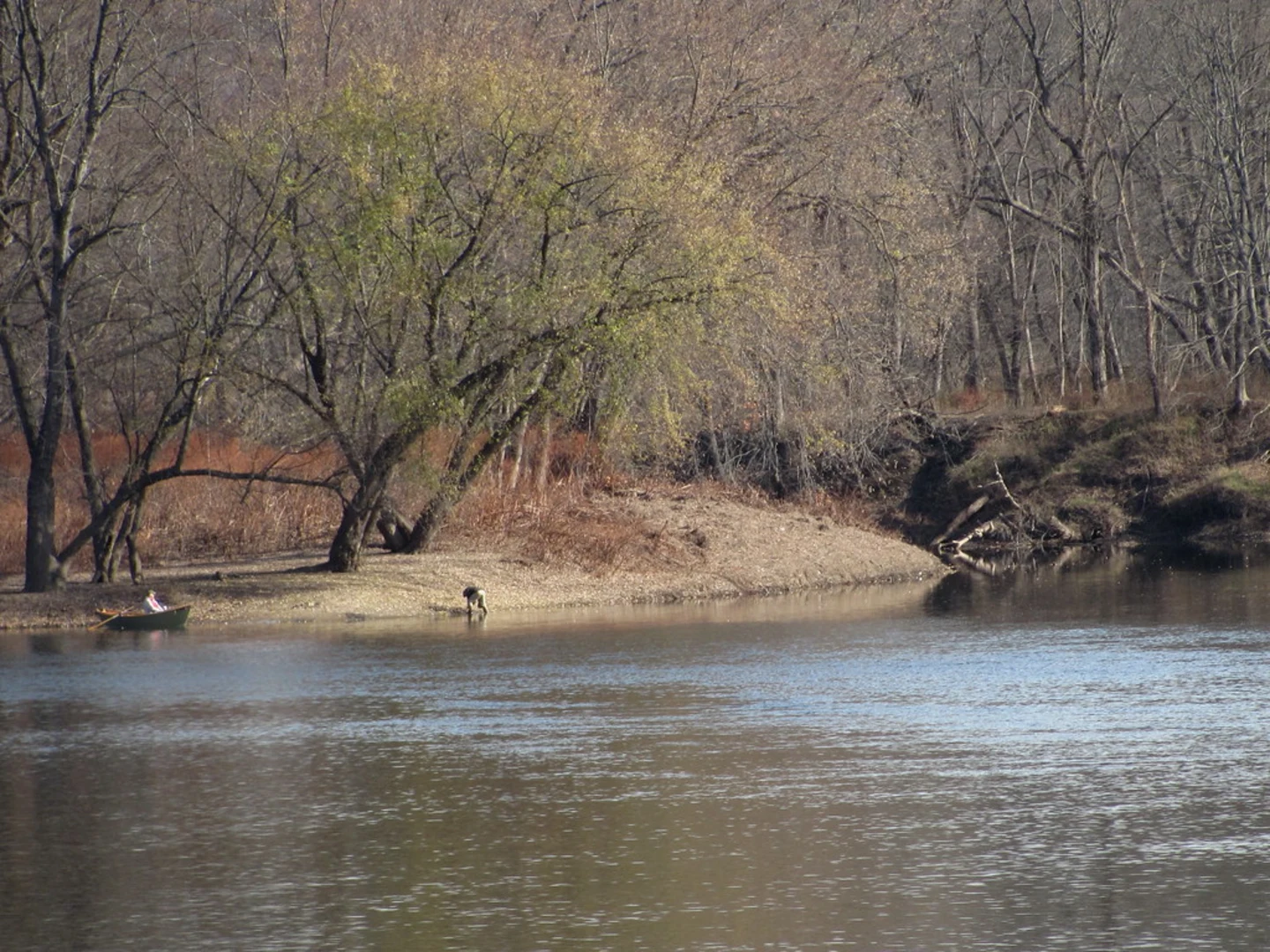
The trail meanders through a mix of terrains, including forested areas, river valleys, and open fields, offering a diverse hiking experience. As you progress along the trail, you'll encounter a variety of wildlife, including white-tailed deer, wild turkeys, and numerous bird species, making it a birdwatcher's delight.
Historical Significance
The region is steeped in history, with the trail itself passing through areas that were once home to early settlers and Native American tribes. Hikers will find remnants of the past, such as old farmsteads and historic structures, that provide a glimpse into the life of the area's former inhabitants.
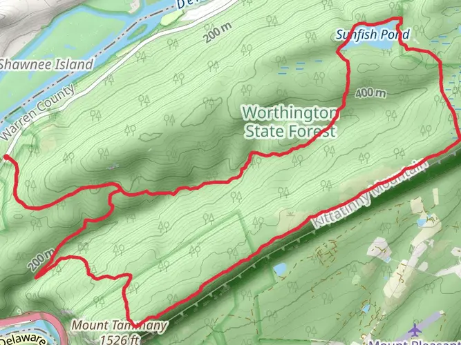
Landmarks and Points of Interest
Approximately 10 kilometers (6 miles) into the hike, you'll reach the Owens Trailhead, which offers restrooms and picnic areas for a convenient break. Further along, at around the 24-kilometer (15-mile) mark, the trail passes by the dramatic cliffs of the Eshback Access area, a popular spot for taking in the views of the Delaware River.
Flora and Fauna
The trail is lined with a variety of plant life, including hardwood forests, rhododendron thickets, and wildflowers in the spring and summer months. The changing seasons bring a dynamic backdrop to the trail, with vibrant autumn colors and serene snow-covered landscapes in winter.
Preparation and Safety
Hikers should come prepared with adequate water, snacks, and clothing suitable for the weather conditions. It's also wise to carry a first-aid kit and a means of communication in case of emergencies. Always check the weather forecast before setting out and be aware of any wildlife advisories.
Conclusion
The McDade Recreational Trail is a journey through natural beauty and history, offering a memorable experience for hikers looking to explore the Delaware Water Gap National Recreation Area. Whether you're seeking a full day's adventure or a multi-day trek, this trail provides ample opportunities for exploration and enjoyment.

What to expect?
Activity types
Frequently asked questions
How long does it take to hike the full McDade Recreational Trail?
The full McDade Recreational Trail is 49.09 km, or about 30.5 miles, with roughly 318 m of elevation gain. Most hikers treat it as a two- to three-day outing, while stronger walkers may cover it in a very long single day. The route runs through Delaware Water Gap National Recreation Area from Hialeah to Milford Beach.
Where can you park for the McDade Recreational Trail in Pennsylvania?
Parking is available at many trailheads along the McDade Recreational Trail, which makes section hikes easy to plan. Named access points include Hialeah, Smithfield Beach, Riverview, Park Headquarters, Bushkill Village, Bushkill Access, Egypt Mills, Eshback Access, Jerry Lees, Schneider Farm, White Pines, Conashaugh, Pittman Orchard, and Milford Beach. Restrooms are available at some trailheads, including Hialeah, Smithfield Beach, Bushkill Access, Bushkill Village, Eshback Access, and Milford Beach.
Is the McDade Recreational Trail dog friendly?
Dogs are allowed on the McDade Recreational Trail if they are kept on a leash. There is an important seasonal restriction: pets are not permitted at Milford Beach or Smithfield Beach, or on the section between Smithfield Beach and Hialeah, from late spring to early fall. That means the southern end of the trail can have pet limits during the main beach season.
Can you bike the McDade Recreational Trail or is it only for hikers?
The McDade Recreational Trail is a multi-use trail for hiking and biking, and it is also used for cross-country skiing and snowshoeing in winter. The posted speed limit on the trail is 15 mph, and bikers are required to yield to hikers. One section has an added restriction: when traveling north, the first 1.5 miles between Conashaugh and Pittman Orchard is walk-only.
What are the best sections of the McDade Recreational Trail for an easy day hike?
Several sections of the McDade Recreational Trail are specifically rated easy. Good shorter options include Smithfield Beach to Riverview at 2.6 miles, Egypt Mills to Eshback Access at 1.8 miles, Eshback Access to Jerry Lees at 1.8 miles, and Jerry Lees to Schneider Farm at 5.3 miles. These stretches are useful for a low-stress walk while still seeing river corridor scenery and historic farmland.
Can you camp on the McDade Recreational Trail?
Camping is not allowed along the McDade Recreational Trail except at Dingmans Campground. Dispersed camping is not permitted on the trail corridor, so the route is not a backpacking trail with informal campsites along the way. For a full-length hike, overnight planning needs to center on established lodging or the campground area.
Are there any seasonal closures on the McDade Recreational Trail?
Yes. The section between Pittman Orchard and Conashaugh is closed from December 15 through July 15 to protect nesting eagles. That closure affects through-hikes and bike trips on the northern part of the McDade Recreational Trail, so that segment needs to be checked before planning a full end-to-end outing.
Comments and Reviews
User comments, reviews and discussions about the McDade Recreational Trail, Pennsylvania.
4.11
average rating out of 5
9 rating(s)