Download
3D Flyover
Add to list
More
41.6 km
~2 days
1103 m
Multi-Day
“The Old Loggers Path: a historical, nature-rich hiking adventure through Pennsylvania's beautiful, diverse wilderness.”
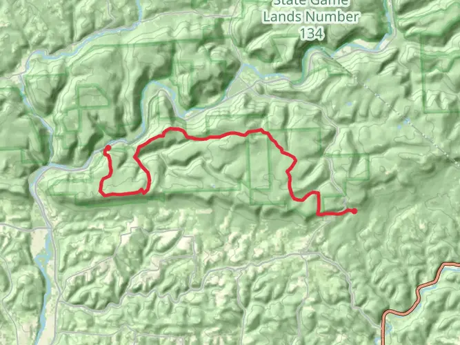
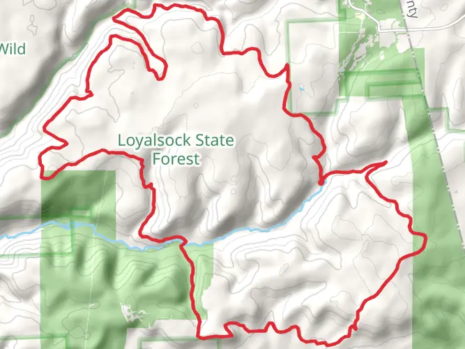
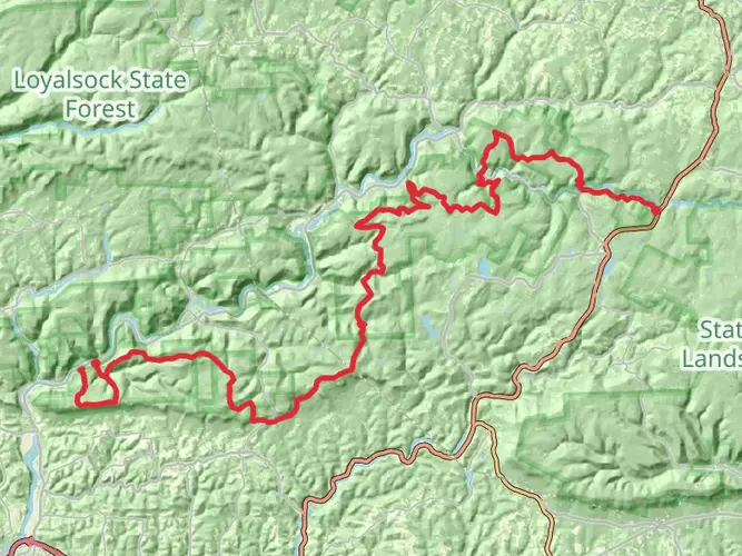
Nestled in the lush forests of Lycoming County, Pennsylvania, the Old Loggers Path is a 42-kilometer (26-mile) loop trail that offers hikers a moderate challenge with an elevation gain of approximately 1100 meters (3600 feet). This scenic route is steeped in history, tracing the paths once trodden by the loggers of the early 20th century, and is now a popular destination for those seeking to immerse themselves in nature.
Getting to the Trailhead
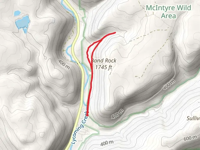
The trailhead for the Old Loggers Path is most commonly accessed by car. It is located near the small town of Ralston, Pennsylvania. From Williamsport, take US-220 N to PA-14 N toward Ralston. Once in Ralston, follow the signs to Masten, which is a ghost town and the starting point for the hike. There is a parking area near the intersection of Pleasant Stream Road and Ellenton Mountain Road, which serves as the trailhead. Public transportation options are limited in this rural area, so driving is the most feasible option for reaching the start of the hike.
Navigating the Trail
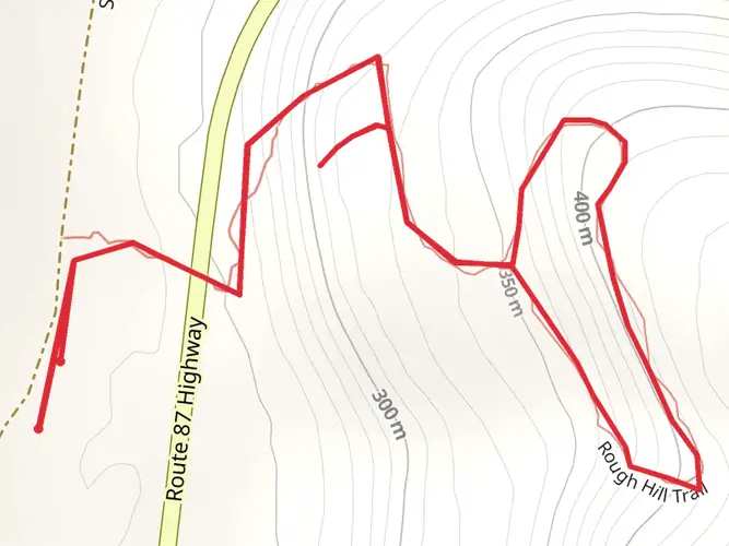
As you embark on the Old Loggers Path, it's advisable to use a reliable navigation tool like HiiKER to keep track of your progress and ensure you stay on the correct path. The trail is marked with orange blazes, and while it is generally well-maintained, some sections may be less distinct, especially after adverse weather conditions.
Historical Significance and Landmarks
The Old Loggers Path winds through areas that were heavily logged in the past, and hikers will encounter remnants of this history throughout the trail. Old railroad grades, log slides, and trestle bridges are scattered along the route, serving as a testament to the region's logging heritage.
One of the most notable landmarks is Sharp Top Vista, offering panoramic views of the surrounding mountains and valleys. Approximately 10 kilometers (6 miles) into the hike, this spot is perfect for a rest and photo opportunity.
Further along, at about the halfway point, you'll reach Rock Run, one of Pennsylvania's most pristine and picturesque streams. The area around Rock Run is ideal for camping, with several established sites available for overnight stays.
Flora and Fauna
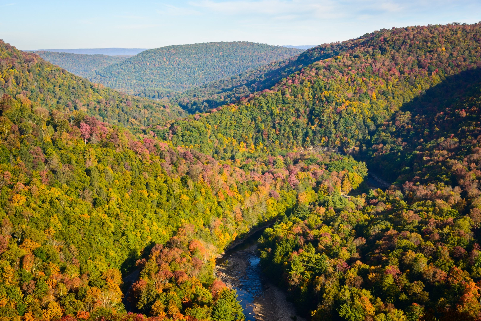
The Old Loggers Path meanders through a variety of ecosystems, including hardwood forests, pine plantations, and mountain streams. This diversity supports an abundance of wildlife, such as white-tailed deer, black bears, and wild turkeys. Birdwatchers will delight in the opportunity to spot species like the scarlet tanager, pileated woodpecker, and a variety of warblers.
Throughout the year, the trail offers a changing palette of flora. Springtime brings a burst of wildflowers, while autumn transforms the landscape into a tapestry of reds, oranges, and yellows as the foliage changes.
Trail Conditions and Preparation
The trail's terrain varies from easy, flat sections to more challenging areas with steep inclines and rocky outcrops. Weather conditions can significantly affect the trail's difficulty, so it's important to check the forecast and prepare accordingly. Sturdy hiking boots, water, and layers of clothing are essential, as temperatures can fluctuate, especially at higher elevations.
Water sources are available along the trail, but it's crucial to treat any water before drinking to avoid contamination. Additionally, as with any backcountry experience, it's important to practice Leave No Trace principles to preserve the beauty and integrity of the trail for future hikers.
Conclusion
The Old Loggers Path offers a rich blend of natural beauty, wildlife, and history. Whether you're looking for a multi-day backpacking adventure or a series of day hikes, this trail provides an opportunity to disconnect from the hustle and bustle of daily life and reconnect with the wilderness. With proper preparation and respect for the environment, your journey on the Old Loggers Path will be a memorable one.

What to expect?
Activity types
Frequently asked questions
How long does it take to hike the Old Loggers Path in Lycoming County, Pennsylvania?
The Old Loggers Path is a 41.63 km, or roughly 26-mile, loop with about 1,103 meters of climbing, so most hikers complete it as a 2- to 3-day backpacking trip. Strong hikers sometimes cover it in a long day, but the repeated climbs, stream valleys, and rocky sections make an overnight itinerary more typical.
Where do you park for the Old Loggers Path and what is the main trailhead?
The usual starting point for the Old Loggers Path is at Masten in Loyalsock State Forest, near Ralston. The main access is the campground parking area in the former ghost town of Masten, with the route also tied to Pleasant Stream Road and Ellenton Road in the loop’s southern section.
How is the Old Loggers Path marked and is it easy to follow?
The Old Loggers Path is a designated Pennsylvania State Forest hiking trail and it is blazed in orange. Much of the route follows old logging grades and forest footpath, which helps with navigation, but intersections with roads and side paths mean a map or offline navigation is still useful, especially after storms or leaf fall.
Are dogs allowed on the Old Loggers Path in Pennsylvania?
Dogs are generally allowed on the Old Loggers Path, and the trail is commonly used by hikers with dogs. In practice, keeping dogs leashed is the safer choice because the route crosses remote forest terrain, stream valleys, road sections near Masten, and rocky vista areas where footing and wildlife can be an issue.
What are the main scenic highlights on the Old Loggers Path?
The Old Loggers Path is known for a mix of forested hollows, cold streams, and broad overlooks rather than one single summit. Noted highlights along the loop include the Rock Run valley, Pleasant Stream, and vista areas around Sullivan Mountain and Sharp Top, plus the historic setting of Masten, a former lumber company town.
Is the Old Loggers Path a good beginner backpacking loop?
The Old Loggers Path is often considered a solid first multi-day backpacking loop for hikers with some fitness and basic backcountry experience. At 41.63 km with 1,103 meters of elevation gain, it is moderate rather than easy, and the route includes steady climbs, uneven tread, and water crossings that can feel more demanding after rain.
Are there stream crossings or water sources on the Old Loggers Path?
Yes. The Old Loggers Path passes clear, cold streams including Rock Run and Pleasant Stream, and water is one of the route’s defining features. Crossings and conditions can change with rainfall, and a current bridge replacement on Upper Pleasant Stream Road has created a short detour with a stream crossing, so high water can make that section more challenging.
Comments and Reviews
User comments, reviews and discussions about the Old Loggers Path, Pennsylvania.
4.4
average rating out of 5
15 rating(s)