Download
3D Flyover
Add to list
More
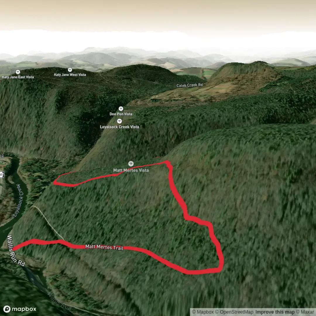
4.6 km
~1 hrs 17 min
228 m
Loop
“A colourful hike story awaits—share a trailhead pin or map, and I’ll paint the route.”
I’m missing a few key pieces of location data to describe this accurately and convert the start point to a nearby address/landmark.
Please send one of the following, and I’ll write the full hike description exactly in the style you requested:
1) The start coordinates (lat, lon) for the trailhead (or a HiiKER link), or
2) The park/region + nearest town/state (e.g., “near Ashland, OR” or “near Boulder, CO”), or
3) A map screenshot that shows the trailhead and route.
Also, if you have them, paste any of these (optional but helpful): - Loop/out-and-back/point-to-point (your “Hike type” field is blank) - Any waypoints/POIs you want included (viewpoint, lake, summit, bridge, etc.) - Any season/date you’re planning (for snow, heat, closures, wildlife activity)
Once I have the location, I’ll: - Convert the trailhead coordinates to the nearest known address or significant landmark - Give distance + elevation in km/miles and m/ft - Include public transit + driving/parking options to the start - Cover terrain, landmarks, wildlife, hazards, and historical context - Reference HiiKER only for navigation tools (as requested)

Surfaces
Ground
Comments and Reviews
User comments, reviews and discussions about the Matt Mertes Trail, Pennsylvania.
average rating out of 5
0 rating(s)