Download
3D Flyover
Add to list
More
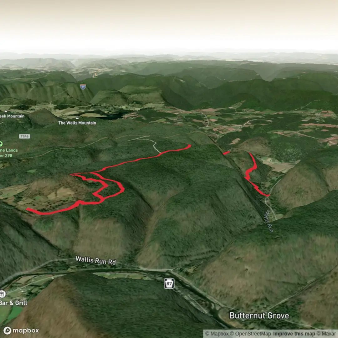
17.3 km
~4 hrs 13 min
455 m
Out and Back
“Share a trailhead or coordinates, and I’ll paint a vivid, mindful hike plan around them.”
I’m missing the key location details needed to make this accurate and safe to plan.
Send one of the following and I’ll turn it into a full, detailed hike description (with km/miles, m/ft, landmarks, wildlife, hazards, history, and car/transit access), and I’ll convert any coordinates to the nearest known address/landmark:
1) Start point as either:
- a latitude/longitude (preferred), or
- a trailhead name / nearest town / park, plus state/country
and (if you have them)
- end point (if different)
- route type (loop / out-and-back / point-to-point)
- any waypoints (peaks, lakes, junctions, parking lots)
If you paste coordinates like -122.1234, 47.1234, I’ll translate them to the nearest recognizable place (e.g., a trailhead parking area, road junction, or park entrance) and build the plan around that.

Surfaces
Ground
Comments and Reviews
User comments, reviews and discussions about the Cheryl's Trail, Pennsylvania.
average rating out of 5
0 rating(s)