Download
3D Preview
Add to list
More
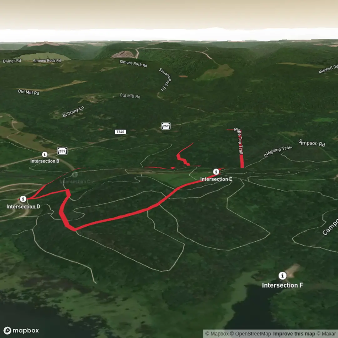
3.7 km
~51 min
78 m
Loop
“A medium ridge-top wander with big-sky views—best tailored once your trailhead details are shared.”
I’m missing a few key pieces of information to make this accurate and useful (especially the start location and what “near …” refers to). Share any of the following and I’ll turn it into a complete, ready-to-plan hike description with distances/elevation in km + miles and m + ft, plus access by car and public transport, landmarks, wildlife, and local history:
1) Start location (pick one)
- A latitude/longitude for the trailhead (I’ll convert it to the nearest known address/landmark), or
- A park/trailhead name, or
- A Google Maps link, or
- The town/city + state it’s near
2) Hike type - Loop / out-and-back / point-to-point
3) Any route specifics (optional but helpful)
- Highest point (if known), notable viewpoints, or a GPX/KML file
- Any constraints you care about (kid-friendly, dog-friendly, avoid steep/rocky, etc.)
Once you send the trailhead location (lat/long is perfect), I’ll write the full description for a ~4 km (2.5 mi), ~100 m (330 ft), medium Ridge Top Trail and include what to watch for (surface, exposure, weather, seasonal hazards), plus navigation guidance using HiiKER.

Surfaces
Dirt
Unknown
Comments and Reviews
User comments, reviews and discussions about the Ridge Top Trail, Pennsylvania.
average rating out of 5
0 rating(s)