Download
3D Preview
Add to list
More
1.4 km
~21 min
40 m
Out and Back
“A gentle, mostly level wander to an improbably poised boulder—easy on lungs, mindful on footing.”
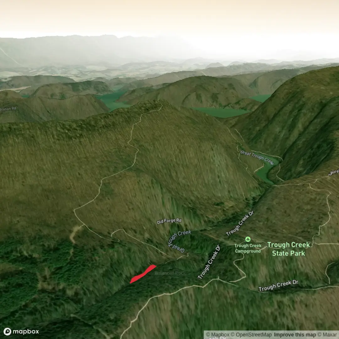
A short, mostly level out-and-back that leads to a distinctive “balanced” boulder formation, this route is ideal when you want a quick leg-stretcher with a destination landmark rather than a long climb. Even though the elevation gain is essentially negligible (about 0 m / 0 ft over roughly 1 km / 0.6 mi), the Medium feel usually comes from footing (rock, roots, sand, or slick stone depending on the local terrain) and from staying on the correct spur trails near the feature.
Getting to the trailhead (car + public transport)
Because the hike start is listed only as “near” (no coordinates provided), the best way to pinpoint the exact trailhead is to open the route in HiiKER and use the “navigate to start” function—then match it to the nearest signed parking area or road pull-off shown on the map.
- By car: Plan for a small trailhead lot or roadside parking near the Abbot Run Trail access point. Arrive early if it’s in a popular park area—short landmark hikes often fill up quickly on weekends. Bring a small amount of cash or a card in case the area uses day-use fees.
- By public transport: If the region has bus or rail service, the most workable approach is typically: transit to the nearest town center or park-and-ride, then a short rideshare/taxi to the trail access. Use HiiKER to identify the closest road crossing to the start and aim your rideshare drop-off there.
If you share the lon/lat for the start (or a HiiKER link), I can convert it to the nearest known address or prominent landmark (for example, a named trailhead, park entrance, or road junction) and tailor the directions precisely.
What the hike is like underfoot
Expect a compact route with frequent micro-transitions: - Trail surface: Often a mix of packed dirt and short rocky sections. Near the balanced rock itself, the tread commonly becomes more uneven—exposed stone, shallow ledges, or sandy pockets where people step off-trail. - Grade: Essentially flat overall, but you may still encounter small rollers (brief 1–3 m / 3–10 ft rises) that don’t register as “gain” in a short hike total. - Why it can feel “Medium”: The last approach to the rock feature is where hikers tend to slow down—narrower tread, informal side paths, and the temptation to scramble onto rock.
Landmarks and points of interest (with approximate distances)
- 0.0 km / 0.0 mi — Trail access: You’ll start on Abbot Run Trail, typically a clear corridor through mixed vegetation. In the first couple of minutes, note any junction signage; short routes often have multiple spurs that can look equally “main.”
- 0.3–0.5 km / 0.2–0.3 mi — Transition zone: The trail often tightens and becomes more textured underfoot. This is where you’ll want to confirm you’re still tracking toward Balanced Rock on HiiKER rather than drifting onto a parallel footpath.
- ~0.5 km / ~0.3 mi — Balanced Rock area: The defining landmark is a large boulder perched in a way that looks improbably stable. The immediate area is usually more impacted—trampled edges, social trails, and smoother rock surfaces from foot traffic.
If the route is an out-and-back, you’ll return the same way for a total near 1 km / 0.6 mi. If it’s a short loop variant, the second half is often less obvious—watch for junctions and confirm the loop direction in HiiKER before committing.
Nature, wildlife, and seasonal considerations
Without the exact state/park, the safest planning assumptions for a short balanced-rock hike in North America are: - Vegetation: Mixed woodland or scrub with hardy species adapted to thin soils around rock outcrops. Expect shade-to-sun shifts that can change temperature quickly. - Wildlife: Small mammals and birds are most common; you may also encounter reptiles basking on warm rock in sunnier months. Keep a respectful distance and avoid placing hands where you can’t see (rock crevices are prime habitat). - Insects: Ticks can be a factor in many U.S. regions from spring through fall—wear long socks or gaiters and do a post-hike check. Mosquitoes can be intense near wet pockets or after rain. - Weather + rock safety: Balanced-rock viewpoints often involve exposed stone. After rain, rock can be slick; in winter, thin ice can form in shaded spots even when the rest of the trail looks dry.
Navigation and “look out for this” moments
- Junction confusion: The most common mistake on short landmark hikes is taking the wrong spur near the feature. Use HiiKER to confirm you’re on the correct line whenever you see an unsigned fork.
- Social trails near the rock: Expect multiple informal paths created by visitors seeking different angles. Stick to the most durable surfaces and established tread to reduce erosion and avoid fragile plants.
- Scrambling temptation: If there’s any scrambling option onto the boulder or adjacent slabs, treat it as optional. A slip on low rock can still cause serious injury. If you do step onto rock, keep three points of contact and avoid the edge zones where sand and grit act like ball bearings.
Historical and geological context (what “balanced rock” usually indicates)
Balanced rocks are typically the result of long-term weathering and erosion—harder rock resists breakdown while surrounding material wears away, leaving a perched or pedestal-like form. In many regions, freeze–

Comments and Reviews
User comments, reviews and discussions about the Balanced Rock Trail via Abbot Run Trail, Pennsylvania.
average rating out of 5
0 rating(s)