Download
3D Flyover
Add to list
More
2.9 km
~37 min
19 m
Loop
“A gentle forest loop where charcoal hearth whispers and sunlit utility clearings invite unhurried reflection.”
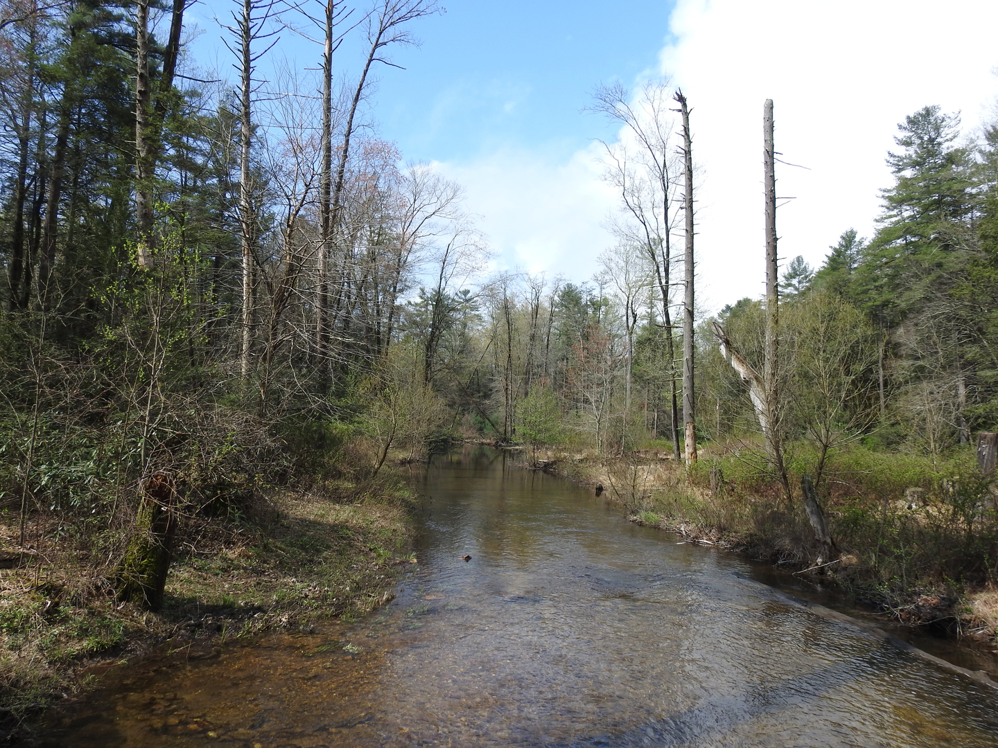
This easy, mostly level loop is a great choice when you want a short walk (about 3 km / 1.9 mi) with negligible elevation gain (around 0 m / 0 ft), wide tread in places, and a mix of open woodland and historic landscape features. Expect a relaxed pace, frequent junctions, and a route that’s more about local history and forest atmosphere than big viewpoints.
Getting to the start (car + public transport)
Because the start point was only provided as “near” (with no coordinates or place name), I can’t reliably convert it to the nearest address or landmark yet. If you share the start lon/lat (or a HiiKER link, trailhead pin, or even the nearest town/park name), I’ll translate it into the closest known address/landmark and tailor the directions precisely.
In the meantime, here’s the practical approach that works for most trailheads with this kind of loop:
- By car: Plan to park at the closest signed trailhead lot or day-use parking area associated with the Charcoal Hearth/Water Line corridor. Arrive early on weekends—small lots fill quickly, and roadside parking is often restricted near utility corridors and historic sites.
- By public transport: If there’s a nearby town, you’ll typically use regional bus/rail to the nearest transit hub, then a rideshare/taxi for the last few miles/km. Many trailheads for short forest loops are not directly served by transit stops.
If you tell me the nearest community (even just “near Chambersburg, PA” or similar), I can outline the most realistic transit chain and driving approach.
What the route feels like underfoot
For an “easy” loop with essentially flat stats, expect: - Gentle grades with only small undulations—short rises over roots, old berms, or drainage dips rather than sustained climbs. - Mixed tread: sections of packed dirt and leaf litter, occasional gravelly or sandy patches, and potentially short muddy stretches after rain (especially where water lines or old industrial clearings altered drainage). - Frequent intersections: utility corridors and historic-use areas often create multiple side paths. Use HiiKER to confirm you’re staying on the intended loop at each junction.
Landmarks and points of interest
Charcoal hearths are the signature feature implied by the name. These are typically subtle, circular or oval, flattened pads—often slightly raised or terraced—where wood was slowly burned under controlled conditions to produce charcoal. Charcoal was historically essential for iron production (fueling furnaces and forges) and other industries before coal and modern fuels dominated. In many eastern U.S. forests, charcoal hearths are among the most common “hidden in plain sight” industrial archaeology features: you may notice:
- A level, round platform on a slope where you’d otherwise expect uneven ground
- Darkened soil or charcoal fragments (don’t disturb—leave artifacts in place)
- A pattern of hearths spaced along workable terrain, often near old haul routes
The water line portion of the loop suggests you’ll parallel or cross a utility corridor tied to municipal or industrial water supply. These corridors can be surprisingly scenic in a quiet way—straight alignments through forest, occasional clearings, and a different plant community where sunlight reaches the ground.
Other common features on loops like this:
- Old roadbeds or grades: wider, smoother paths that hint at historic hauling or maintenance access
- Drainage structures: small culverts, ditches, or stonework that mark long-term land use
- Edge habitats: where corridor meets woods, you’ll often see more birds and flowering plants
Nature and wildlife to look for
With a short, low-elevation loop, the experience is often about the forest community and seasonal changes:
- Birdlife: corridor edges and mixed woods are good for songbirds; listen for calls in the morning and watch for movement along shrub lines.
- Mammals: deer are common; you may also see signs like tracks, scat, or browse lines. Small mammals tend to stay near cover.
- Reptiles/amphibians: on warm days, snakes may bask on open tread or sunny edges; after rain, watch for amphibians on damp sections.
- Plants: utility clearings often host sun-loving wildflowers and grasses that you won’t see under closed canopy.
Navigation and safety notes (what to watch out for)
- Junction density: Utility and historic areas can create “extra” paths that look equally worn. Keep HiiKER open and confirm direction at every split.
- Ticks: Edge habitat and grassy corridor sections can be prime tick territory in spring through fall. Long pants, repellent, and a post-hike check help a lot.
- Poison ivy: Common along sunny edges and disturbed ground—especially near corridors and old industrial clearings.
- After rain: Even flat routes can get slick where water pools on compacted soil. Expect short muddy patches rather than long bogs.
- Respect infrastructure: If you encounter marked water-line features (valves, vents, access covers), give them space and stay on the established tread.
Timing and planning
At an easy pace with stops to look for hearth platforms and read the landscape, most hikers will take 45–75 minutes for 3 km / 1.9 mi, depending on how often you pause at junctions or points of interest. Because elevation gain is effectively 0 m / 0 ft, this is a good option for: - a quick morning walk, - a family-friendly outing, - or a low-effort nature/history loop.
If you send

Surfaces
Unknown
Gravel
Unpaved
Asphalt
Comments and Reviews
User comments, reviews and discussions about the Charcoal Hearth Trail and Chambersburg Water Line Loop, Pennsylvania.
average rating out of 5
0 rating(s)