
Download
3D Flyover
Add to list
More
2.2 km
~33 min
68 m
Loop
“A short, punchy creekside climb—roots, rocks, and cool shade—rewarding careful footing and curiosity.”
I’m missing a few key specifics needed to make this accurate (especially the start location). Please paste either the trail’s GPS coordinates (lat, lon) for the trailhead or a HiiKER link, and if you have it, the state/park/nearest town. Once I have that, I’ll convert the coordinates to the nearest known address/landmark and tailor the directions, landmarks, and hazards.
In the meantime, here’s what you can generally expect from a ~2 km (1.2 mi) out-and-back or short loop with ~100 m (328 ft) of gain at a Medium effort level—this will match closely once I know where “Lower Bear Run Trail” is located.
You’re looking at a short hike that packs most of its effort into one or two sustained pitches rather than long endurance. 100 m (328 ft) over 2 km (1.2 mi) is a noticeable average grade, so even though the distance is brief, it can feel “punchy,” especially if the climb comes early or if the tread is rocky or rooty. Plan for 45–90 minutes on-trail depending on stops, footing, and whether it’s a loop with steady climbing or an out-and-back with a turnaround viewpoint.
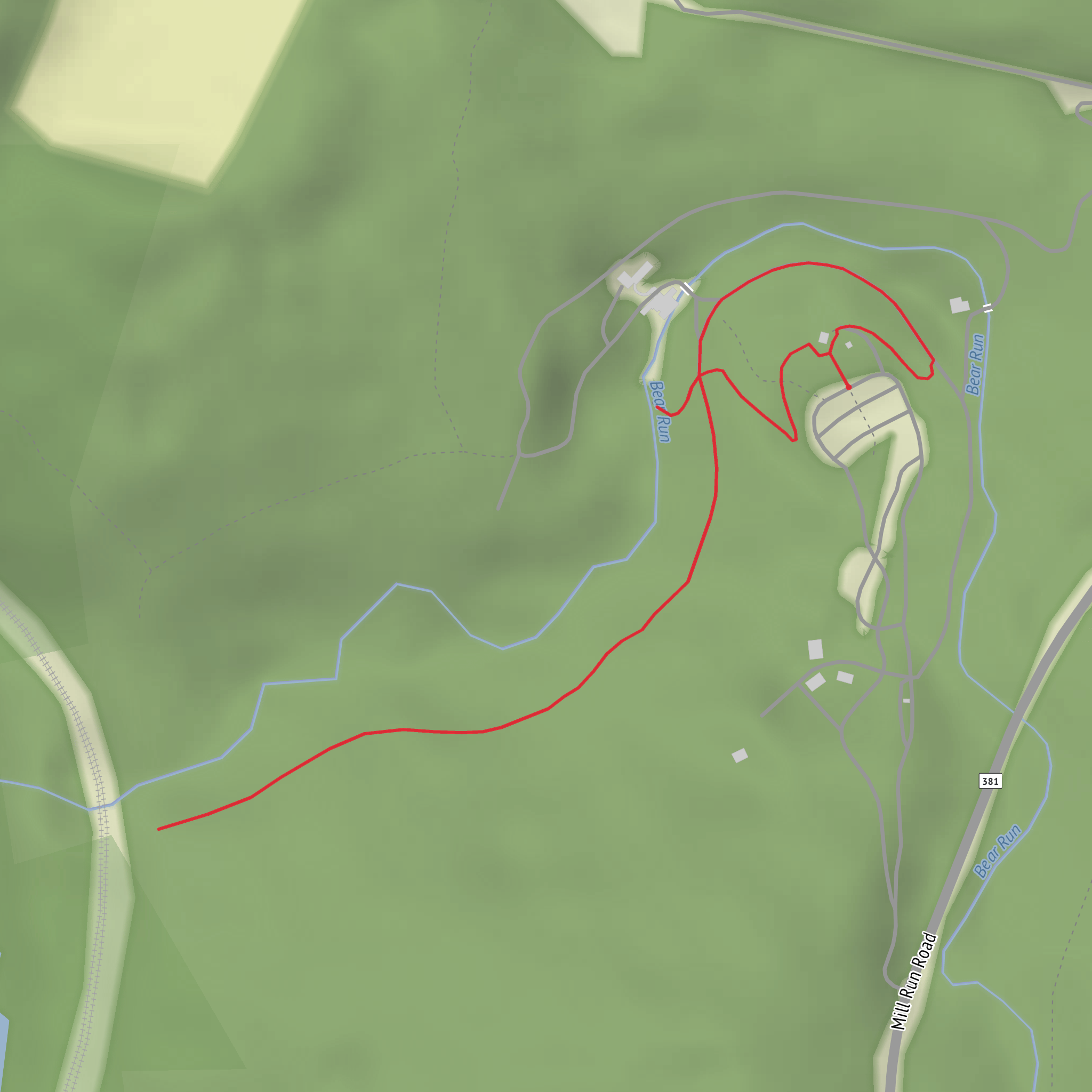
Expect the trail to start relatively gently for the first 0.3–0.6 km (0.2–0.4 mi), then steepen into the main climb where you’ll gain most of the 100 m (328 ft). If the route follows a “run” (a small stream), the grade often ramps up where the trail leaves the watercourse and climbs to a bench, ridgelet, or overlook.
Terrain, footing, and what to watch for
On a short, medium-rated trail like this, the difficulty usually comes from footing and grade, not navigation complexity. Common tread types: - Packed dirt with roots in shaded sections—slick when wet, especially on angled roots. - Rocky steps / embedded stones on the steeper pitch—watch for ankle-rolling rocks near the edges. - Narrow sidehill segments if the trail contours above a creek—these can feel exposed even without true cliffs.
If there’s a creek crossing (common on “Run” trails), it’s often within the first 0.2–0.5 km (0.1–0.3 mi). After rain, stepping stones can be submerged and the safest line may shift—give yourself time to pick a stable crossing rather than hopping quickly.
Bring traction-conscious footwear (trail runners with good lugs or light hikers). Trekking poles help on the descent; on a short steep trail, the downhill is where most slips happen.
Landmarks and natural features you’re likely to encounter
Without the exact location, I can’t name the specific overlooks or structures yet, but “Lower Bear Run” trails commonly feature: - Riparian corridor: cooler air, mossy rocks, ferns, and spring wildflowers. These areas stay damp—expect mud pockets and slick stones. - Hemlock/hardwood shade (region-dependent): deep shade can keep snow/ice lingering longer in shoulder seasons. - Small cascades or riffles: even modest elevation change can create pretty water features; listen for water to help orient yourself if the trail parallels the run.
Wildlife expectations depend heavily on region, but in many North American “run” valleys you may see songbirds, woodpeckers, salamanders near wet rocks, and white-tailed deer. If this is in black bear country (the name suggests it might be), the practical concern is usually food smells, not aggression—carry snacks sealed, don’t leave packs unattended, and make noise around blind corners near running water.
Navigation and cell coverage
Even on a short trail, junctions can be confusing if there are spur paths to water, viewpoints, or old access tracks. Download the route in HiiKER before you arrive so you have it offline. In narrow valleys, cell signal can drop unexpectedly; don’t rely on streaming maps.
Seasonal and safety considerations
- After rain: creekside trails can flood, and the steep pitch becomes slick. Add time for careful footing.
- Autumn leaf-fall: leaves hide rocks and roots—slow down on the descent.
- Winter/early spring: shaded hollows can hold ice. If temps are near freezing, consider microspikes.
- Ticks: common in brushy edges and leaf litter. Use repellent and do a check after the hike.
Getting to the trailhead (car vs public transport)
I can’t give accurate turn-by-turn directions or the nearest address/landmark until you provide the trailhead location, but here’s how I’ll format it once you send coordinates: - By car: nearest major road → park entrance/forest road → parking area name (or closest signed pull-off) → any parking fees/permits typical for that land manager. - By public transport (where feasible): nearest town transit hub → bus/train line to closest stop → rideshare/taxi distance to trailhead → realistic walking distance if no rideshare is available.
If you reply with (1) trailhead lat/lon and (2) whether it’s a loop or out-and-back, I’ll produce a fully tailored description with: - exact start landmark/address conversion, - mile/km + feet/meters for each segment, - notable junctions and landmarks, - likely flora/fauna for that specific region, - any historical context tied to the park/valley/settlement or land use history.
Surfaces
Dirt
Unknown
Gravel
Asphalt
Concrete
Wood
Comments and Reviews
User comments, reviews and discussions about the Lower Bear Run Trail, Pennsylvania.
average rating out of 5
0 rating(s)
