Download
3D Flyover
Add to list
More
6.3 km
~1 hrs 25 min
97 m
Out and Back
“A shaded Ohiopyle loop where creekside hush builds to Jonathan’s roar and Sugar Run’s hidden shimmer.”
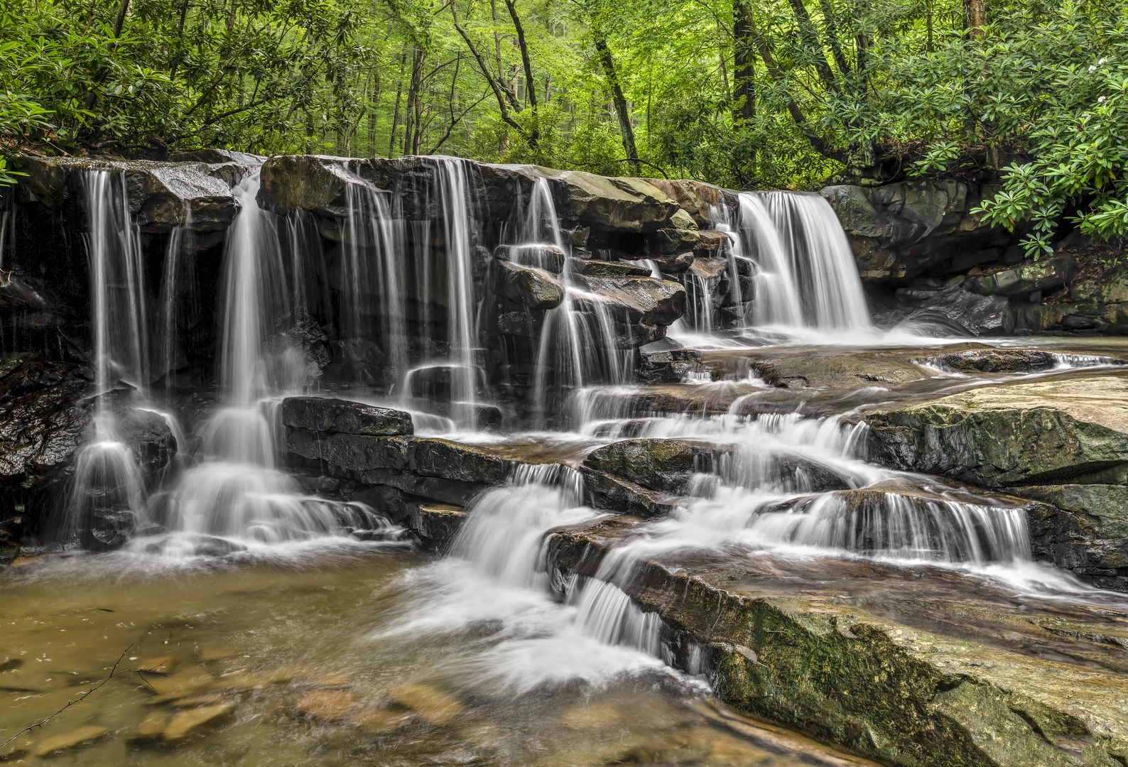
A short, waterfall-rich loop in Ohiopyle State Park that packs a lot into about 6 km (3.7 mi) with roughly 100 m (330 ft) of climbing. Expect shaded forest, rocky creek corridors, and two standout cascades—Jonathan Run Falls (the larger, multi-tiered showpiece) and Sugar Run Falls (smaller, tucked into a quieter hollow). Footing is generally straightforward for most hikers, but the trail surface can turn slick near the water and after rain.
Getting to the trailhead (car + public transport)
By car:
The most practical start is from the Ohiopyle State Park / Ohiopyle Borough area, near the park’s main day-use facilities and trail access around Ohiopyle, Pennsylvania 15470 (Fayette County). If you’re navigating, use HiiKER to pinpoint the closest official trail access/parking for the Jonathan Run and Sugar Run trail network near Ohiopyle. Roads in and around Ohiopyle are well-signed for state park access, but weekends can be busy—arrive early for easier parking.
By public transport:
Direct public transit to Ohiopyle is limited. The most workable approach is typically:
- Travel by bus/train to a larger hub such as Pittsburgh or Connellsville, then
- Use a rideshare/taxi to reach Ohiopyle State Park trail access near Ohiopyle Borough.
If you’re trying to do this car-free, plan extra time and confirm schedules in advance—service frequency can be sparse outside peak seasons.
What the hike is like underfoot
You’ll be on a mix of packed dirt, leaf litter, roots, and rock—with the “easy” rating mostly reflecting the modest elevation gain and short distance rather than perfectly smooth tread. Near both falls, expect wet rock, spray, and muddy patches, especially in spring or after storms. Good tread shoes are usually enough; trekking poles can help if you’re cautious on slick stone.
Because the route is short, it’s common to see families and casual walkers near the most popular viewpoints. A quieter feel returns quickly once you move away from the main access points and deeper into the hollows.
Waterfalls, viewpoints, and the best landmarks
Within the first couple of kilometers (about 1–1.5 mi), the sound of moving water becomes a constant companion as you approach the Jonathan Run drainage. The forest here is classic Laurel Highlands: mixed hardwoods with hemlock pockets, mossy boulders, and ferny understory.
- Jonathan Run Falls: The main event—broad, stepped cascades dropping through a rocky chute. There are usually a few natural vantage points where the trail edges close to the creek. Keep a respectful distance from the lip and any undercut edges; the rock can be deceptively slick even when it looks dry.
- Sugar Run Falls: Typically reached after a gentle transition into a narrower, more enclosed stream corridor. It’s smaller than Jonathan Run Falls but feels more secluded, with a “hidden glen” character when vegetation is lush.
If you’re using HiiKER, keep an eye on short spur paths and junctions near the falls—social trails can tempt people toward unstable edges. Stick to the established line shown in HiiKER for safer footing and to reduce erosion.
Elevation and pacing (easy, but not flat)
Total climbing is around 100 m (330 ft) over the full outing. Most of that gain is spread out in short rises rather than one long grind. A comfortable pace for most hikers (including time for photos and waterfall stops) is 1.5–2.5 hours for 6 km (3.7 mi), depending on how long you linger at viewpoints and how crowded the falls area is.
Nature and wildlife to look for
This corner of the Laurel Highlands is known for moist forest microclimates—great for: - Spring wildflowers (look along richer soils near drainages) - Ferns, mosses, and fungi on shaded rock and downed logs - Songbirds in the canopy and along the creek edges
Wildlife is typical of southwestern Pennsylvania woodlands: - White-tailed deer are common - Wild turkey may be seen on quieter stretches - Black bears exist in the region but are usually shy—store food securely and keep a clean pack
Near water, watch for amphibians (especially in cooler, wetter months). Give them space and avoid stepping in shallow stream margins where they blend in.
Hazards and what to watch out for
- Slippery rock near waterfalls: Mist and algae make stone slick. The most common mishaps here are simple slips—slow down near spray zones.
- High water after rain: Creek crossings (if any on your chosen line) can become unsafe. If water is moving fast or above ankle/shin height, reroute using the established trail shown on HiiKER rather than improvising.
- Erosion and crumbling edges: Waterfall viewpoints often have undercut banks. Stay on durable surfaces and avoid “one more step” toward the edge.
- Ticks (seasonal): In warmer months, do a tick check after the hike, especially if you brush through understory.
Historical context of the area
Ohiopyle and the surrounding Laurel Highlands sit in a landscape shaped by Appalachian geology and long-running water erosion—exactly what you’re seeing at Jonathan Run and Sugar Run as they cut through rock to form cascades and plunge pools. The broader region is also closely tied to

Surfaces
Dirt
Unknown
Comments and Reviews
User comments, reviews and discussions about the Jonathan Run Falls and Sugar Run Falls, Pennsylvania.
average rating out of 5
0 rating(s)