Download
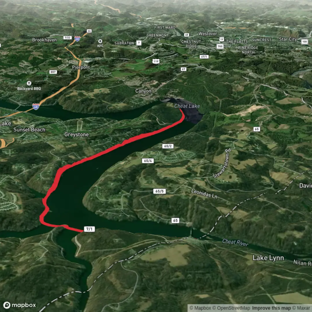
3D Flyover
Add to list
More
7.3 km
~1 hrs 29 min
23 m
Point-to-Point
“Glide the paved lakeside rail-trail, where calm water views invite easy strolling and birdwatching.”
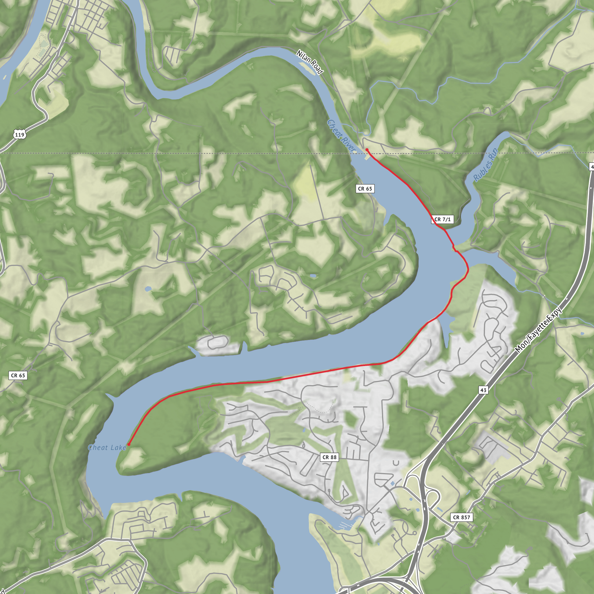
This easy lakeside rail-trail is a mostly flat, family-friendly out-and-back that tracks the shoreline of Cheat Lake (the Cheat River reservoir) on a wide, paved surface. At roughly 7 km (4.3 mi) round trip with about 0 m (0 ft) of climbing, it’s well-suited to relaxed walking, strollers, mobility devices, and casual cycling—while still delivering constant water views, fishing access, and a few standout nature-watching spots. (visitmountaineercountry.com)
Getting to the trailhead (car + public transport)
By car: The most reliable “put it in your GPS” start point is the main parking area for Cheat Lake Park:
- Cheat Lake Park Parking, Morgan Run Road, Morgantown, WV 26508 (adventurewv.wvu.edu)
You’ll commonly approach via I‑68 (Exit 10) toward the Cheat Lake area, then work your way to Morgan Run Rd; signage for Cheat Lake/Cheat Haven Park is often referenced in local directions. (adventurewv.wvu.edu)
Nearest known landmark/address: Cheat Lake Park is also commonly listed around the Cheat Lake community in Morgantown, with park access associated with the Bunker Hill Rd / Morgantown, WV 26508 area. (visitmountaineercountry.com)
By public transport: Morgantown has local bus service, but routes and stop locations near Cheat Lake can be limited and change seasonally. Plan to use a bus/taxi/rideshare combination to reach Cheat Lake Park Parking (Morgan Run Rd), then start on foot. Before you go, confirm the best drop-off point and walking-safe roads to the park entrance.
What the hike is like underfoot
From the park access, the route follows an abandoned railroad right-of-way converted into a multi-use paved path (about 12 ft wide), which is why the grade stays so gentle and consistent. (visitmountaineercountry.com)
Expect:
- Smooth pavement with occasional debris (small sticks, gravel) after storms
- A steady lakeside feel—open sun in places, with intermittent shade where trees edge the corridor
- Frequent side views to the water and small inlets
Because it’s flat, the main “effort” factors are sun exposure, humidity, and wind off the lake, not elevation.
Landmarks and points of interest along the way
Distances below assume a ~7 km / 4.3 mi total out-and-back; adjust slightly depending on where you begin within the park.
- 0.0 km / 0.0 mi – Park amenities zone: Near the developed park area you may find seasonal facilities and family features (playground, picnic areas). (diyoutdoors.wvu.edu)
- ~1.0–2.0 km / 0.6–1.2 mi – Fishing access & lake viewpoints: The trail is known for fishing platforms and shoreline access points where the corridor widens and sightlines open across the reservoir. (diyoutdoors.wvu.edu)
- Northern end features: A fishing platform near the station area is specifically noted in local visitor information, making it a good “turnaround goal” if you want a defined endpoint. (visitmountaineercountry.com)
- Southern tip nature viewing area: One of the best wildlife-scanning stretches is the nature viewing area at the southern tip, where quieter water and edge habitat can concentrate birds. (visitmountaineercountry.com)
If you’re using HiiKER, treat these as practical waypoints: parking → mid-trail fishing access → nature viewing area / station platform (depending on direction) → return.
Nature, wildlife, and what to look out for
Cheat Lake is a reservoir on the Cheat River in Monongalia County, and the trail’s shoreline position makes it a strong spot for water-associated wildlife watching. (en.wikipedia.org)
Common things hikers tend to notice here:
- Birdlife: waterfowl and shoreline birds are most active in the morning and near calmer coves
- Seasonal insects: expect mosquitoes and gnats in warm months, especially near still water and at dusk
- Turtles and amphibians: often seen near sunny banks and quieter edges
- Deer and small mammals: more likely at quieter times of day, especially where the corridor meets thicker vegetation
Practical cautions: - Water-edge hazards: banks can be slick with algae or mud; keep kids close near openings to the
Surfaces
Unknown
Gravel
Comments and Reviews
User comments, reviews and discussions about the Cheat Lake Trail, Pennsylvania.
average rating out of 5
0 rating(s)
