
Download
3D Flyover
Add to list
More
2.0 km
~24 min
0 m
Out and Back
“A gentle pondside wander—wildflowers, birdsong, and muddy mysteries—best enjoyed with steady footing.”
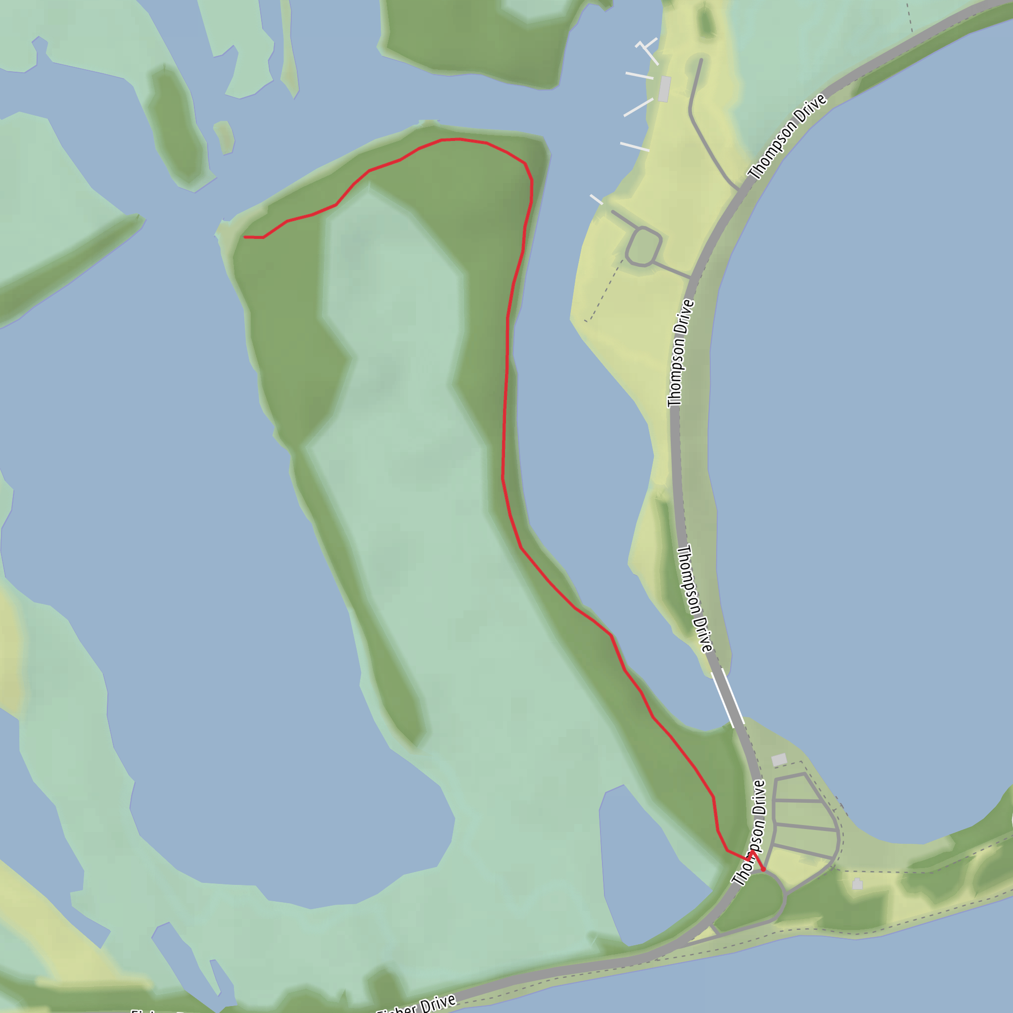
This is a short, low-effort walk of roughly 2 km (1.2 mi) with essentially 0 m (0 ft) of elevation gain, ideal for a relaxed loop or out-and-back where the main “challenge” is staying oriented on gentle, sometimes indistinct tread near wet ground.
Getting to the trailhead (car + public transport)
I’m missing the key location detail: your hike head is listed only as “near” with nothing after it, and there are multiple places that use the name Graveyard Pond. To convert coordinates to the nearest address/landmark (as you requested) and give accurate directions, I need either: - a lon/lat for the trailhead, or - the state/province + nearest town/park, or - a HiiKER link to the route.
If you share any one of those, I’ll pin it to the nearest known address or prominent landmark and give specific driving and transit options.
What the walk is like (surface, pacing, and where the distance goes)
Expect a mostly level route that typically breaks down like this on a ~2 km (1.2 mi) easy pond trail:
- 0.0–0.5 km (0.0–0.3 mi): A gentle approach from the parking/pull-off area into mixed woods or scrubby lakeshore vegetation. Surfaces are often packed dirt, pine needles, or short grass, with occasional roots.
- 0.5–1.0 km (0.3–0.6 mi): The trail usually begins to hug the pond edge or transitions onto slightly wetter ground. This is where you’re most likely to encounter mud patches, shallow standing water after rain, and short sections where the tread narrows.
- 1.0–2.0 km (0.6–1.2 mi): The return leg (or second half of a loop) tends to mirror the first, with the best views often appearing where the shoreline opens up—look for small clearings, informal viewpoints, or a subtle high spot that gives a wider angle across the water.
Even with negligible elevation gain, plan for slower steps if the route crosses boggy margins—easy trails around ponds can still be slippery.
Navigation and what to watch for
Because pond-side paths can braid into multiple faint tracks (fishing access paths, wildlife trails, or old maintenance lines), it’s smart to keep a map open on HiiKER and confirm you’re staying on the intended line, especially at: - Shoreline pinch points where the trail detours inland to avoid wet ground - Beaver-influenced areas (if present) where water levels can change and reroute the tread - Unmarked junctions with short spurs to the water
If you notice the tread becoming very narrow and “tunneled” with vegetation, pause and check HiiKER—those are often social paths rather than the main route.
Landmarks, nature, and wildlife you’re likely to notice
Pond trails concentrate wildlife activity because water, food, and cover are all close together. Common things to look for:
- Wetland edge plants: sedges, rushes, and moisture-loving shrubs; in warmer months, expect wildflowers in sunnier openings.
- Birdlife: ponds often host waterfowl (ducks, geese), plus songbirds in the surrounding brush. Early morning and late afternoon are typically the most active times.
- Amphibians: frogs and salamanders are common near shallow edges; listen for calls in spring and early summer.
- Mammal sign: tracks in mud, scat on the trail edge, and chewed sticks near the shoreline. If the area has beavers, you may see gnawed trunks and small dams or channels.
Bugs can be the biggest “hazard” on an easy pond walk: mosquitoes and black flies (season-dependent) can be intense near still water. A head net can be overkill for many hikes, but it’s a game-changer on short wetland loops when conditions are right.
Footing, seasonal conditions, and what to pack
Because the route is short and flat, comfort and conditions matter more than fitness:
- Footwear: trail runners are fine in dry spells; after rain or during spring thaw, water-resistant shoes or light hikers help with mud and puddles.
- Traction: roots + damp soil can be slick; step carefully on angled shoreline rocks or wet boardwalk (if any).
- Clothing: long sleeves/pants can help with insects and brushy sections.
- Essentials (even on 2 km / 1.2 mi): water, a light layer, and HiiKER for quick orientation checks.
Historical significance (once the location is confirmed)
“Graveyard Pond” place names are often tied to local history—sometimes a nearby old cemetery, sometimes a shipwreck/settlement story, and sometimes simply a traditional name that stuck on early maps. The specific historical context depends entirely on which Graveyard Pond this is (and what region it’s in). If you provide the trailhead lon/lat or nearest town/park, I’ll include the relevant local history (land use, indigenous history where documented, logging/mining/settlement patterns, and any known cemetery or historic site connections) with concrete place references.
Send the trailhead coordinates (or a HiiKER route link, or at least the nearest town/state) and I’ll rewrite this as a fully location-specific plan with exact access directions, nearest address/landmark,
Surfaces
Unknown
Asphalt
Comments and Reviews
User comments, reviews and discussions about the Graveyard Pond Trail, Pennsylvania.
average rating out of 5
0 rating(s)


