Download
3D Flyover
Add to list
More
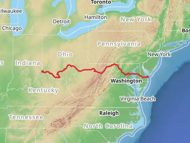
508.2 km
~21 days
11637 m
Multi-Day
“The Mid State Trail, a medium-difficulty trek through Pennsylvania's history-rich landscapes, offers diverse beauty and challenges.”
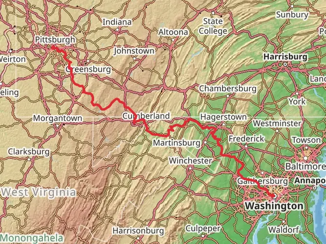
Spanning approximately 508 kilometers (about 316 miles) and with an elevation gain of around 11,600 meters (approximately 38,000 feet), the Mid State Trail weaves its way through the rugged terrain of Pennsylvania. This point-to-point trail, considered to have a medium difficulty rating, begins near Bedford County and stretches northward to the West Rim Trail in Tioga County.
Getting to the Trailhead
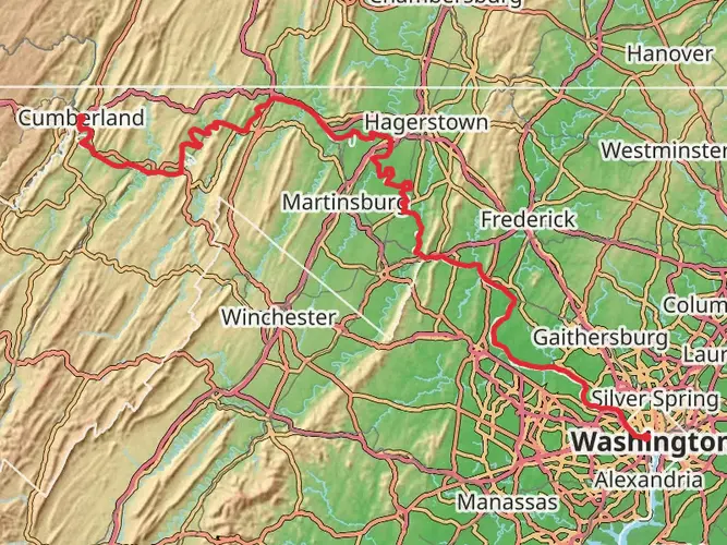
The southern terminus of the Mid State Trail is accessible near the town of Everett, Pennsylvania. Those arriving by car can navigate to the town and follow local roads towards the Buchanan State Forest, where the trailhead is located. Public transportation options are limited in this rural area, but hikers can reach nearby towns using bus services and then arrange for a taxi or a local shuttle to the trailhead.
Navigating the Trail
Hikers can rely on HiiKER to navigate the trail, ensuring they stay on the correct path and can plan their journey with up-to-date maps and waypoints. The trail is marked with orange blazes, and additional signage is present at key junctions to assist with navigation.
Trail Highlights and Landmarks
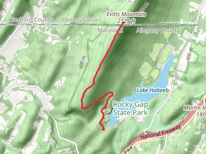
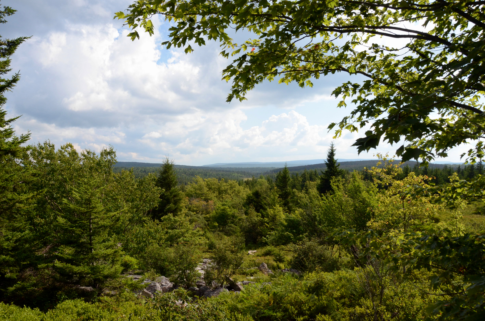
The Mid State Trail offers a diverse array of landscapes, including dense forests, mountain ridges, and scenic streams. One of the early highlights is the climb up Tussey Mountain, which provides panoramic views of the surrounding valleys. As the trail progresses, hikers will encounter the remnants of Pennsylvania's rich coal mining history, with abandoned mines and ghost towns dotting the landscape.
The trail crosses several state parks and natural areas, such as Bald Eagle State Forest and Ravensburg State Park, where the flora and fauna of Pennsylvania can be fully appreciated. Wildlife sightings may include white-tailed deer, black bears, and a variety of bird species.
Challenges and Considerations
While the Mid State Trail is rated as medium difficulty, certain sections can be challenging due to steep climbs and rocky terrain. It is essential for hikers to be well-prepared with appropriate footwear and gear. Water sources are available along the trail, but it is advisable to carry a water filter or purification tablets.
Historical Significance
The region through which the Mid State Trail passes is steeped in history. The trail itself follows paths used by Native Americans and early settlers. Hikers will pass near historic towns like Woolrich, known for its woolen mill that dates back to the 19th century, and can observe the impact of the logging industry that once thrived in the area.
Seasonal Considerations
The best times to hike the Mid State Trail are during the spring and fall when the weather is mild, and the foliage is either blooming or displaying vibrant autumn colors. Summer hikes are also popular, though the weather can be hot and humid. Winter brings its own beauty, but hikers should be prepared for snow and cold temperatures, which can make the trail more challenging.
End of the Trail
The northern terminus of the Mid State Trail connects with the West Rim Trail near the town of Ansonia, close to the Pennsylvania Grand Canyon, also known as the Pine Creek Gorge. This natural landmark serves as a fitting conclusion to the long journey, offering one last spectacular view before hikers depart from the trail.

What to expect?
Activity types
Frequently asked questions
How long does it take to hike the Mid State Trail - Pennsylvania end to end?
The Mid State Trail - Pennsylvania is about 508.24 km, or roughly 316 miles, so most end-to-end hikers need several weeks rather than a long weekend. A common backpacking pace on a route this length is around 15 to 25 km per day, which puts a full thru-hike in the range of about 20 to 35 days depending on fitness, weather, and resupply stops.
Where does the Mid State Trail - Pennsylvania start and finish?
The Mid State Trail - Pennsylvania runs south to north across the state. Its southern end is near the Mason-Dixon Line in the Buchanan State Forest area near Everett in Bedford County, and the northern end reaches the New York state line just north of Cowanesque Lake, where it connects onward from the West Rim Trail area in Tioga County.
How hard is the Mid State Trail - Pennsylvania and what kind of terrain is on it?
The Mid State Trail - Pennsylvania is generally rated medium, but that still means a demanding long-distance route with about 11,637 meters of total elevation gain. The southern and central sections are known for rocky ridge walking, long forest stretches, and repeated climbs, while farther north the route includes more old trails, rail grades, and road-grade walking.
How is the Mid State Trail - Pennsylvania marked and is it easy to follow?
The Mid State Trail - Pennsylvania is marked with rectangular orange blazes on the main route, with side trails commonly using yellow or red blazes. Navigation is usually straightforward at a broad level, but on a 508 km point-to-point trail there are many junctions, road crossings, and remote sections, so careful map-based navigation is still important.
What are the main highlights on the Mid State Trail - Pennsylvania?
The Mid State Trail - Pennsylvania is known for long ridge walks, broad forest sections, and repeated valley views across central Pennsylvania. Notable highlights include the Tussey Mountain area, scenic overlooks along the ridge-and-valley sections, and the trail’s progression from rugged southern ridges to the wilder northern country near Cowanesque Lake and Tioga County.
When is the best time of year to hike the Mid State Trail - Pennsylvania?
Spring and fall are usually the best seasons for the Mid State Trail - Pennsylvania because temperatures are cooler and visibility from the ridges is often better. Summer can bring heat, humidity, and ticks, while late fall also overlaps with hunting seasons on the state forests and game lands the trail crosses, so bright orange clothing is a smart precaution.
Can you camp along the Mid State Trail - Pennsylvania?
Camping is possible along much of the Mid State Trail - Pennsylvania because large sections cross Pennsylvania public lands including state forests, state parks, and game lands. Rules vary by land manager and by specific corridor, so overnight plans need to match the regulations for each section, especially where the route briefly uses private land by permission.
Comments and Reviews
User comments, reviews and discussions about the Mid State Trail - Pennsylvania, Pennsylvania.
4.69
average rating out of 5
16 rating(s)