Download
3D Flyover
Add to list
More
1.6 km
~18 min
0 m
Loop
“Stroll Pittsburgh’s riverfront ribbon from Point State Park toward the GAP, with skyline-and-bridge views.”
This is a short, flat riverside walk (about 2 km / 1.2 mi with roughly 0 m / 0 ft of climbing) that links Pittsburgh’s riverfront trail network with the start of the Great Allegheny Passage (GAP) corridor. Expect wide, paved multi-use paths, constant city-and-water views, and a steady flow of cyclists and runners—ideal for an easy outing, a quick leg-stretcher, or a family-friendly stroll.
Getting to the start (public transport + car)
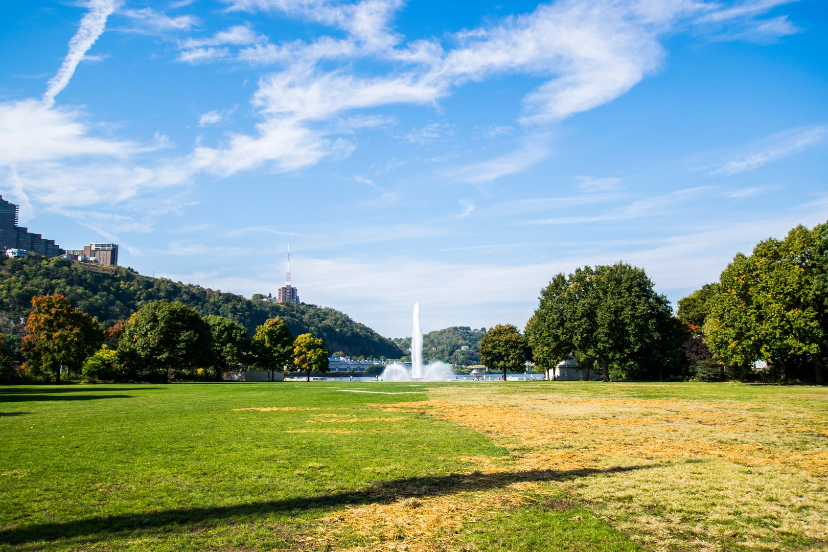
Because “near” wasn’t fully specified, the most common and practical place to begin a ~2 km segment that clearly connects the Three Rivers Heritage Trail to the GAP is at Point State Park (near the Fort Pitt Museum / Point State Park Fountain, Downtown Pittsburgh)—a major landmark at the tip of the “Golden Triangle,” where the Allegheny and Monongahela Rivers form the Ohio River.
- By public transport:
- Pittsburgh Light Rail (the “T”): Get off at Gateway Station or Steel Plaza and walk to Point State Park (generally 0.6–1.3 km / 0.4–0.8 mi, depending on station and route).
- Port Authority buses: Many routes serve Downtown; aim for stops near Liberty Ave / Wood St, Smithfield St, or Stanwix St, then walk to the park.
- Pittsburgh Light Rail (the “T”): Get off at Gateway Station or Steel Plaza and walk to Point State Park (generally 0.6–1.3 km / 0.4–0.8 mi, depending on station and route).
- By car:
- Street parking can be limited; the simplest option is a Downtown garage (near Fort Pitt Blvd, Commonwealth Pl, or Stanwix St) and then walk to the riverfront.
- If you prefer to park closer to the trail corridor, look for lots/garages near Station Square (across the river) and reach the trail via the riverfront connections.
- Street parking can be limited; the simplest option is a Downtown garage (near Fort Pitt Blvd, Commonwealth Pl, or Stanwix St) and then walk to the riverfront.
If you share the exact lon/lat (or the neighborhood), I can pin the nearest specific trail access point and the closest recognizable address/landmark.
What the walk is like underfoot
You’ll be on paved, mostly level trail with gentle curves and frequent access points to streets, parks, and overlooks. With essentially no elevation gain, the main “effort” comes from distance and pace rather than terrain. This is a true multi-use corridor: - Keep right, pass on the left, and expect fast-moving bikes. - Watch for driveway/road crossings where trail users and turning vehicles meet. - After rain, puddles can linger in low spots; in winter, shaded sections can hold ice.
Landmarks and river views you’ll notice
Starting near Point State Park, you’re immediately in one of Pittsburgh’s most iconic settings: - Point State Park & Fountain: A classic photo stop and a good place to check gear, water, and layers before you set off. - The confluence of the rivers: You’ll see the meeting of the Allegheny and Monongahela forming the Ohio River, with big-sky views framed by bridges. - Bridge scenery: This area is defined by Pittsburgh’s bridge network—expect dramatic steel spans and constant river traffic visuals (barges are common).
As you continue along the riverfront alignment toward the GAP corridor, you’ll pass a mix of landscaped park edges, trail-side rail/industrial remnants, and modern cityfront development—an “urban nature” feel rather than deep woods.
Nature and wildlife (urban river corridor)
Even though you’re in the city, the rivers bring wildlife:
- Birdlife: Gulls, Canada geese, mallards, and other waterfowl are common; in migration seasons you may spot additional songbirds along planted river edges.
- River activity: Fish are present but not always visible; you’ll often see anglers near calmer edges.
- What to look out for:
- Geese can be territorial in spring; give them space.
- Watch for slick patches from mud, algae, or leaf litter near the waterline and under trees.
Historical significance of the route
This short walk sits in a region with outsized historical weight:
- Point State Park area marks the strategic “Forks of the Ohio,” contested in the 18th century and central to early North American colonial conflict and fort-building.
- The GAP itself follows corridors shaped by railroads, river commerce, and industry, later repurposed into one of the country’s best-known long-distance rail-trails—so even a 2 km segment often passes subtle clues of Pittsburgh’s industrial and transportation history (bridge infrastructure, old alignments, and riverfront engineering).
Planning notes (what to bring and how to navigate)
- Footwear: Comfortable walking shoes are enough; the surface is hard-packed pavement, so cushioning helps.
- Water/snacks: Easy to keep this minimal for 2 km / 1.2 mi, but sunny riverfront stretches can feel warmer with reflected heat.
- Weather: Wind off the rivers can make it feel cooler than inland streets; bring a light layer even on mild days.
- Navigation: Use HiiKER to confirm the exact trail junctions (especially where the Three Rivers Heritage Trail links into the GAP alignment) and to avoid accidentally detouring onto a parallel sidewalk or bridge approach.
If you tell me where you want the 2 km to begin and end (or provide coordinates), I’ll tailor the description to that exact segment—pinpointing the nearest trail access, the best parking/transit stop, and the specific landmarks you’ll pass in order.

Surfaces
Unknown
Paved
Concrete
Asphalt
Comments and Reviews
User comments, reviews and discussions about the Great Allegheny Passage via Three Rivers Heritage Trail, Pennsylvania.
average rating out of 5
0 rating(s)