Download
3D Flyover
Add to list
More
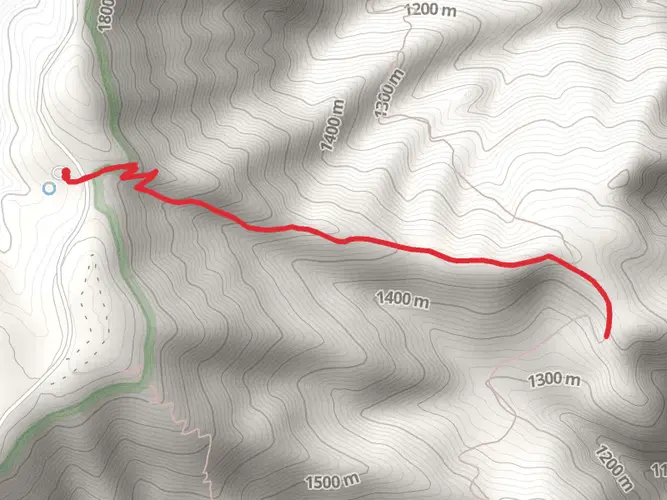
72.2 km
~3 days
1740 m
Multi-Day
“Embark on a breathtaking 45-mile trek through Hells Canyon's diverse landscapes, rich history, and stunning vistas, suited for the prepared hiker.”
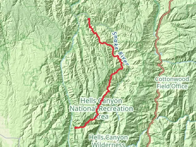
Embarking on the Hells Canyon Western Rim Trail, you'll traverse approximately 45 miles (72 kilometers) of rugged landscapes with an elevation gain of about 5,577 feet (1,700 meters). This point-to-point trail is nestled near Wallowa County, Oregon, and offers a medium difficulty rating, making it accessible to hikers with a reasonable level of fitness and experience.
Getting to the Trailhead
To reach the trailhead, you can drive to the vicinity of Hat Point, which is the closest landmark to the starting point. If you're relying on public transport, your options may be limited due to the remote nature of the area. The nearest significant town with transport links is Joseph, Oregon. From there, you may need to arrange a shuttle or taxi service to the trailhead, as direct public transport is not available to this remote location.
Navigating the Trail
As you set out on your journey, ensure you have the HiiKER app downloaded for up-to-date trail maps and navigation. The app will be an invaluable tool for staying on course along the Western Rim, especially in areas where the trail may be less defined.
Landmarks and Scenery
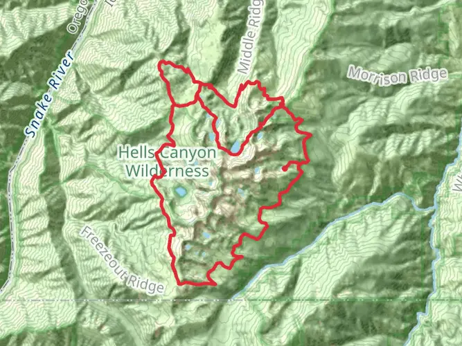
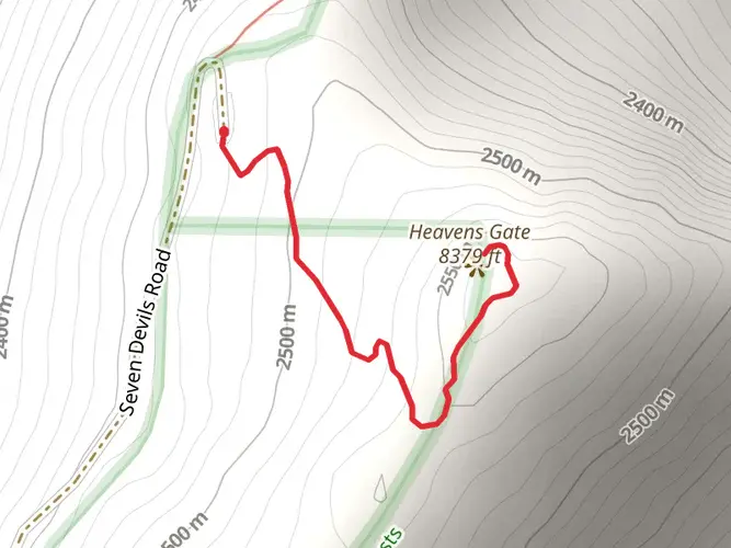
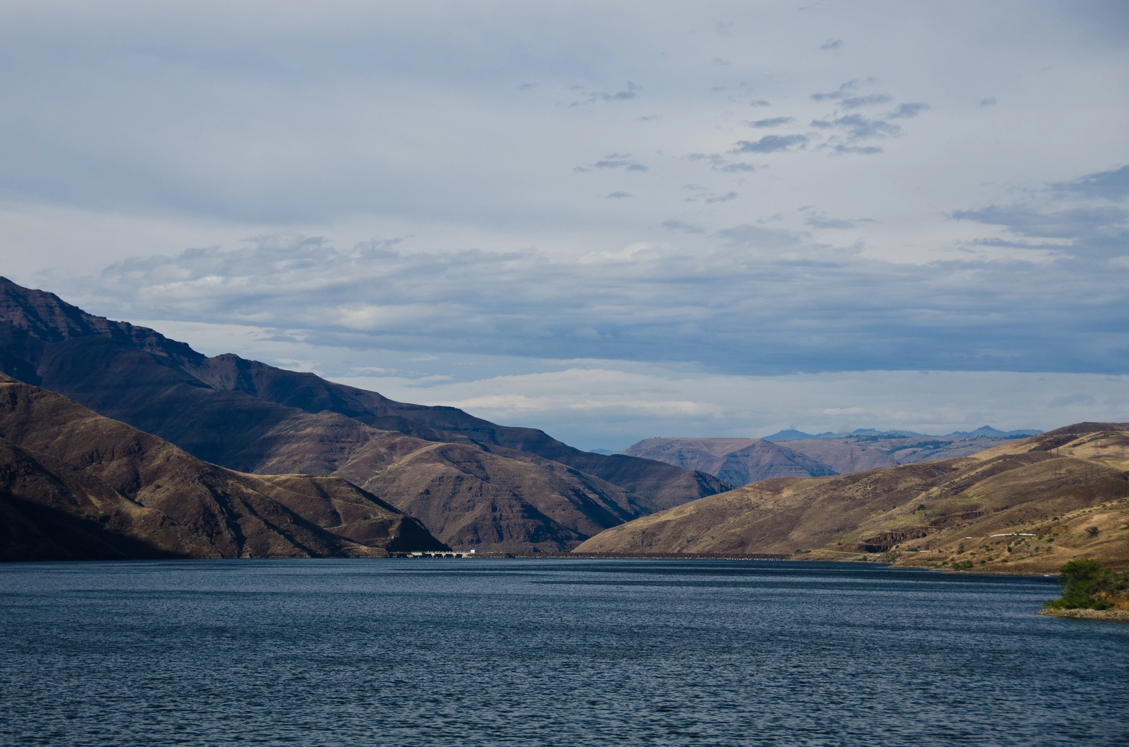
The trail offers panoramic views of Hells Canyon, which is North America's deepest river gorge, and the adjacent Seven Devils mountain range. You'll be treated to a variety of landscapes, from grassy ridges to rocky outcrops. Approximately 10 miles in, you'll reach the summit of Hat Point, which provides a breathtaking overlook of the canyon and the Snake River below.
Flora and Fauna
As you hike, you'll be immersed in a diverse ecosystem. The area is home to ponderosa pines, Douglas firs, and a variety of wildflowers that bloom in the spring and early summer. Wildlife sightings may include elk, deer, black bears, and various bird species, such as the golden eagle and peregrine falcon. Always keep a safe distance from wildlife and practice Leave No Trace principles to protect their natural habitat.
Historical Significance
The region is steeped in history, with the Nez Perce tribe having lived in the area for thousands of years. The canyon itself was named by early explorers and miners in the 19th century. As you hike, you may encounter historical remnants like old homesteads and evidence of past mining activity.
Preparation and Safety
Given the trail's length and remote nature, it's essential to be well-prepared with adequate supplies, including water, food, and emergency gear. Weather conditions can change rapidly, so pack layers and be prepared for both hot and cold weather. It's also wise to inform someone of your hiking plans and expected return time.
Conclusion
By following these guidelines and preparing accordingly, your trek along the Hells Canyon Western Rim Trail will be a memorable adventure through one of Oregon's most spectacular landscapes.

What to expect?
Activity types
Frequently asked questions
How long is the Hells Canyon Western Rim Trail and how many days does it take to hike?
The Hells Canyon Western Rim Trail is 72.16 km, or about 45 miles, with roughly 1,740 meters of climbing. Most backpackers split that into a 3- to 5-day trip, depending on pace, camp locations, and how much time is spent at overlooks along the rim above the Snake River.
Where do you start the Hells Canyon Western Rim Trail and where can you park?
A common access point for the Hells Canyon Western Rim Trail is the Hat Point area above Hells Canyon. Hat Point Overlook is reached from Enterprise through Joseph and Imnaha, then by Forest Road 4240 and Forest Road 315, and the overlook area is used as a trail access and parking point for hikes along the rim.
Is the road to the Hells Canyon Western Rim Trail at Hat Point open year-round?
No. The Hat Point access road is typically seasonal because snow can block the high-elevation route well into early summer. Local trail and overlook information commonly notes that vehicle access is usually reliable from around July into fall, with conditions varying by snowpack and road maintenance.
What can you see on the Hells Canyon Western Rim Trail?
The Hells Canyon Western Rim Trail follows the Oregon side of the canyon and delivers broad views into Hells Canyon and across to Idaho's Seven Devils range. Hat Point is one of the standout viewpoints, with a fire lookout tower and sweeping views over the Wild and Scenic Snake River far below.
Is the Hells Canyon Western Rim Trail difficult?
The Hells Canyon Western Rim Trail is generally rated medium, but the route is still a serious multi-day hike because it covers 72.16 km through remote country with about 1,740 meters of elevation gain. The challenge comes less from technical terrain and more from distance, exposure, and the isolation of the Hells Canyon rim.
Can dogs go on the Hells Canyon Western Rim Trail?
Dogs are generally allowed on trails in the Hells Canyon National Recreation Area and Hells Canyon Wilderness, but they need to be under control around wildlife, stock, and other hikers. Because this route is remote and exposed, dogs also need enough water, paw protection for rocky stretches, and tolerance for hot, dry conditions later in the season.
Comments and Reviews
User comments, reviews and discussions about the Hells Canyon Western Rim Trail, Oregon.
4.63
average rating out of 5
8 rating(s)