Download
Preview
Add to list
More
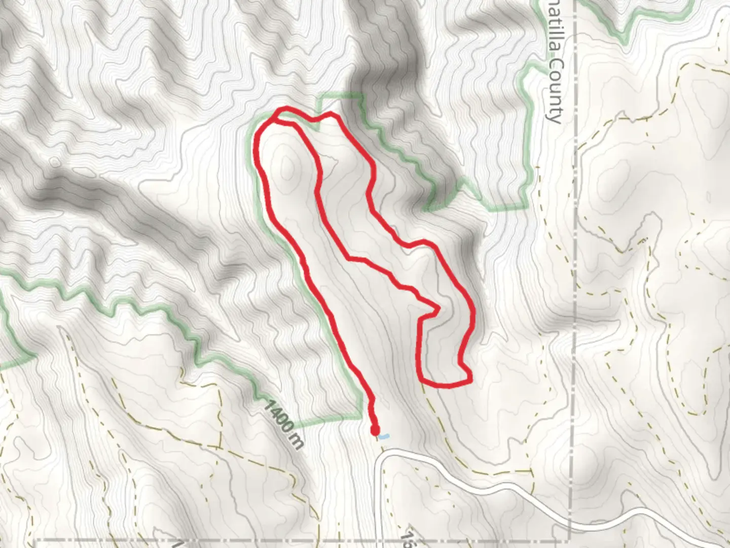
11.3 km
~2 hrs 38 min
235 m
Loop
“Embark on the Umatilla Rim Loop Trail for a scenic, moderately challenging 11 km hike through Oregon's diverse landscapes.”
Starting your adventure near Umatilla County, Oregon, the Umatilla Rim Loop Trail offers a captivating journey through diverse landscapes. This 11 km (approximately 6.8 miles) loop trail features an elevation gain of around 200 meters (656 feet), making it a moderately challenging hike suitable for those with some hiking experience.
Getting There
To reach the trailhead, you can drive or use public transport. If driving, head towards the nearest significant landmark, the Umatilla National Forest. The trailhead is accessible via local roads branching off from the forest's main entrance. For those relying on public transport, the nearest bus stop is in Pendleton, Oregon. From there, you can take a taxi or rideshare service to the trailhead.
Trail Overview
The Umatilla Rim Loop Trail begins with a gentle ascent through a dense forest of Ponderosa pines and Douglas firs. The initial 2 km (1.2 miles) of the trail are relatively easy, with a gradual elevation gain of about 50 meters (164 feet). This section is perfect for warming up and getting accustomed to the terrain.
Significant Landmarks and Nature
As you progress, you'll encounter the first significant landmark, the Umatilla River Overlook, approximately 3 km (1.9 miles) into the hike. This vantage point offers stunning views of the Umatilla River winding through the valley below. It's an excellent spot for a short break and some photography.
Continuing along the trail, you'll traverse a series of switchbacks that lead you to the highest point of the hike, around 5 km (3.1 miles) in. Here, the elevation gain reaches its peak at 200 meters (656 feet). The panoramic views from this vantage point are breathtaking, with the Blue Mountains visible in the distance.
Wildlife and Flora
The Umatilla Rim Loop Trail is home to a variety of wildlife. Keep an eye out for deer, elk, and the occasional black bear. Birdwatchers will be delighted by the presence of species such as the Northern Goshawk and the Great Horned Owl. The flora is equally diverse, with wildflowers like lupines and Indian paintbrush adding splashes of color to the landscape, especially in the spring and early summer.
Historical Significance
The region around the Umatilla Rim Loop Trail holds historical significance. The Umatilla National Forest was established in 1908, and the area has a rich history of Native American habitation. The Umatilla tribe, part of the Confederated Tribes of the Umatilla Indian Reservation, has lived in this region for thousands of years. As you hike, you'll be walking through lands that have been significant to indigenous cultures for millennia.
Navigation and Safety
For navigation, it's highly recommended to use the HiiKER app, which provides detailed maps and real-time GPS tracking. The trail is well-marked, but having a reliable navigation tool ensures you stay on course. Always carry sufficient water, snacks, and a first-aid kit. Weather can change rapidly, so pack layers and be prepared for sudden shifts in temperature.
Completing the Loop
The descent begins around the 7 km (4.3 miles) mark, where the trail gradually winds down through a series of meadows and forested areas. This section is less strenuous, allowing you to enjoy the serene surroundings. The final stretch of the trail brings you back to the starting point, completing the loop.
The Umatilla Rim Loop Trail offers a rewarding hike with diverse landscapes, significant landmarks, and a touch of historical and cultural richness. Whether you're a seasoned hiker or looking to challenge yourself, this trail provides an unforgettable outdoor experience.

What to expect?
Activity types
Comments and Reviews
User comments, reviews and discussions about the Umatilla Rim Loop Trail, Oregon.
4.6
average rating out of 5
5 rating(s)