Download
3D Flyover
Add to list
More
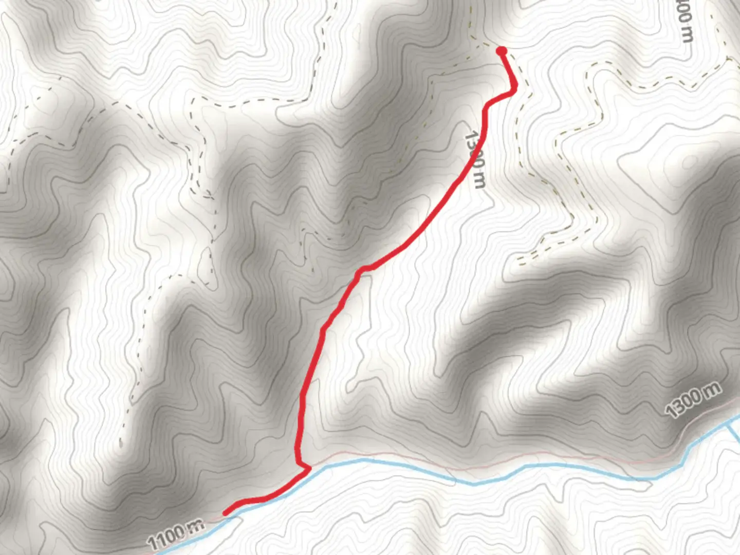
4.4 km
~1 hrs 18 min
258 m
Out and Back
“Embark on a 4 km hike through Oregon’s lush forests to stunning Blue Mountains vistas.”
Starting your adventure near Umatilla County, Oregon, the Tiger Ridge Trail Out and Back offers a moderately challenging hike with a total distance of around 4 km (approximately 2.5 miles) and an elevation gain of about 200 meters (656 feet). This trail is perfect for those looking to experience the natural beauty of the Pacific Northwest without committing to a full-day trek.
Getting There
To reach the trailhead, you can drive or use public transportation. If driving, head towards the nearest known landmark, the Umatilla National Forest. From there, follow local signage to the trailhead. For those using public transport, the nearest bus stop is in Pendleton, Oregon. From Pendleton, you can take a taxi or rideshare service to the trailhead, which is approximately a 30-minute drive.
Trail Overview
The trail begins with a gentle ascent through a dense forest of Douglas fir and Ponderosa pine. The initial 1 km (0.6 miles) is relatively easy, with a gradual incline that allows you to warm up your legs. As you continue, the trail becomes steeper, gaining most of its elevation in the next 1.5 km (0.9 miles).
Key Landmarks and Nature
At around the 2 km (1.2 miles) mark, you'll reach a scenic overlook that offers panoramic views of the Blue Mountains. This is a great spot to take a break, hydrate, and snap some photos. Keep an eye out for local wildlife, including deer, elk, and various bird species like the Northern Goshawk and the Great Horned Owl.
Historical Significance
The region around Umatilla County has a rich history, particularly with the Native American tribes who have lived here for thousands of years. The trail itself passes through areas that were once used as hunting grounds by the Umatilla, Cayuse, and Walla Walla tribes. You might notice some interpretive signs along the way that provide more information about the historical significance of the area.
Navigation and Safety
Given the moderate difficulty of the trail, it's advisable to use a reliable navigation tool like HiiKER to keep track of your progress and ensure you stay on the correct path. The trail is well-marked, but having a digital map can be very helpful, especially if you decide to explore any of the side trails.
Flora and Fauna
As you make your way back, take the time to appreciate the diverse flora and fauna. The forest floor is often carpeted with wildflowers in the spring and summer, including lupines and Indian paintbrush. In the fall, the foliage transforms into a stunning array of reds, oranges, and yellows.
Final Stretch
The descent back to the trailhead is much easier, allowing you to enjoy the serene environment without the strain of climbing. The entire hike can be completed in about 2-3 hours, making it a perfect half-day adventure.
Remember to pack plenty of water, wear sturdy hiking boots, and bring a camera to capture the breathtaking views. Happy hiking!

What to expect?
Activity types
Comments and Reviews
User comments, reviews and discussions about the Tiger Ridge Trail Out and Back, Oregon.
4.75
average rating out of 5
4 rating(s)