
Download
3D Flyover
Add to list
More
9.5 km
~2 hrs 27 min
334 m
Out and Back
“Explore diverse forests, wildflower meadows, and panoramic vistas on this rewarding 10 km Pacific Crest Trail hike.”
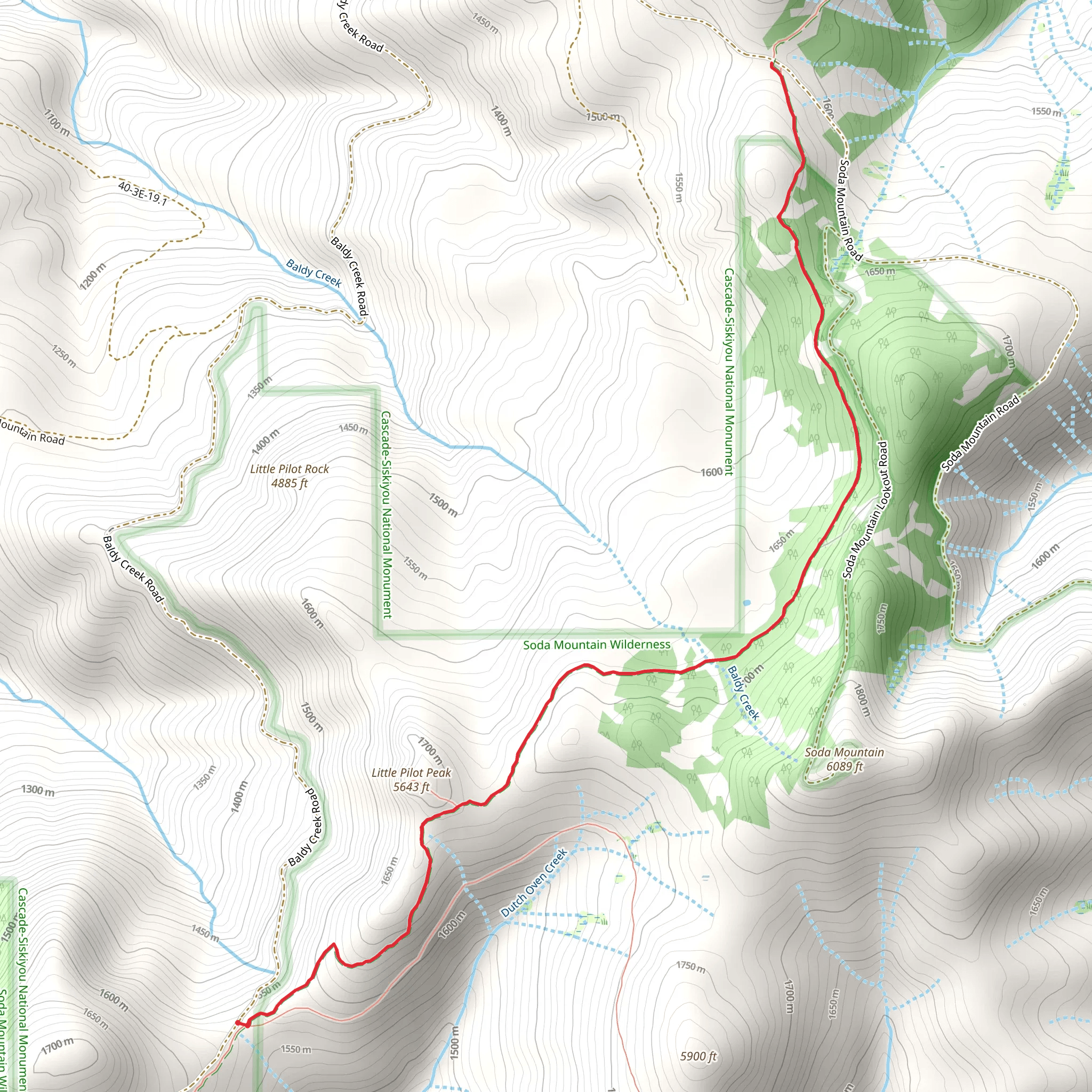
Starting near Jackson County, Oregon, the Pacific Crest Trail to Soda Mountain Road offers a rewarding out-and-back hike of approximately 10 km (6.2 miles) with an elevation gain of around 300 meters (984 feet). This trail is rated as medium difficulty, making it suitable for moderately experienced hikers.
Getting There
To reach the trailhead, you can drive or use public transportation. If driving, head towards the Greensprings Summit on Highway 66, which is the nearest significant landmark. From there, follow the signs to the Pacific Crest Trailhead. For those using public transport, the nearest major city is Ashland, Oregon. From Ashland, you can take a local bus or taxi to the Greensprings Summit area.
Trail Overview
The trail begins with a gentle ascent through a mixed forest of Douglas fir, Ponderosa pine, and white fir. As you progress, the trail opens up to meadows filled with wildflowers during the spring and summer months. Keep an eye out for lupines, Indian paintbrush, and columbines, which add vibrant colors to the landscape.
Wildlife and Nature
This region is home to a variety of wildlife. Deer and elk are commonly seen grazing in the meadows, while black bears and mountain lions are more elusive but present. Birdwatchers will enjoy spotting species like the Northern goshawk, red-tailed hawk, and various songbirds. Always carry bear spray and make noise to avoid surprising any wildlife.
Significant Landmarks
Around the 3 km (1.9 miles) mark, you'll come across a small, serene creek that provides a perfect spot for a short break. The trail then continues to climb gradually, offering panoramic views of the surrounding valleys and distant peaks. At approximately 5 km (3.1 miles), you'll reach the highest point of the trail, where you can enjoy breathtaking vistas of the Cascade and Siskiyou mountain ranges.
Historical Significance
The area around the Pacific Crest Trail has a rich history. It was originally inhabited by the Takelma and Shasta tribes, who used the land for hunting and gathering. During the 19th century, the region saw an influx of settlers and gold miners, which led to the establishment of nearby towns like Ashland. The trail itself is part of the larger Pacific Crest Trail, which was officially designated in 1968 and spans from Mexico to Canada.
Navigation
For navigation, it's highly recommended to use the HiiKER app, which provides detailed maps and real-time updates. The trail is well-marked, but having a reliable navigation tool will ensure you stay on track and can find your way back easily.
Final Stretch
As you approach Soda Mountain Road, the trail descends slightly, leading you through another section of dense forest before opening up to the road. This marks the turnaround point for your hike. Take a moment to rest and enjoy the peaceful surroundings before retracing your steps back to the trailhead.
This hike offers a mix of natural beauty, wildlife, and historical significance, making it a fulfilling experience for those looking to explore the Pacific Crest Trail in Oregon.
What to expect?
Activity types
Comments and Reviews
User comments, reviews and discussions about the Pacific Crest Trail to Soda Mountain Road, Oregon.
4.5
average rating out of 5
18 rating(s)
