Download
3D Flyover
Add to list
More
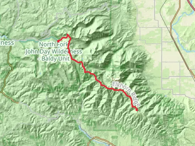
40.3 km
~2 days
1353 m
Multi-Day
“The Elkhorn Crest Trail: a breathtaking, challenging trek through Oregon's historic, wildlife-rich high country.”
The Elkhorn Crest Trail, winding through the Blue Mountains of Eastern Oregon, offers a challenging yet rewarding experience for seasoned hikers. Spanning approximately 40 kilometers (about 25 miles) with an elevation gain of around 1,300 meters (approximately 4,265 feet), this point-to-point trail is not for the faint of heart. Its difficulty rating is well-earned due to the rugged terrain and significant elevation changes.
Getting to the Trailhead
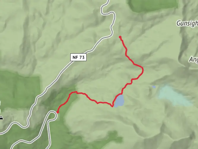
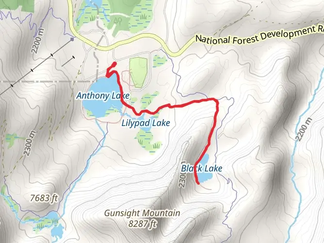
To reach the trailhead, located near Baker County, Oregon, hikers can drive to the Anthony Lakes area, which is the most common starting point. From Baker City, take the Pocahontas Road towards Anthony Lakes Mountain Resort. The trailhead is accessible via a parking area near the resort. Public transportation options are limited in this remote area, so driving is the most feasible option for reaching the starting point.
Navigating the Trail
Hikers should prepare for a remote and exposed journey along the crest of the Elkhorn Range. The trail can be accessed using the HiiKER app, which provides detailed maps and navigation tools to keep you on the right path. The app is particularly useful for identifying the numerous trail junctions and side trails you'll encounter along the way.
Landmarks and Scenery
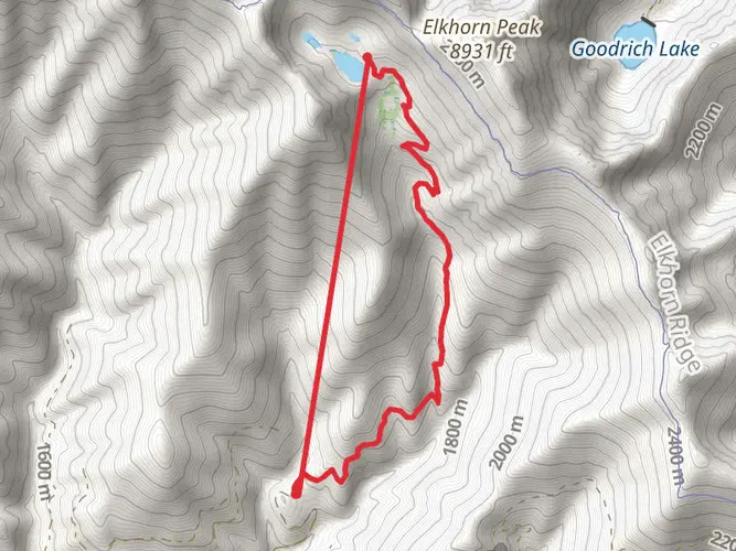
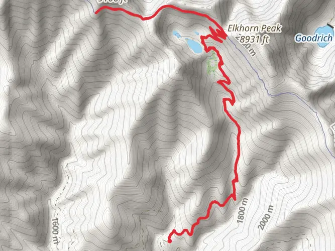
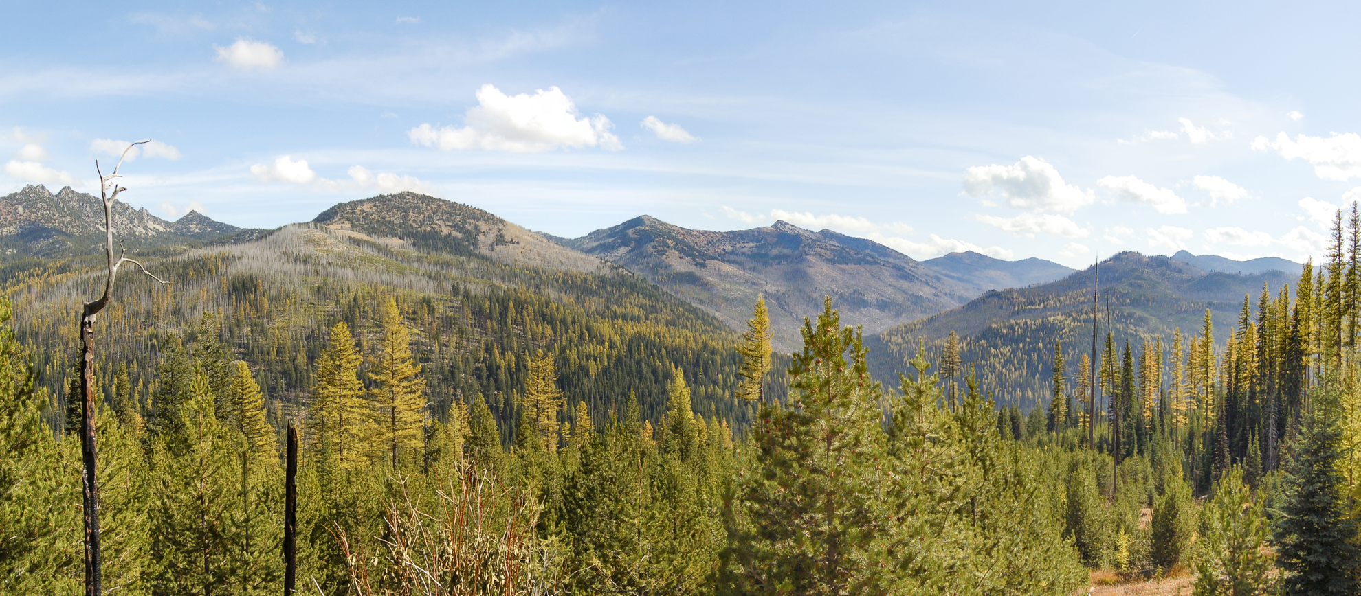
As you traverse the Elkhorn Crest Trail, you'll be greeted with panoramic views of the surrounding valleys and peaks. Notable landmarks include Rock Creek Butte and Elkhorn Peak, the highest points in the range. The trail also skirts the edges of several alpine lakes, perfect for a refreshing break or a scenic lunch spot.
Wildlife and Flora
The area is rich in biodiversity, with opportunities to spot mountain goats, elk, and a variety of bird species. Wildflowers bloom in abundance during the summer months, adding splashes of color to the alpine landscape.
Historical Significance
The Blue Mountains have a rich history, with the Elkhorn Range playing a significant role during the gold rush era. The region was heavily prospected, and remnants of old mines can still be found along the trail. Hikers walking these paths are treading the same ground that prospectors and pioneers once did in their search for fortune.
Preparation and Safety
Given the trail's difficulty and remote nature, it is imperative to be well-prepared. Hikers should carry plenty of water, as sources along the trail are not always reliable. Weather conditions can change rapidly at high elevations, so layered clothing is recommended. Due to the trail's length and elevation gain, it is often tackled as a multi-day hike, so packing appropriate camping gear is essential for overnight stays.
Conclusion
In conclusion, the Elkhorn Crest Trail is a must-hike for those seeking a challenging adventure amidst the beauty of Oregon's high country. With proper preparation and respect for the trail's difficulty, hikers will find themselves immersed in a landscape rich with history, natural beauty, and a sense of accomplishment upon completion.

What to expect?
Activity types
Frequently asked questions
How long does it take to hike the Elkhorn Crest Trail in Baker County, Oregon?
The Elkhorn Crest Trail is 40.34 km, or about 25 miles, with 1,353 meters of climbing, so it is usually treated as a strenuous overnight or multi-day route rather than a casual day hike. Strong hikers sometimes cover it in a very long day, but the combination of distance, elevation gain, and exposed ridge travel makes 2 to 3 days a more typical pace.
Where do you park for the Elkhorn Crest Trail near Anthony Lakes?
The main northern access is the Elkhorn Crest Trailhead in the Anthony Lakes Recreation Area west of Baker City. The trailhead sits just before Anthony Lake Campground and the ski area, and it is the primary portal for day hikers, backpackers, and stock users heading onto the Elkhorn Crest National Recreation Trail.
Where does the Elkhorn Crest Trail start and end?
The Elkhorn Crest Trail is commonly hiked as a point-to-point route between the Anthony Lakes area on the north end and Marble Pass on the south end. The Anthony Lakes side is the best-known access point, while the Marble Pass end is more remote and is often used when hikers arrange a car shuttle.
Is the Elkhorn Crest Trail difficult?
Yes. The Elkhorn Crest Trail is rated Extra Difficult, and that matches the route’s 40.34 km length, 1,353 meters of elevation gain, and high, rugged terrain along the Elkhorn Range. It is better suited to experienced hikers who are comfortable with long climbs, remote trailheads, and sustained travel on exposed ridgelines.
What are the main views and landmarks on the Elkhorn Crest Trail?
The route follows the crest of the Elkhorn Mountains in the Blue Mountains of eastern Oregon, so the defining feature is big ridge-top scenery for much of the hike. Notable landmarks in the range include Rock Creek Butte and Elkhorn Peak, and the trail is known for wide views over surrounding valleys, alpine basins, and nearby lakes around Anthony Lakes.
Is the Elkhorn Crest Trail a backpacking trail or a day hike?
The Elkhorn Crest Trail is best known as a multi-day backpacking route. At 40.34 km with over 1,300 meters of ascent, it is long enough to require careful pacing, and the Anthony Lakes trailhead is specifically used by hikers heading out for day trips or multiple nights in the surrounding wilderness.
Can you get to the Elkhorn Crest Trail without a car?
Public transportation to the Elkhorn Crest Trail is very limited because the Anthony Lakes area is remote and high in the Elkhorn Range. Most hikers reach the trail by driving from Baker City toward Haines and then following the Anthony Lake Highway into the recreation area, especially if they are starting at Anthony Lakes or arranging a point-to-point shuttle.
Comments and Reviews
User comments, reviews and discussions about the Elkhorn Crest Trail, Oregon.
4.8
average rating out of 5
15 rating(s)