
Download
3D Flyover
Add to list
More
6.3 km
~1 hrs 19 min
46 m
Loop
“Stroll quiet dikes between shimmering lakes, birdsong everywhere—relaxed, yet wild enough for mud and bugs.”
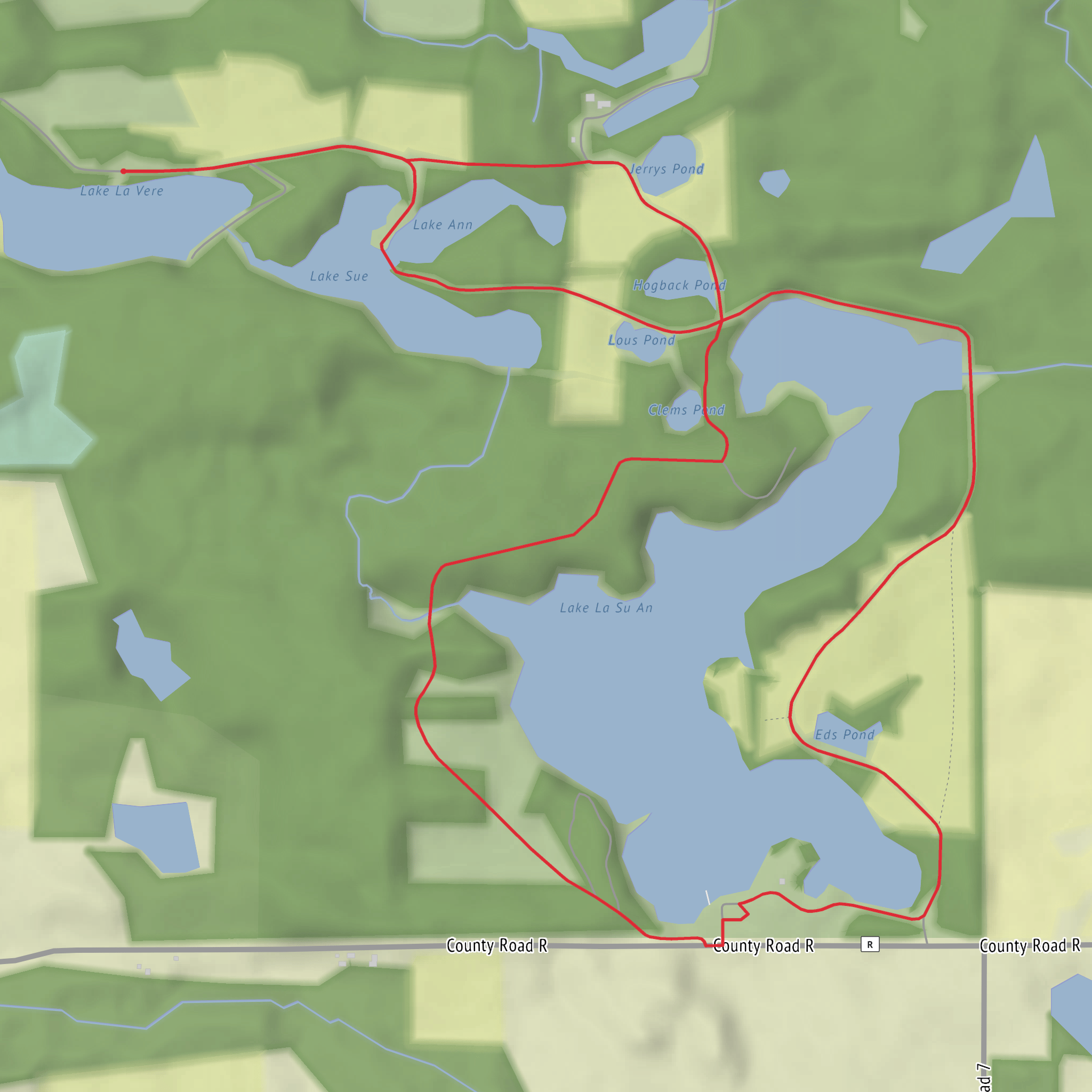
This easy loop wanders through a quiet patchwork of small lakes, low dikes, and flat wildlife-area roads in northwest Ohio. Expect a mostly level walk with frequent water views, lots of birds, and a “choose-your-own-pace” feel—great for a relaxed outing, but still remote enough that mud, insects, and hunting-season awareness matter.
Distance & elevation (what to plan for) - Distance: ~6 km / ~3.7 mi (many published tracks for the broader lake loop in this area come in closer to 6.9 km / 4.3 mi, depending on which connectors you take). - Elevation gain: effectively flat; plan for 0–30 m / 0–100 ft of gentle ups/downs on dikes and road crowns rather than sustained climbing. - Time: ~1.5–2 hours at an easy pace with stops for wildlife viewing. (alltrails.com)
Where it is (nearest known address / landmark) The loop sits inside Lake La Su An Wildlife Area in Williams County, near Pioneer, Ohio, with common access from the south side of Lake La Su An along County Road R. A widely used navigation point for the area is: - Lake La-Su-An Wildlife Area, 9455 County Road R, Montpelier, OH 43543 (use this as your “get to the area” address, then follow signs to the parking areas/trail access). (mapquest.com)
Getting to the start
- By car: Aim for the wildlife area access off County Road R (south side of Lake La Su An). There are multiple clearly marked parking areas; birders often start near the fisherman’s check station on the south end of Lake La Su An. (ohiobirds.org)
- By public transport: This corner of Williams County is very rural; there typically isn’t practical, frequent transit that drops you at the trailhead. If you must go car-free, the most realistic approach is arranging a ride from Montpelier or Bryan to County Road R, then walking in from the nearest parking/check-station area.
Bring the route up in HiiKER before you arrive and download it for offline use—cell coverage can be inconsistent around low-lying wetlands and back roads.
What the trail is like underfoot
Most of this loop uses wide gravel or grassy two-tracks and earthen dikes between lakes/ponds. Because it’s flat and close to water, conditions swing quickly: - After rain: expect soft shoulders, puddles, and short muddy stretches where grass meets the roadbed. - In dry spells: the same surfaces can turn firm and fast, but dustier and more exposed to sun/wind. - Footwear: light hikers or trail runners are fine in dry weather; after wet periods, waterproof shoes help.
Landmarks & scenery you’ll actually notice
You’ll spend much of the walk moving between named waters—Lake La Vere and Lake La Su An are the headline lakes, with additional ponds/reservoirs nearby (often visible or signed depending on the exact loop variant). (alltrails.com)
Look for:
- Dams/dikes and water-control structures (common in managed wildlife areas), including the Lake La Su An Dam and Lake La Vere Dam area features. (alltrails.com)
- Edges of marsh and open water that create excellent viewing corridors—especially in the morning when the water is calm.
Nature & wildlife (what to look out for)
This is prime habitat
Surfaces
Gravel
Unknown
Comments and Reviews
User comments, reviews and discussions about the Lake La Vere and Lake La Su An Loop, Ohio.
average rating out of 5
0 rating(s)
