
Download
3D Flyover
Add to list
More
9.8 km
~1 hrs 59 min
18 m
Out and Back
“Stroll a shaded canal towpath into Fort Laurens, where river-valley calm meets frontier echoes.”
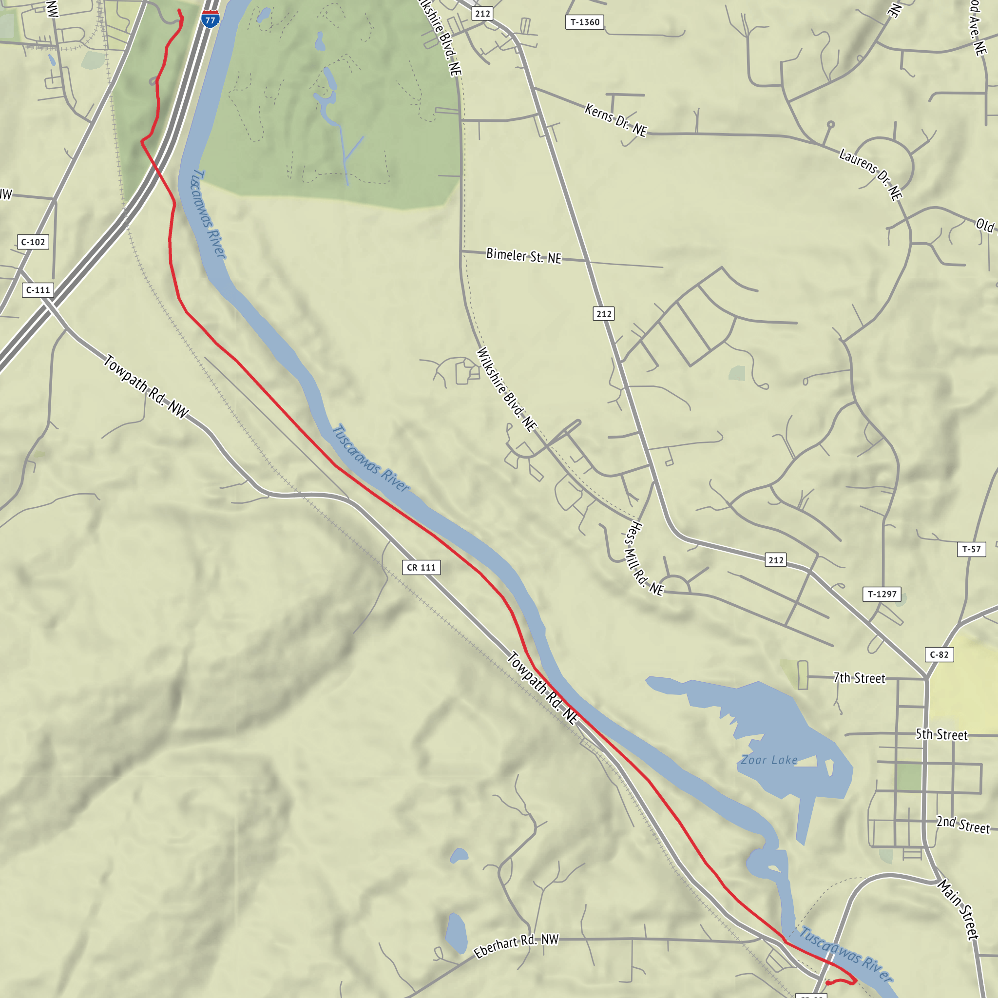
This easy out-and-back (or point-to-point if you arrange a pickup) follows the Ohio & Erie Canal Towpath on very gentle terrain to Fort Laurens State Memorial and Museum. Expect a mostly flat, well-defined crushed-limestone/gravel towpath with frequent shade, a few road crossings, and plenty of history layered into a quiet river-valley walk. At ~10 km / ~6.2 mi total with roughly ~0 m / ~0 ft of climbing, it’s a good choice for families, casual walkers, and anyone looking for a low-effort history-and-nature day.
Getting to the start (car + public transport realities)
By car: The most practical approach is to park at a signed Ohio & Erie Canal Towpath trailhead near Bolivar, Ohio, close to the Fort Laurens State Memorial area. A common, easy-to-find anchor for navigation is Fort Laurens State Memorial, 11067 Fort Laurens Rd NW, Bolivar, OH 44612 (museum/grounds area). If you prefer to start a little farther out to make the distance work out to ~10 km / ~6.2 mi, use a nearby Towpath access/parking area along the Tuscarawas River corridor and walk the towpath to the fort and back.
By public transport: This part of Tuscarawas County is rural and doesn’t have reliable, frequent fixed-route transit to the towpath. The closest options are typically: - Rideshare/taxi from Canton or New Philadelphia/Dover (availability can be limited). - County or regional demand-response services (often require advance booking and may have eligibility rules). If you’re trying to do this without a car, plan on arranging a ride to Fort Laurens State Memorial (Bolivar) or to a Towpath trailhead in the Bolivar/Zoar area, then hiking from there.
What the route is like underfoot
You’ll be on the Ohio & Erie Canal Towpath, which is generally: - Wide and obvious (easy to follow even for beginners) - Firm crushed stone/gravel with occasional softer patches after rain - Nearly level (the canal corridor was engineered for boats, so grades are minimal)
Because the elevation change is negligible, the main “effort” comes from distance and surface—comfortable walking shoes are usually enough, but after wet weather the towpath can hold puddles and become a bit slick in shaded spots.
Landmarks and historical context you’ll actually notice
The big destination is Fort Laurens, the only Revolutionary War-era fort in Ohio. The site is tied to the 1778–1779 campaign period on the western frontier, and the memorial grounds interpret the fort’s role, the hardships of garrison life, and the broader conflict dynamics in the region. Even if you don’t go inside the museum, the grounds themselves are a worthwhile stop for interpretive signage and a sense of place.
Along the way, the towpath setting helps you read the later transportation history of Ohio: - The Ohio & Erie Canal era shaped settlement patterns, industry, and trade through the 1800s. - The towpath corridor you’re walking was built for mules towing canal boats, which is why the route stays so steady and flat.
Plan a little extra time at the fort if you want to explore exhibits or walk the memorial area slowly.
Nature, wildlife, and what to look out for
This stretch of towpath runs through a river-and-woodland mosaic typical of the Tuscarawas River valley. Depending on season, you’ll likely see: - Riparian trees (sycamore, cottonwood, maple) and dense summer greenery - Songbirds and woodpeckers in the wooded edges - Water-associated wildlife such as turtles and frogs in wetter pockets - White-tailed deer especially early/late in the day
Things to watch for: - Ticks and mosquitoes in warm months—use repellent and do a tick check afterward. - Poison ivy along sunny edges of the path. - After heavy rain: puddles and soft shoulders; step carefully to avoid slipping on wet gravel. - Cyclists: the towpath is multi-use. Stay right, keep dogs leashed, and listen for bikes approaching from behind.
Navigation and pacing (keeping it simple)
Navigation is straightforward: stay on the towpath and follow signs toward Fort Laurens. If you want extra confidence, download the route on HiiKER before you arrive so you can: - Confirm your turnaround point to hit ~10 km / ~6.2 mi total - See where road crossings and access points are - Track distance without relying on cell service (which can be patchy)
A comfortable pace for most hikers is 3–5 km/h (2–3 mph). With stops for photos and the museum grounds, many people will spend 2.5–4 hours total.
Practical planning: what to bring for an easy, flat 10 km
- Water: at least 1 liter per person (more in summer heat/humidity)
- Snacks/lunch: easy calories; there may not be services right on the towpath
- Sun + bug protection: hat, sunscreen, repellent
- Footwear: walking shoes are fine; choose something with decent grip if it’s been wet
- Layers: the corridor can feel cooler in shade and warmer in open stretches
- Small first-aid basics: especially blister care if you’re new to gravel paths
If you’re aiming for the full museum visit, check posted hours before you go and build that time into your day.
Surfaces
Unknown
Unpaved
Concrete
Comments and Reviews
User comments, reviews and discussions about the Fort Laurens Museum via Ohio - Erie Canal Towpath Trail, Ohio.
average rating out of 5
0 rating(s)
