Download
3D Flyover
Add to list
More
4.9 km
~1 hrs 1 min
25 m
Out and Back
“Explore the scenic, historic Ohio and Erie Canal Towpath Trail, perfect for nature and history enthusiasts alike.”
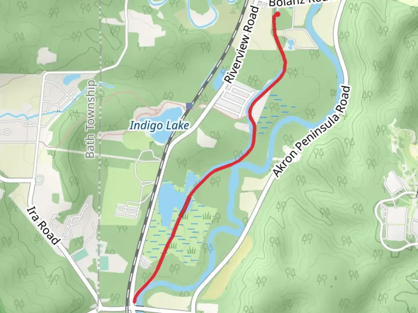
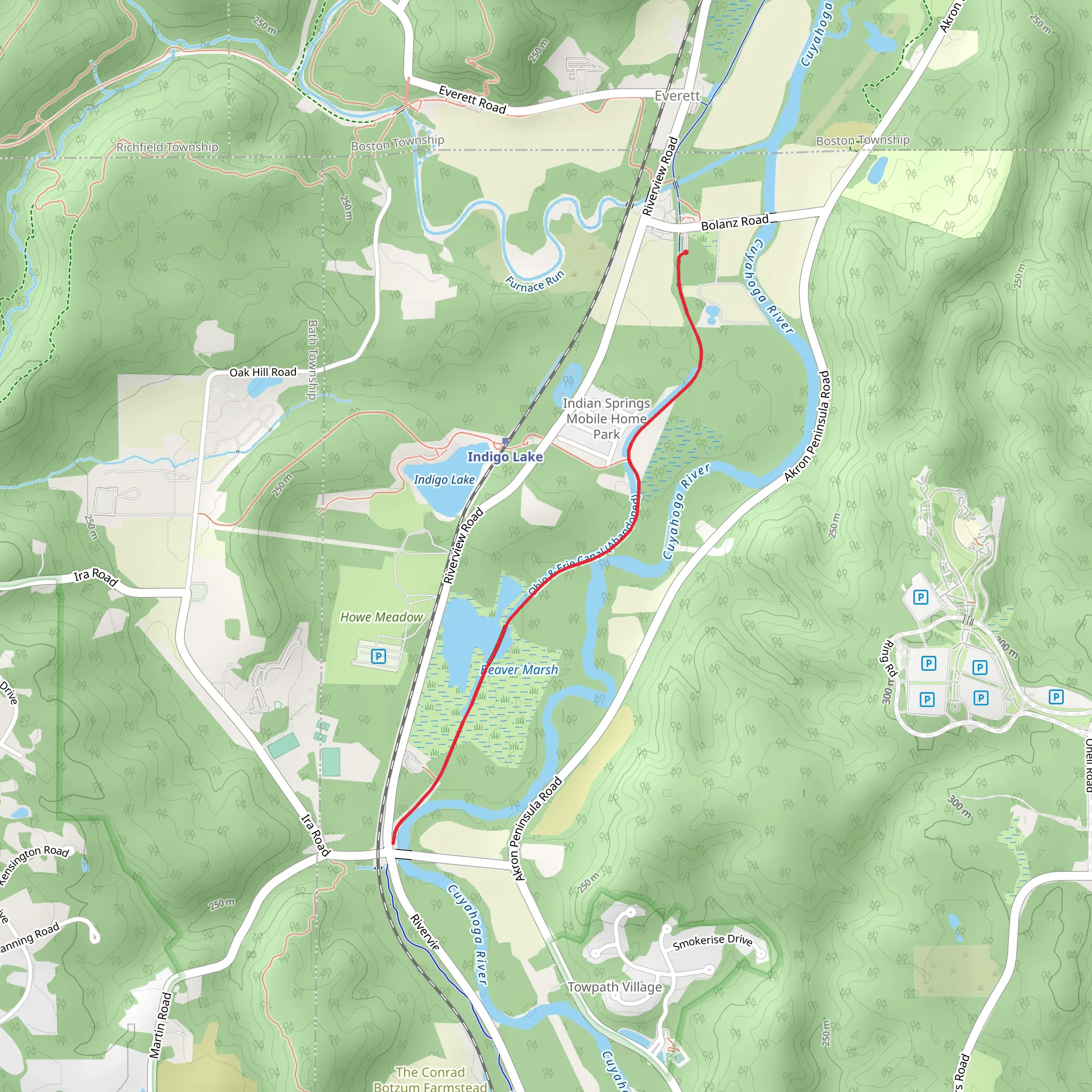
Starting near Summit County, Ohio, the Ohio and Erie Canal Towpath Trail to Ira is a delightful out-and-back trail that stretches approximately 5 kilometers (3.1 miles) with virtually no elevation gain, making it accessible for hikers of varying skill levels. This trail meanders through the picturesque Cuyahoga Valley National Park, offering a blend of natural beauty and historical significance.
Getting There
To reach the trailhead, you can drive to the nearest significant landmark, the Boston Store Visitor Center, located at 1550 Boston Mills Rd, Peninsula, OH 44264. From there, it's a short drive to the trailhead. If you prefer public transport, the Cuyahoga Valley Scenic Railroad offers a convenient way to access the park, with a stop at the Boston Mill Station, just a short walk from the trailhead.
Trail Highlights
As you embark on this trail, you'll be walking along a historic route that once served as a vital transportation corridor in the 19th century. The Ohio and Erie Canal was a significant engineering feat, facilitating the movement of goods and people between Lake Erie and the Ohio River. Today, the towpath where mules once pulled canal boats has been transformed into a serene hiking path.
Nature and Wildlife
The trail is flanked by lush greenery, with towering trees providing ample shade. Keep an eye out for local wildlife, including white-tailed deer, red foxes, and a variety of bird species such as the great blue heron and the red-tailed hawk. The Cuyahoga River, which runs parallel to parts of the trail, is home to beavers and river otters, so you might catch a glimpse of these industrious creatures.
Significant Landmarks
About 1.5 kilometers (0.9 miles) into the hike, you'll come across the Beaver Marsh, a restored wetland teeming with life. This area is a prime spot for birdwatching and offers a boardwalk that allows for closer observation of the marsh's inhabitants. Continuing along the trail, you'll encounter remnants of the canal's infrastructure, including old locks and stonework, which serve as a testament to the area's rich history.
Navigation and Safety
The trail is well-marked and maintained, but it's always a good idea to have a reliable navigation tool. HiiKER is an excellent app for this purpose, providing detailed maps and real-time updates. Since the trail is relatively flat, it's suitable for families and those looking for a leisurely hike. However, be mindful of cyclists who also frequent the path.
Historical Significance
The Ohio and Erie Canal played a crucial role in the economic development of Ohio and the Midwest. Completed in 1832, it spurred the growth of towns and industries along its route. Hiking this trail offers a unique opportunity to step back in time and appreciate the ingenuity and hard work that went into creating this vital waterway.
Practical Tips
- Wear comfortable walking shoes, as the trail is mostly flat but can be uneven in places.
- Bring water and snacks, especially if you plan to spend time exploring the Beaver Marsh.
- Check the weather forecast before heading out, as parts of the trail can become muddy after rain.
This trail offers a perfect blend of natural beauty, wildlife, and historical intrigue, making it a must-visit for anyone exploring Cuyahoga Valley National Park.
What to expect?
Activity types
Comments and Reviews
User comments, reviews and discussions about the Ohio and Erie Canal Towpath Trail to Ira, Ohio.
4.52
average rating out of 5
33 rating(s)
