Download
3D Flyover
Add to list
More
7.5 km
~1 hrs 31 min
12 m
Out and Back
“Drift around Dale Walborn Reservoir on a mostly level loop of shimmering views and quiet coves.”
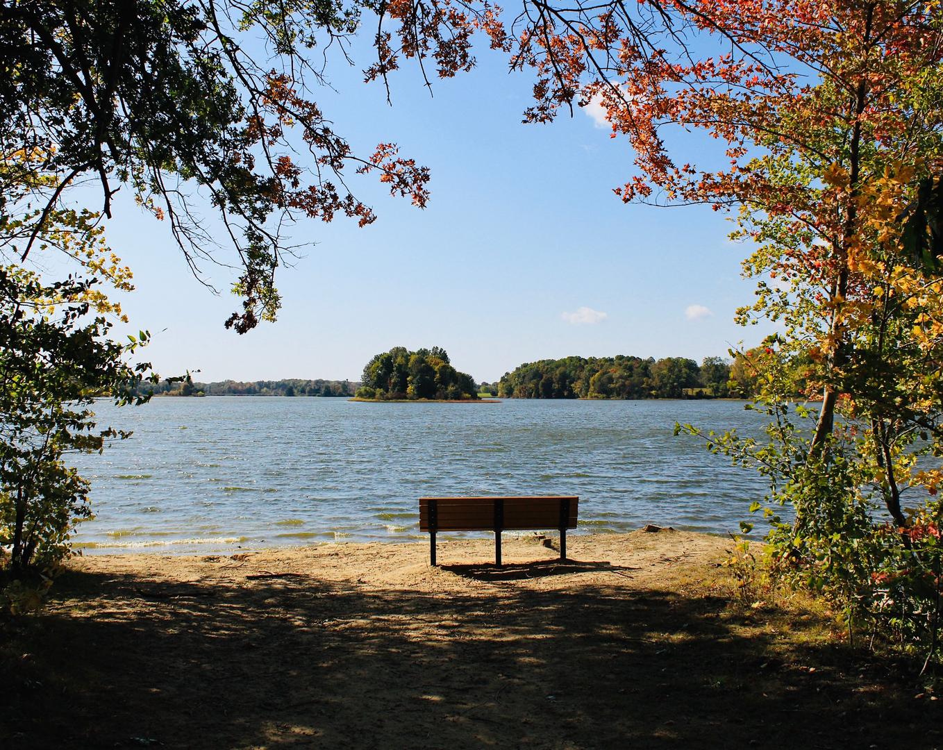
A flat, easy-going shoreline walk circles Dale Walborn Reservoir on wide, well-used paths with frequent water views and almost no climbing. At roughly 7 km (4.3 mi) with about 0 m (0 ft) of elevation gain, it’s a good choice for a low-effort outing, a recovery walk, or a family-friendly loop where the scenery changes more than the terrain.
Getting to the trailhead (car + public transport)
Because the start point is only listed as “near” and no coordinates were provided, the best I can do is describe the typical access pattern for this kind of reservoir shoreline loop:
- By car: Look for the main reservoir access/parking area (often signed as a reservoir day-use lot, boat launch, or “shoreline trail” parking). Plan on arriving earlier on weekends—reservoir lots can fill quickly when the weather is good. If there are multiple lots, choose the one closest to the dam/primary access road; that usually gives the clearest signage and the most straightforward loop direction.
- By public transport: Reservoir trailheads are often limited or indirect by transit. The usual approach is to take the nearest bus/rail line to the closest town center or major road corridor, then use a short rideshare/taxi to the day-use entrance. If you tell me your nearest city (or share a lon/lat), I can translate that to the nearest known address/landmark and outline the most realistic transit connection.
What the route is like underfoot
Expect a shoreline path that stays close to the water for long stretches, with occasional short inland detours where the bank is steep, marshy, or fenced. Surfaces are commonly packed gravel, dirt, or mown grass, and the grade is essentially level—any “ups and downs” are usually just small ripples where the trail skirts coves or crosses drainage dips.
A practical way to think about the loop:
- 0–2 km (0–1.2 mi): Settling in—open views across the reservoir, easy walking, and the first good spots for photos and birdwatching.
- 2–5 km (1.2–3.1 mi): The most “shoreline-feeling” section—more coves, reeds, and pockets of shade depending on tree cover. This is often where you’ll see the most wildlife activity near the water’s edge.
- 5–7 km (3.1–4.3 mi): Returning toward the access area—typically a bit busier with other walkers, anglers, and families as you near parking and day-use facilities.
If you’re navigating, load the route on HiiKER before you arrive so you can confirm the correct loop direction and avoid accidentally taking a spur path to a picnic area or service road.
Landmarks and points of interest
- The reservoir edge and coves: The main “landmark” is the water itself—look for small inlets where the shoreline bends. These spots often have calmer water and more bird activity.
- Dam/overflow structures (if present): Many reservoir loops pass near a dam, spillway, or outlet channel. These areas can be interesting to view from a safe distance and are often where signage explains water management.
- Angling pull-offs and informal viewpoints: You’ll likely notice worn side paths leading to the water. They can be tempting shortcuts, but they’re often muddy, slippery, or eroded—stay on the main tread where possible.
Nature, wildlife, and what to watch for
Reservoir shorelines tend to concentrate wildlife because water, food, and cover are all close together.
- Birdlife: Expect waterfowl (ducks, geese), shorebirds around muddy margins, and raptors overhead scanning the shoreline. Early morning and late afternoon are usually the most active times.
- Mammals: Depending on the region, you may see small mammals near brushy edges. Keep an eye out for movement in reeds and low shrubs.
- Reptiles/amphibians: Sunny banks and logs can attract basking reptiles; marshy pockets can hold amphibians. Give them space and watch where you step near the waterline.
Things to look out for: - Mud and slick edges: Even on a “flat” hike, the most common hazard is slipping near the shoreline, especially after rain or where anglers have worn the bank down. - Biting insects: Still water and reeds can mean mosquitoes and gnats in warm months—bring repellent and consider long sleeves if you’re sensitive. - Sun and wind exposure: Reservoirs can feel surprisingly exposed. A calm day at the car can turn into a breezy loop with strong sun reflection off the water.
Planning notes (time, gear, and accessibility)
- Time estimate: Most hikers will take 1.5–2.5 hours for 7 km (4.3 mi) depending on stops.
- Footwear: Light hikers or trail runners are usually enough; after wet weather, choose shoes with decent grip.
- Water and snacks: Even though it’s short and easy, bring water—flat routes can still feel long in heat or wind.
- Strollers/wheelchairs: Some reservoir shoreline trails are suitable if they’re gravel and well-maintained, but others have narrow pinch points, soft sand, or muddy sections. Check recent conditions on HiiKER and be ready to turn around if the shoreline gets rough.
Historical significance (what reservoir landscapes usually represent)
Reservoirs are often tied to regional water supply, flood control, irrigation, or industrial-era water management, and many were created by damming creeks that once supported farms, mills, or small settlements

Surfaces
Ground
Unknown
Comments and Reviews
User comments, reviews and discussions about the Dale Walborn Reservoir via Shoreline Trail, Ohio.
average rating out of 5
0 rating(s)