
Download
3D Flyover
Add to list
More
8.6 km
~1 hrs 51 min
82 m
Out and Back
“A gentle woodland loop of rolling creekside calm—best savoured slowly, especially after rain.”
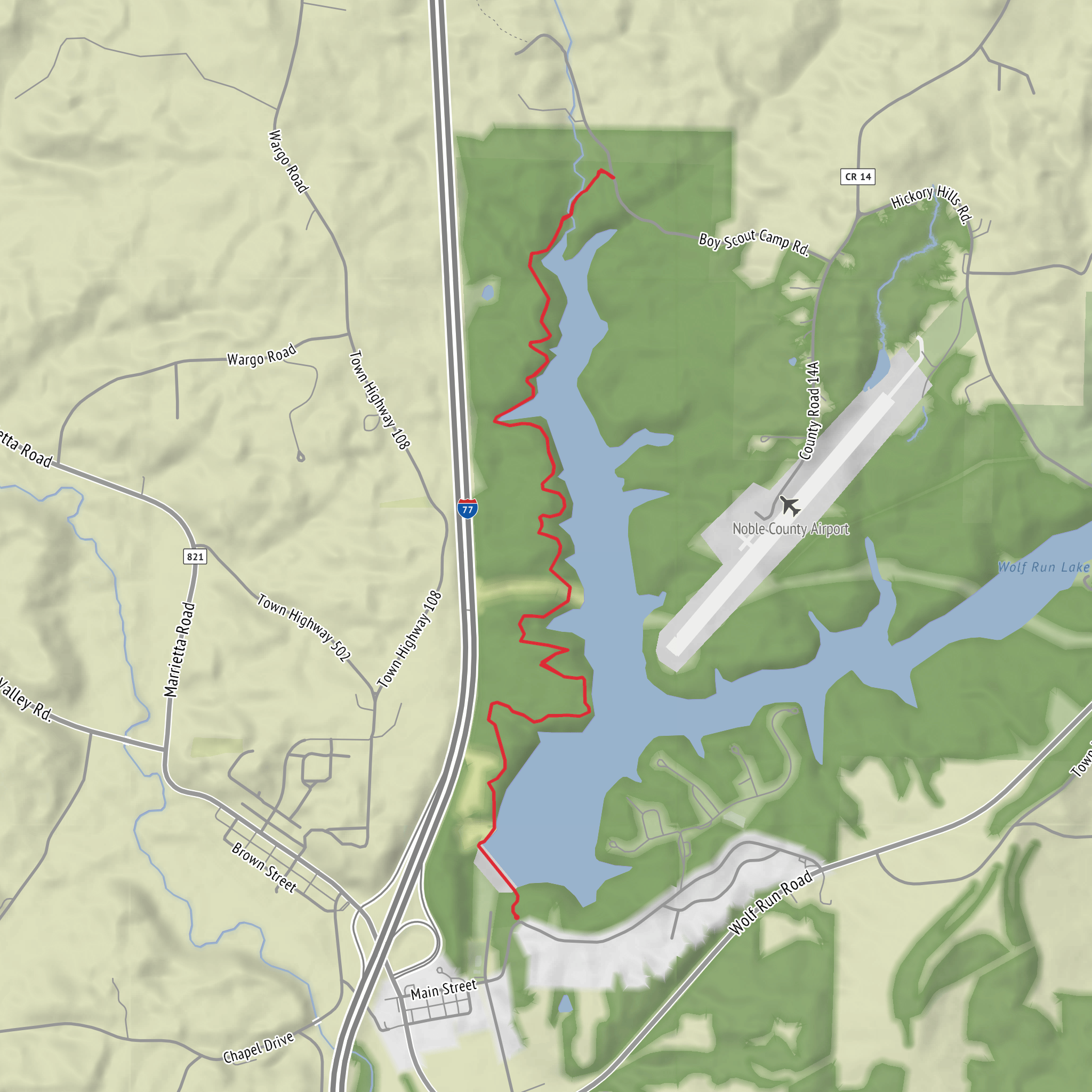
This easy loop/route of roughly 9 km (5.6 mi) with about 100 m (330 ft) of total climbing is a good choice when you want a low-stress walk with frequent woodland scenery and a few gentle ups and downs rather than sustained hills. Expect a mix of packed dirt singletrack, leaf-covered forest tread, and short connecting stretches that can feel more like a wide footpath—overall straightforward underfoot, but with a few spots where mud and wet leaves can slow you down after rain.
Getting to the trailhead (car + public transport)
Because the hike start is listed only as “near” (no coordinates or town provided), I can’t reliably convert the start point to a nearest address or landmark yet. If you share the lon/lat (or a HiiKER link), I’ll pin it to the closest recognizable place (e.g., a trailhead parking lot name, road intersection, park entrance, or a nearby public facility).
In the meantime, here’s how planning typically works for Buckeye Trail access points:
- By car: Most Buckeye Trail segments are reached from small pull-offs, park lots, or road crossings rather than a single big “trailhead.” Plan for limited parking capacity and no services. If you’re using HiiKER, confirm the exact start point and look for a marked parking icon or a named access point; if it’s a road crossing, arrive early and park fully off the roadway.
- By public transport: Many Buckeye Trail sections are not well-served by transit. If the start is near a town, the usual approach is: bus to the nearest town center, then a short rideshare/taxi to the trail access. Share the start coordinates and I can suggest the most realistic transit hub and last-mile options.
What the route feels like underfoot
With only about 100 m (330 ft) of gain over 9 km (5.6 mi), the climbing is spread out in small rises—think gradual rollers rather than a single climb. The “easy” rating fits most hikers with basic fitness, but a few conditions can make it feel harder:
- After rain: low spots can hold water; mud can be slick, especially where the tread is shaded and slow to dry.
- Autumn leaf cover: roots and small rocks disappear under leaves; watch footing on gentle descents.
- Winter/early spring: freeze–thaw can create rutted, uneven tread and lingering ice in shaded hollows.
Plan on 2–3 hours at a relaxed pace with time for short stops, depending on trail surface and how often you pause.
Navigation and wayfinding (using HiiKER)
This is the kind of route where turns can be easy to miss if you’re chatting or moving quickly—especially where a footpath meets an old track or where the Buckeye Trail shares corridor with other local paths. Use HiiKER to: - confirm you’re on the intended line at junctions, - check distance remaining (helpful if you’re timing a turnaround), - and identify any short road connectors so they don’t feel like “wrong turns.”
If you notice blazing/markers, treat them as helpful—but rely on HiiKER for the definitive route, since signage can be inconsistent between segments.
Landmarks, nature, and what to look for
“Wolf Run” routes in Ohio and the broader Buckeye Trail network commonly follow or cross small drainages—so expect the character of the walk to be shaped by creek bottoms, shallow ravines, and mixed hardwood forest.
Typical features you’re likely to encounter along a route like this: - Creekside corridors: cooler air, denser understory, and more mosquitoes in warm months. Listen for woodpeckers and songbirds; look for animal tracks in soft mud near water. - Hardwood woodland: oak–hickory and maple–beech mixes are common; spring brings wildflowers (trillium, violets, mayapple depending on the exact region), while fall color can be excellent. - Edge habitat: where the trail skirts fields or young forest, you’ll often see more deer activity and a higher chance of raptors overhead.
Wildlife you should be prepared for in much of Ohio’s Buckeye Trail country: - White-tailed deer (most common at dawn/dusk) - Wild turkey - Small mammals (squirrels, chipmunks, raccoons) - Snakes (usually non-aggressive; watch sunny edges and log crossings) - Ticks in warm months—especially in brushy sections and leaf litter
If the route truly stays close to a run/creek for portions, bring a small towel or be ready for mud on shoes; waterproof trail runners can be a comfort upgrade in wet seasons.
Hazards and practical prep
Even on an easy hike, a few practical considerations make the day smoother:
- Footwear: light hikers or trail shoes with decent tread; mud-prone sections can be slick.
- Water: for 9 km (5.6 mi), many hikers are fine with 0.5–1 L, more in summer humidity.
- Bugs/sun: insect repellent in late spring through early fall; sun protection if there are open stretches.
- Road crossings: Buckeye Trail segments often intersect roads—pause, look both ways, and don’t assume drivers expect hikers.
- Hunting seasons: if this segment passes near public hunting areas or mixed-use lands, wear bright colors in season and stay on the mapped line in HiiKER.
Historical significance (Buckeye Trail context)
The Buckeye Trail is one of Ohio’s signature long-distance foot
Comments and Reviews
User comments, reviews and discussions about the Wolf Run via Buckeye Trail, Ohio.
average rating out of 5
0 rating(s)



