
Download
3D Flyover
Add to list
More
5.6 km
~1 hrs 10 min
36 m
Loop
“A gentle woodland wander linking three mossy waterfalls—mostly level, but watch slick roots and misty rocks.”
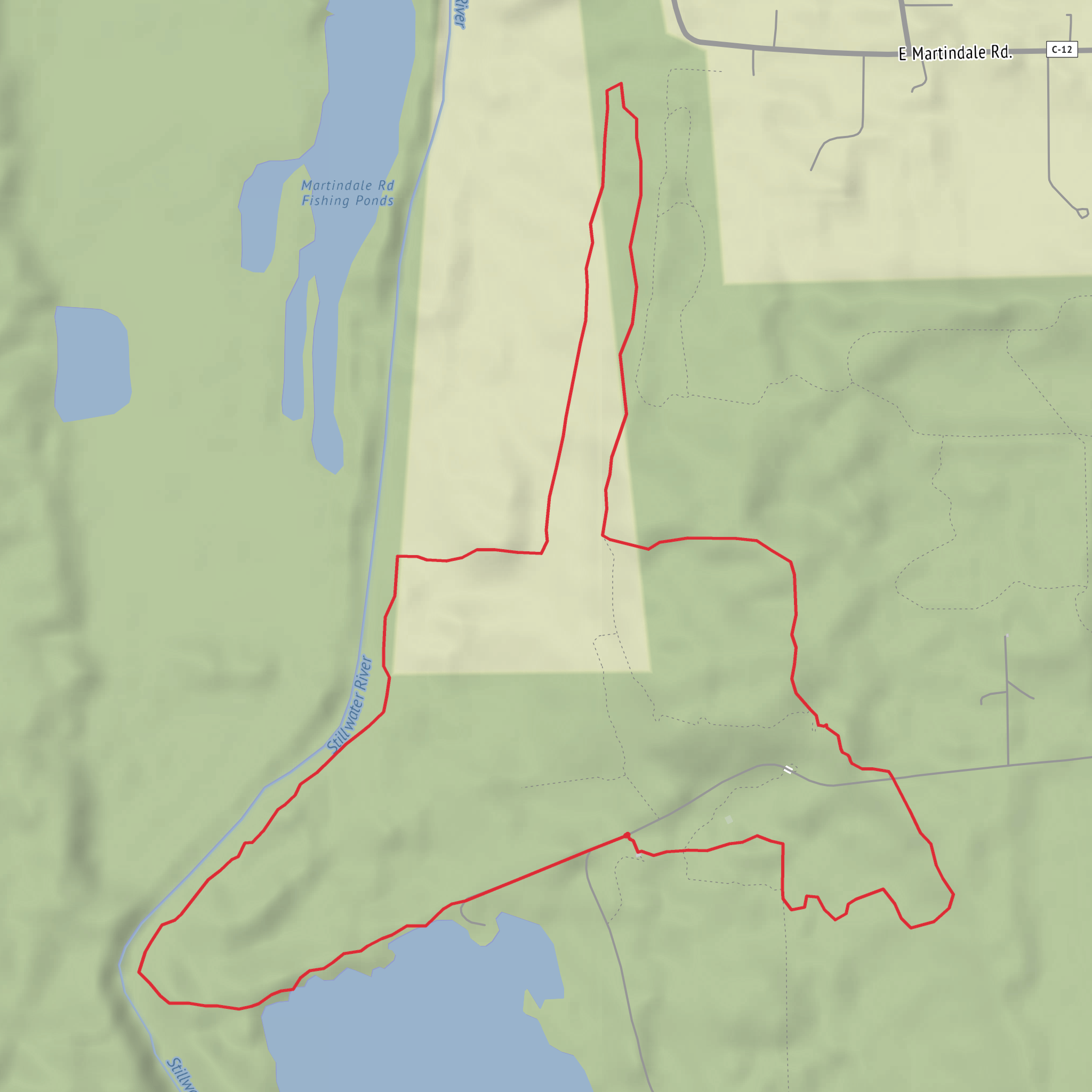
This easy, mostly level out-and-back/loop-style walk (depending on how you link the spurs) is about 6 km / 3.7 miles with roughly 0 m / 0 ft of climbing, making it a good choice for a relaxed waterfall-and-woods outing. Expect well-used forest paths, short connectors between named falls, and a few damp, rooty sections near the water where footing matters more than fitness.
Getting to the trailhead (car + public transport)
Because the hike head is listed only as “near” (no town/coordinates provided), I can’t reliably convert the start point to a nearest address or landmark yet. If you share a lon/lat (even just one point for the trailhead/parking), I’ll translate it to the closest recognizable street address or major landmark and tailor the directions precisely.
In the meantime, here’s the practical approach that works for most trail systems with a “Green Trail” designation: - By car: Look for the primary trailhead parking area associated with the Green Trail (often signed at the main park entrance or a day-use lot). Arrive earlier on weekends—waterfall trails tend to fill first. - By public transport: If the area is served by buses/trains, the most common pattern is: transit to the nearest town center, then a local bus/ride-share to the park entrance. If you tell me the nearest city you’re coming from, I can outline the most realistic transit chain and what to watch for (limited weekend service is common).
What the route feels like underfoot
With essentially no elevation gain, the “effort” here is about surface conditions rather than climbing. The Green Trail is typically a maintained, easy-grade path through mixed woodland. You’ll likely encounter: - Packed dirt and leaf litter on the main tread - Short muddy patches in low spots (especially after rain or snowmelt) - Roots and slick rock as you approach the falls—these are the only places where people commonly slip
Plan on a relaxed pace of 1.5–2.5 hours total depending on how long you linger at each waterfall and how busy the viewpoints are.
Landmarks and the three falls (approximate spacing)
On a 6 km / 3.7 mi outing that links multiple named falls, the usual rhythm is a main corridor trail with short spurs to viewpoints. Without the exact map geometry, use these planning distances as a realistic framework:
Trailhead to first waterfall viewpoint: ~1.5–2.0 km / 0.9–1.2 mi
The forest tends to feel quieter here, and you’ll often hear water before you see it. Expect the first proper “near-water” footing—slippery stones and damp roots.First to second falls (Patty / Oaks area): ~0.8–1.2 km / 0.5–0.75 mi
This section is usually the most “wandery,” with small junctions. If there are multiple signed spurs, confirm you’re staying on the Green Trail using HiiKER so you don’t accidentally take a longer connector.Second to Martindale Falls: ~0.8–1.2 km / 0.5–0.75 mi
Often the most photogenic stretch, with more people near the main viewpoint. If there’s a fenced overlook or a worn social path closer to the brink, stick to the official tread—banks near falls undercut and crumble.Return to trailhead: ~2.0–2.5 km / 1.2–1.6 mi
The return is straightforward and fast on easy grades, but fatigue can make roots and mud more “trip-prone” than they felt on the way out.
If the route is a true loop rather than an out-and-back, the loop closure is usually on a wider multi-use path or a park access track—still easy, but sometimes less scenic than the falls corridor.
Nature you’re likely to see
Waterfall corridors create a cooler, wetter microclimate than the surrounding woods. Even on an “easy” trail, that means more moss, ferns, and shade-tolerant plants close to the creek.
- Vegetation: Expect mixed woodland with a greener, denser understory near the water—mossy rocks, ferns, and moisture-loving shrubs. In spring and early summer, wildflowers often cluster where sunlight breaks through.
- Wildlife: You’ll commonly see songbirds and small mammals; near water, watch for amphibians (frogs/salamanders) in damp leaf litter. If this is in black bear country, the main concern is food smells—carry snacks sealed and keep moving calmly if you encounter wildlife.
- Insects: Near falls and slow pools, mosquitoes and black flies can be intense in warm months. A head net can be overkill for 6 km, but repellent and long sleeves can make the difference between pleasant and miserable.
Hazards and what to look out for
Even with ~0 m / 0 ft of gain, waterfall hikes have a few consistent risk points: - Slippery rock at viewpoints: Mist and algae make stone slick. Treat every wet rock like it’s icy. - Undercut edges: The ground near falls can be unstable. If you see exposed roots, cracking soil, or a “crumbly” lip, back up. - High water after storms: Small creeks can rise quickly. If any crossing looks pushy or opaque, don’t force it—turn around or use
Comments and Reviews
User comments, reviews and discussions about the Oaks, Patty and Martindale Falls via Green Trail, Ohio.
average rating out of 5
0 rating(s)


