
Download
3D Flyover
Add to list
More
4.0 km
~47 min
0 m
Loop
“Stroll river-flat paths beside the Great Miami, where sycamore shade, birdsong, and high-water surprises linger.”
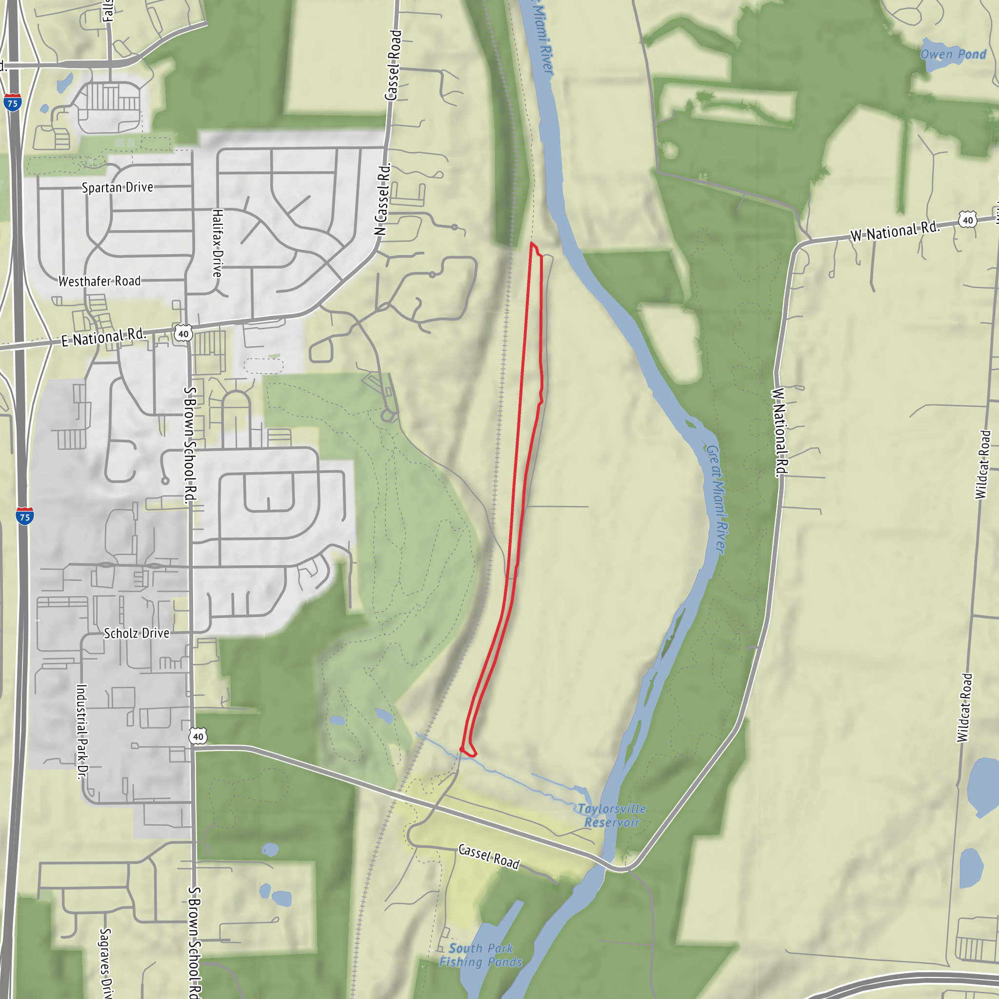
This easy riverside walk links short sections of the Buckeye Trail with the Tadmor Trail along the Great Miami River, staying essentially flat the whole way (about 4 km / 2.5 mi with roughly 0 m / 0 ft of climbing). Expect a mix of paved multi‑use path and smooth crushed gravel, with frequent views of the river, broad floodplain woods, and a few spots where high water can temporarily change the feel of the trail.
Getting to the start (car + public transport)
Because the hike head location is listed only as “near,” the most reliable way to pinpoint your start is to open the route in HiiKER and use the trailhead/parking pin it provides. In general for this area, the most practical access points are the Great Miami River trailheads and park lots near the Tadmor historic area (often signed locally as “Tadmor” or “Great Miami River Trail” access).
- By car: Aim for a signed Great Miami River Trail / Tadmor parking area near the river. These lots are typically small-to-moderate sized, with straightforward access from nearby local roads. If you arrive after rain or during spring melt, choose a lot on slightly higher ground if available—low river lots can have puddling or minor flooding.
- By public transport: Service varies a lot by county and township along the Great Miami corridor. The usual approach is to take the nearest bus route to a town center or main road corridor, then use a short rideshare/taxi hop to the closest river trailhead. If you share the nearest town/intersection you’re targeting (or a HiiKER link), I can translate that into the closest stop + walking approach.
What the route feels like underfoot
For an “easy” rating, this one earns it: the grade is nearly level, and the tread is generally forgiving.
- Surface: Mostly paved or well-packed gravel. After storms, expect thin silt on low sections and occasional debris (small branches, driftwood) where the river has pushed material up onto the path.
- Width: Typically wide enough for two people side-by-side, and you’ll likely share it with cyclists and runners—stay right and be ready for quiet bikes approaching from behind.
- Exposure: A mix of open river edge and shaded stretches under cottonwoods, sycamores, and maples. In summer, the open sections can feel hotter than you’d expect for a short walk.
Landmarks and natural highlights along the Great Miami
You’ll spend much of the hike with the Great Miami River close by—sometimes visible through trees, sometimes fully open with broad water views.
- River bends and gravel bars: In lower water, you may see exposed bars and shallow riffles. These are great wildlife-viewing zones, but they’re also where mosquitoes can be thick at dawn/dusk.
- Floodplain forest: Look for sycamore (mottled white bark), cottonwood, and dense understory in wetter pockets. These floodplain woods are dynamic—fallen trees and fresh deposits of sand/silt are normal and part of how the corridor renews itself.
- Seasonal wildflowers: Spring often brings ephemeral blooms in the shadier edges; late summer shifts to taller, sun-loving plants along the open margins.
Wildlife you’re likely to notice (and what to watch for)
This corridor is classic river habitat—productive, busy, and sometimes surprisingly loud with birds.
- Birds: Expect songbirds in the woods and larger birds near open water. You may spot great blue herons stalking shallows, kingfishers darting low over the river, and seasonal migrants using the corridor as a travel route.
- Mammals: White-tailed deer are common. Near dusk, keep an eye out for movement at the edge of the trees.
- Turtles and amphibians: Sunny logs and calm backwaters can hold basking turtles; wetter pockets can have frogs calling in warm months.
- Ticks and poison ivy: River-edge trails often have both. Wear long socks or use repellent, and learn poison ivy’s “leaves of three” pattern—especially where the path narrows near brush.
Historical significance: the Tadmor area and the Miami Valley corridor
The Great Miami River valley has long been a natural travel corridor—first for Indigenous peoples, later for settlement-era routes, mills, and canal/rail development that followed the easiest grades through the landscape. The Tadmor name is commonly associated with a historic settlement/stop in this region, and the area’s trails often pass near interpretive signs or remnants that reflect how river towns formed around crossings, trade, and transportation. Even when you don’t see obvious ruins, the flatness of the corridor and the straight, efficient alignments of some trail segments echo the valley’s long history as a route through southwest Ohio.
Practical planning for a 4 km / 2.5 mi easy outing
- Time: Most hikers will take 45–90 minutes depending on stops for river views and wildlife.
- Footwear: Light hikers or running shoes are fine in dry weather; after rain, choose something with decent grip for slick silt on pavement and damp gravel.
- Water & sun: Short distance, but bring water in warm months—open river stretches can be sun-baked.
- High water: If the river is up, expect detours or short turnarounds on the lowest sections. Check conditions in HiiKER before you go, and be willing to reverse course if you encounter water over the path.
- Navigation: The network of riverside connectors can look similar. Keep HiiKER handy to confirm which spur
Comments and Reviews
User comments, reviews and discussions about the Buckeye Trail and Tadmor Trail near Great Miami River, Ohio.
average rating out of 5
0 rating(s)

