Download
3D Flyover
Add to list
More
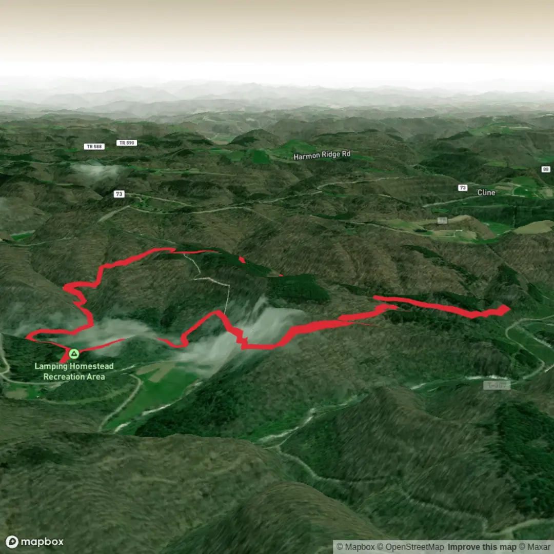
6.0 km
~1 hrs 24 min
120 m
Loop
“Wander from bustling picnic grounds into hushed woods, rolling gently toward a reflective pond.”
A mellow-but-engaging out-and-back (or lollipop-style, depending on the exact spur you take) that threads through mixed woodland to a quiet pond near the Lamping Homestead Picnic Grounds. At roughly 6 km / 3.7 mi with about 100 m / 330 ft of climbing, it’s a solid “medium” outing: short enough for a half-day, but with enough rolling terrain and junctions that you’ll want to stay attentive.
Getting to the trailhead (car + public transport)
Because the start location is listed only as “near” (no coordinates or town/state provided), the best I can do is describe how to plan your approach once you confirm which “Lamping Homestead” this refers to:
- By car: Search your mapping app for “Lamping Homestead Picnic Grounds” and navigate to the signed picnic area/parking. Most trail systems that include picnic grounds have a primary lot with a kiosk or bulletin board—that’s typically where the Lamping Homestead Trail begins or where the closest connector starts. Arrive early on weekends; picnic-ground lots can fill quickly in fair weather.
- By public transport: If this site is within a county/state park near a town center, the usual pattern is bus/train to the nearest town, then a rideshare/taxi for the last few miles to the picnic grounds. If you tell me the nearest town or share the lon/lat, I can convert it to the nearest known address/landmark and give a realistic transit plan.
If you can provide any lon/lat for the trailhead (even approximate), I’ll translate it to the nearest recognized address or prominent landmark and tighten up the directions.
What the hike is like underfoot
Expect a well-used footpath near the picnic grounds that gradually narrows as you move away from the day-use area. The first kilometer or so (about 0.6 mi) is often the most “social”—you may pass families, dog walkers, and people heading to tables or water access. After that, the trail typically becomes quieter and more wooded.
- Grade and effort: The 100 m / 330 ft gain is usually spread across short rises rather than one sustained climb. You’ll feel it most on the return if the pond sits slightly lower than the mid-route high points.
- Surface: Plan for packed dirt with roots, occasional muddy pockets in low areas, and possibly short boardwalks or puncheon if the route skirts wet ground near the pond. After rain, the “easy” parts can become slick—especially where leaf litter hides roots.
- Navigation: Bring HiiKER and use it proactively at junctions—homestead/picnic-ground trail networks often have multiple short connectors that look equally “main.”
Key landmarks and the pond approach
Around 2–3 km (1.2–1.9 mi) in, you’ll usually notice a shift in vegetation and moisture: the air feels cooler, the ground softer, and you may see skunk cabbage, sedges, or other wetland-edge plants depending on region. As you near the picnic grounds pond, the trail often flattens and you’ll pick up subtle signs of a managed day-use area—wider tread, occasional signage, and clearer sightlines.
The pond itself is the natural “turnaround” and a good place for a break: - Look for open shoreline pockets or a designated viewing spot rather than forcing your way through brush. - If there are picnic tables or a maintained clearing, it’s a good indicator you’re at/near the intended destination even if the water is partially screened by vegetation.
Nature, wildlife, and what to watch for
This kind of homestead-to-pond corridor is classic edge habitat—great for wildlife viewing, but it comes with a few practical cautions.
- Birdlife: Ponds and their margins often attract songbirds, woodpeckers, and water-associated birds (species vary widely by state). Early morning is typically best for activity.
- Mammals: You may see signs more than animals—tracks in mud, chewed nuts, or scat along the trail. Keep food secured; picnic-ground areas can habituate wildlife.
- Insects: From late spring through early fall, expect mosquitoes and ticks, especially near wet sections approaching the pond. Long pants and a tick check after the hike are smart.
- Amphibians: Wetland edges can host frogs/salamanders; watch your footing on damp rocks and roots.
Safety and trail etiquette notes: - Mud management: Step through mud (where appropriate) rather than widening the trail—these areas can braid quickly near ponds. - Dogs: If dogs are allowed, keep them close near water and picnic areas; wildlife and other visitors are common. - Water hazards: Pond edges can be deceptively soft. Avoid undercut banks and slick algae-coated rocks.
Historical context: “homestead” landscapes
A “homestead” trail name usually points to a landscape shaped by early settlement, small-scale farming, and later reforestation. Even when original structures are gone, you can often spot clues: - Old stone walls running straight through the woods (former property lines or pasture boundaries) - Non-native plantings near former house sites (lilac, apple, ornamental shrubs) - Level terraces or unusually flat clearings that don’t match the surrounding terrain
If there’s interpretive signage at the picnic grounds, it often explains who lived there, what the land was used for, and how it transitioned into public recreation

Comments and Reviews
User comments, reviews and discussions about the Lamping Homestead Picnic Grounds Pond via Lamping Homested Trail, Ohio.
average rating out of 5
0 rating(s)