
Download
3D Flyover
Add to list
More
12.9 km
~2 hrs 38 min
37 m
Out and Back
“Drift along the Great Miami’s quiet flats from Piqua to Lockington—easy-going, watchful of roads and weather.”
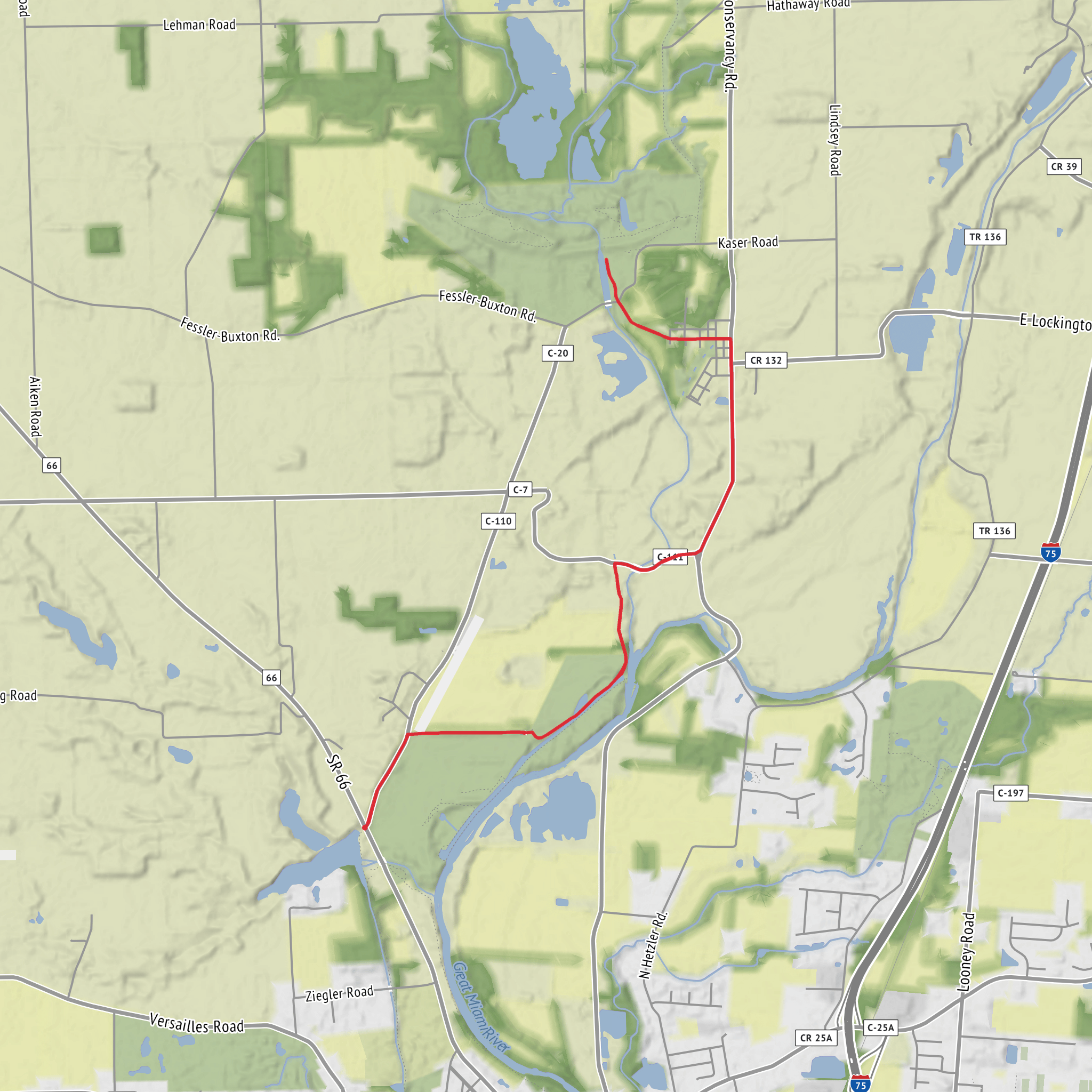
This is a mostly level, point-to-point walk of about 13 km (8.1 mi) with ~0 m (0 ft) of climbing, following the Buckeye Trail corridor as it threads along the Great Miami River valley between Piqua and Lockington. Expect easy footing overall, a mix of paved/packed surfaces and short rougher stretches, and frequent road-adjacent segments typical of the Buckeye Trail in western Ohio—great for a relaxed day out, but still worth planning for traffic, weather exposure, and seasonal high water.
Getting to the start (Piqua area)
Because the start is listed only as “near,” the most practical, easy-to-find staging point in Piqua is the downtown riverfront / Great Miami River Trail access near the Piqua Public Library (116 W High St, Piqua, OH 45356) or nearby public parking around Lock 9 Park / the riverfront. Those spots are close to where many local routes and river-adjacent paths converge, and they’re straightforward to navigate to.
- By car:
Piqua sits just off I‑75 (north of Dayton). Use downtown Piqua parking near the riverfront or civic buildings so you can step onto the river corridor quickly. If you’re doing this as a one-way hike, it’s simplest to spot a car in Lockington first (see below), then drive back to Piqua to start. - By public transport:
Public transit between small towns in this part of Ohio can be limited and schedule-dependent. If you’re relying on transit, plan around regional bus options (often requiring advance planning) or consider a rideshare/taxi for the “last mile” to the trail access. If you tell me the city you’re coming from (e.g., Dayton, Troy, Sidney), I can tailor the most realistic approach.
Getting from the finish (Lockington area)
A reliable, recognizable endpoint landmark is Lockington Locks Park in Lockington, Ohio (commonly signed and easy to locate in town). It’s a logical place to end, regroup, and retrieve a shuttle vehicle.
- Car shuttle: Leave a vehicle near Lockington Locks Park (or other public parking in Lockington), then drive back to Piqua to begin.
- Out-and-back option: If shuttling isn’t feasible, you can do an out-and-back from either end, adjusting distance to taste.
What the route feels like underfoot
With essentially no meaningful elevation gain, the “effort” here is less about hills and more about time on feet, sun/wind exposure, and surface variety:
- River-valley flats: Expect long, gentle grades typical of a broad floodplain. After heavy rain or snowmelt, low areas can hold water or turn soft.
- Mixed surfaces: You’ll likely encounter a combination of paved multi-use path, gravel/packed trail, and short roadside connectors. Even on an easy hike, wear shoes with decent tread—wet leaves, algae on pavement near water, and muddy shoulders can be slick.
- Road crossings and shoulders: Buckeye Trail segments in this region can include quiet country roads. Stay alert at bends and bridges, and walk facing traffic where there’s no sidewalk.
Navigation (keep it simple, keep it accurate)
Even on flat terrain, the Buckeye Trail can weave through parks, neighborhoods, and road links. Use HiiKER to: - confirm you’re on the correct Buckeye Trail segment at each junction, - anticipate road crossings and turns before you reach them, - identify nearby bail-out points (roads, parks, town access) if weather changes.
Landmarks, scenery, and the character of the Great Miami River valley
This hike sits in the Great Miami River corridor, a landscape shaped by glacial history and river processes—broad, flat ground, fertile soils, and a patchwork of riparian woods, fields, and small-town edges.
- River and floodplain views: You’ll spend much of the day near the river valley, with open sightlines in places and shaded riparian stretches in others.
- Woodlots and hedgerows: Look for cottonwood, sycamore, and willow closer to wetter ground, with oak/maple mixes where it’s slightly higher and drier.
- Seasonal color: Spring brings fresh green and high water; summer can be humid with tall vegetation; fall is comfortable and clear; winter is exposed and windy.
Wildlife you’re likely to see (and what to watch for)
This is classic western Ohio river-and-farmland habitat:
- Birdlife: Expect red-winged blackbirds, great blue herons, kingfishers, and seasonal migrants. Early morning and late afternoon are best for activity.
- Mammals: White-tailed deer, rabbits, and groundhogs are common along field edges. Near water, you may spot signs of beaver (chewed trunks) or muskrat.
- Insects and ticks: From late spring through early fall, plan for mosquitoes near still water and ticks in grassy margins. Long socks and a tick check at the end are smart.
- Poison ivy: Very common along sunny edges and fence lines—learn the “leaves of three” look and avoid brushing through overgrowth.
Historical significance: why Lockington matters
Lockington is closely tied to the region’s canal era. The town is known for the Lockington Locks, part of the Miami & Erie Canal system that once connected communities and moved goods through
Surfaces
Unknown
Gravel
Comments and Reviews
User comments, reviews and discussions about the Piqua to Lockington via Buckeye Trail, Ohio.
average rating out of 5
0 rating(s)

