
Download
3D Flyover
Add to list
More
755 m
~9 min
0 m
Loop
“A breezy out-and-back to Greenville Falls, where forested rim paths frame roaring cascades—watch your footing near edges.”
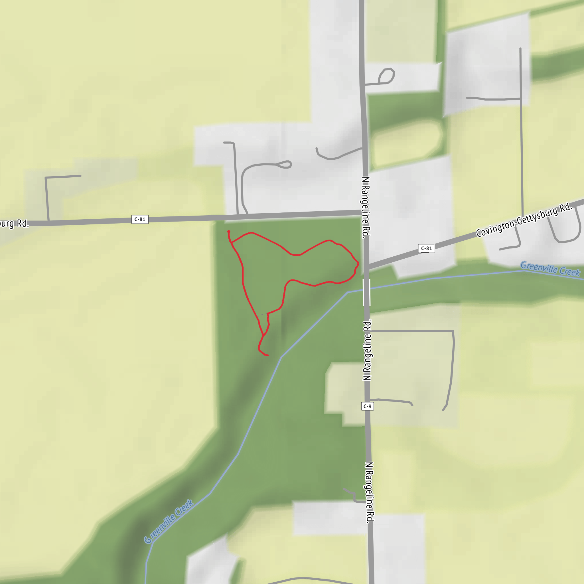
A short, mostly level out-and-back stroll of about 1 km (0.6 mi) with ~0 m (0 ft) of climbing, centered on the Greenville Falls overlook area and the easy paths around the gorge. Expect a wide, family-friendly walk with frequent stopping points for photos, plus a few short spur viewpoints where the ground can be uneven near the rim.
Getting to the trailhead (car + public transport)
Because the hike head location wasn’t fully provided (“near …”), the most common and practical access point hikers use for Greenville Falls is the Greenville Falls State Scenic River Area in Covington, Ohio, with parking at/near the Greenville Falls parking area off U.S. Route 36 (a well-known signed access for the falls and gorge). If you share the lon/lat (or the town/state), I can convert it to the nearest address/landmark precisely and tailor the directions.
- By car: Navigate to the Greenville Falls State Scenic River Area (Covington, OH) and follow signs for Greenville Falls / parking. Arrive early on weekends—this is a popular quick-stop waterfall.
- By public transport: Rural western Ohio has limited transit to the falls. The most realistic approach is to take intercity service to a larger nearby hub (often Dayton, OH) and then use a rideshare/taxi to Covington and the falls access. If you tell me your starting city, I’ll outline the cleanest route and approximate travel times.
What the walk is like (surface, pacing, and navigation)
From the parking area, you’ll be on short connector paths leading toward the gorge and primary viewpoints. The route is typically packed gravel, dirt, and short paved/boardwalk-like segments depending on which spur you choose. Even though the overall elevation gain is essentially flat, the terrain can feel “up-and-down” in tiny pulses as you step over roots, rock edges, and small drainage dips.
For navigation, load the area in HiiKER and keep an eye on: - Short spur junctions that lead to different overlooks - Any closed/eroded edge sections (these can change seasonally) - The return line back to the parking area—easy to miss if you wander between viewpoints
Landmarks and scenery you’ll see
The main attraction is the waterfall dropping into a rocky gorge, with layered stone and a narrow river corridor that creates a surprisingly dramatic scene for such a short walk. You’ll likely encounter:
- Primary falls viewpoint: The classic look at the cascade and plunge pool area. After rain, the flow is louder and more forceful; in dry spells it can be gentler but still scenic.
- Gorge rim views: Short side paths often bring you to rim openings where you can look down into the channel. These are the most “watch your footing” spots.
- River corridor and rock shelves: Depending on water level, you may see exposed rock benches and swirling eddies below.
Nature and wildlife (what to look for)
This is a compact hike, but the gorge concentrates wildlife activity and plant diversity.
- Birdlife: Listen for woodpeckers, songbirds, and raptors riding thermals above the gorge. Early morning tends to be best.
- Amphibians and aquatic life: In wetter months, watch for frogs/salamanders near damp edges and seeps. Keep a respectful distance—these areas are sensitive.
- Deer and small mammals: White-tailed deer, squirrels, and chipmunks are common, especially near quieter trail edges.
- Plants: Expect a mix of riparian vegetation near the water and hardwood forest species on slightly higher ground. In spring and early summer, wildflowers can be a highlight along shaded margins.
Hazards and what to watch out for
Even on an “Easy” 1 km (0.6 mi) walk, the falls environment adds a few real risks:
- Slippery rock and mud: Mist and spray can slick up stone near viewpoints. Treat any dark, wet rock as low-traction.
- Gorge-edge exposure: Some overlooks have steep drop-offs. Keep children close, avoid backing up for photos, and don’t step onto undercut edges.
- High water after storms: Water levels can rise quickly, and currents below the falls can be deceptively strong. Stay out of the river unless you’re in a clearly designated safe access area.
- Bugs and ticks (seasonal): Use repellent in warm months and do a tick check after, especially if you step off the main path for photos.
Planning tips (time, footwear, and accessibility)
- Time needed: Most hikers spend 20–45 minutes walking the short distance and lingering at viewpoints; longer if you’re photographing or exploring every spur.
- Footwear: Comfortable walking shoes are fine in dry conditions; choose trail shoes if it’s wet or you plan to step onto rocky viewpoints.
- What to bring: Water (even for a short walk), a light layer (gorge areas can feel cooler), and a small first-aid kit for minor scrapes.
- Accessibility: The overall distance and minimal elevation gain help, but surface unevenness and edge exposure can limit stroller/wheelchair suitability depending on the exact spur chosen.
Historical significance of the area
Greenville Falls sits within a river-and-gorge landscape shaped by long-term erosion and regional glacial history typical of western Ohio waterways. The falls and gorge have also served as a local landmark for generations—places like this often became natural gathering points for early settlement
Comments and Reviews
User comments, reviews and discussions about the Greenville Falls, Ohio.
average rating out of 5
0 rating(s)
