
Download
3D Flyover
Add to list
More
2.4 km
~32 min
33 m
Loop
“A gentle woodland loop leads to a silver curtain waterfall spilling into a cool, shaded gorge.”
This easy loop is a short, mostly level wander through a protected limestone-spring landscape that quickly delivers its main highlight: a broad, curtain-like waterfall spilling over a rocky ledge into a shaded gorge. At roughly 2 km (1.2 mi) with about 0 m (0 ft) of climbing overall, it’s well-suited to families, casual walkers, and anyone looking for a low-effort nature stop with a big payoff.
Getting to the trailhead (car + public transport)
Nearest well-known start point: the main parking area for Charleston Falls Preserve, near 2380 E. State Route 41, Tipp City, OH 45371 (this is the commonly used access point for the preserve and the most practical landmark/address to navigate to).
- By car: From Tipp City or Troy, you’ll typically approach via OH-41 and follow signs for Charleston Falls Preserve. Parking is at the preserve lot; arrive earlier on pleasant weekends because the lot can fill.
- By public transport: This area is rural and not reliably served by local transit to the preserve entrance. The most workable option is to take regional service to the Dayton area (or to Troy/Tipp City if you’re already nearby), then use a rideshare/taxi for the final leg to the preserve entrance on OH-41.
Before you set off, open the route in HiiKER and download it for offline use—tree cover and the gorge can make reception inconsistent.
What the trail is like underfoot
Expect a mix of packed dirt, short boardwalk/bridged sections, and limestone or gravelly tread. Because the preserve is built around springs and a creek, the path can be muddy or slick after rain, and the rock near the falls often stays damp even in dry weather. Footwear with decent grip is the main “upgrade” that makes this walk feel effortless.
Although the total elevation gain is minimal, you may encounter short, gentle dips toward the creek and falls area. These are brief and don’t add meaningful climbing, but they can be the slickest spots.
Landmarks and the flow of the loop
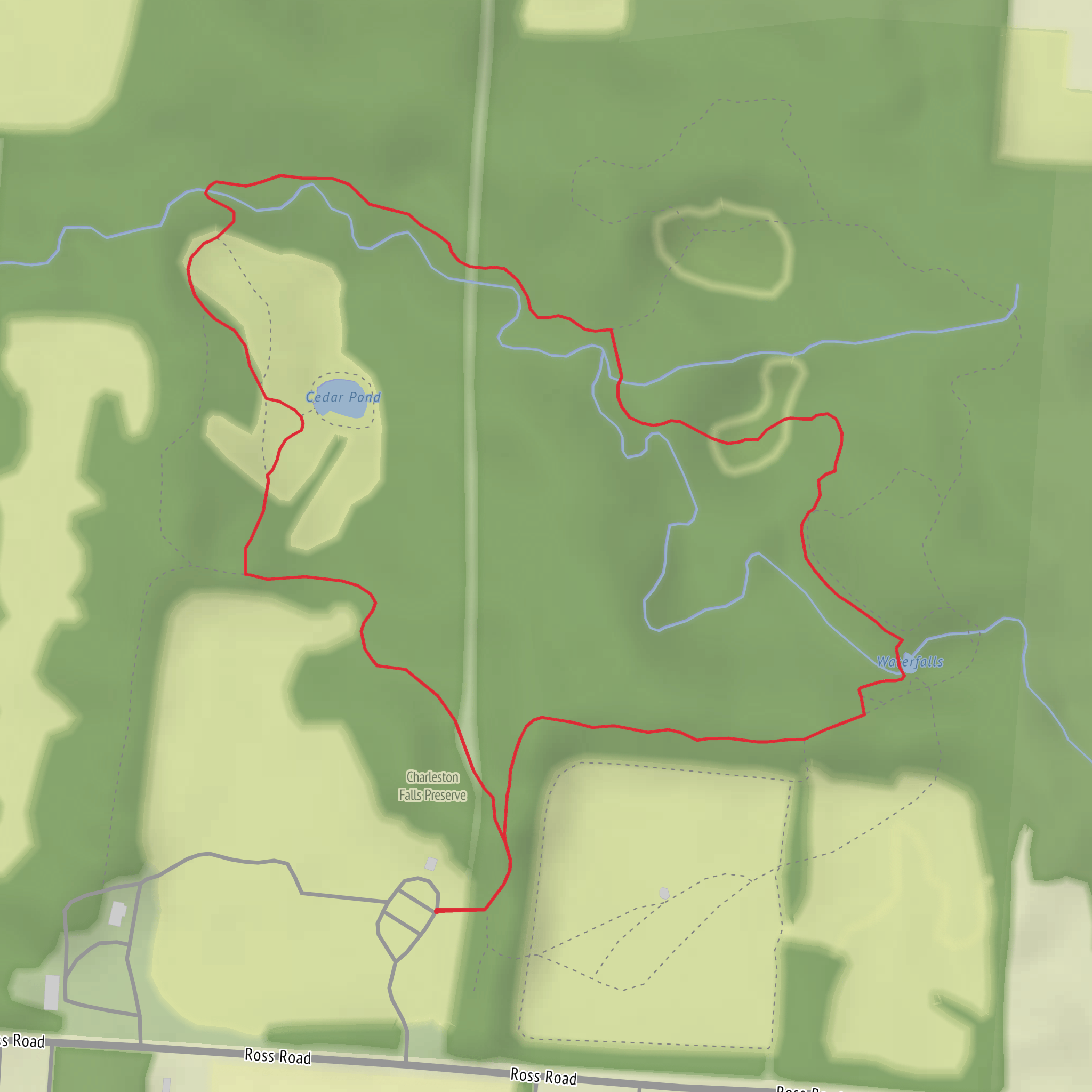
From the main access area, the loop quickly settles into mixed woodland with a cool, shaded feel. Within the first 0.4–0.8 km (0.25–0.5 mi) you’ll start to notice the preserve’s defining feature: water. Small seeps and wet ground hint at the spring-fed system that keeps the creek active.
The waterfall viewpoint is typically reached around 0.8–1.2 km (0.5–0.75 mi) depending on the exact loop option you follow. The falls themselves are a wide, stepped drop over a rocky ledge—more “sheeting” than “plunging”—and they’re especially impressive after recent rain or during spring melt. Take your time here: the best views are often from slightly different angles along the designated path, but stay on-trail to protect fragile streamside plants and to avoid unstable edges.
Past the falls, the loop continues through riparian corridor (creekside habitat) and then back into slightly drier woods as it arcs toward the trailhead. The return leg is usually the quickest-feeling portion, with fewer stops unless you’re birding or photographing wildflowers.
Nature, wildlife, and seasonal highlights
This preserve is a classic Ohio limestone-and-spring setting: cool water, shaded ravines, and rich soils that support a lot of plant diversity.
- Spring (best for wildflowers): Look for trillium, violets, spring beauties, and other ephemeral blooms along the forest floor before the canopy fully leafs out.
- Summer: Dense greenery and shade make it comfortable, but mosquitoes and ticks can be more active—use repellent and do a tick check afterward.
- Fall: Color can be excellent in the hardwoods, and the cooler air makes the loop feel even easier.
- Winter: Ice can form near the falls and on boardwalks/bridges; traction can be helpful if temperatures have been fluctuating around freezing.
Wildlife is typical of protected woodland and creek habitat: songbirds, woodpeckers, frogs and salamanders near wet areas, and occasional white-tailed deer. Move quietly near the creek and you’ll often notice more activity.
Safety and things to look out for
- Slippery rock and wet roots: The area around the falls and creek crossings is the most accident-prone part of the loop. Slow down and keep to the established tread.
- High water after storms: Water levels can rise quickly; avoid stepping onto flooded edges or informal side paths.
- Poison ivy: Common along woodland margins—long socks/pants help if you’re sensitive.
- Leave no trace + preserve rules: This is a protected area; stay on marked trails and respect any seasonal closures or posted guidance.
Historical and regional context
Charleston Falls Preserve protects a landscape shaped by water moving through limestone, creating springs, a creek corridor, and the ledge that forms the waterfall. In this part of Ohio, such sites were historically important as reliable water sources and natural gathering points, and today they’re valued for conserving stream habitat and mature woodland in a region that has seen extensive agricultural and settlement history.
Comments and Reviews
User comments, reviews and discussions about the Charleston Falls in Charleston Falls Preserve Loop, Ohio.
average rating out of 5
0 rating(s)



