
Download
3D Flyover
Add to list
More
2.5 km
~34 min
40 m
Loop
“Wander a mostly level, shaded creek path to Charleston Falls—seasonal sparkle, occasional mud, and quiet reflection.”
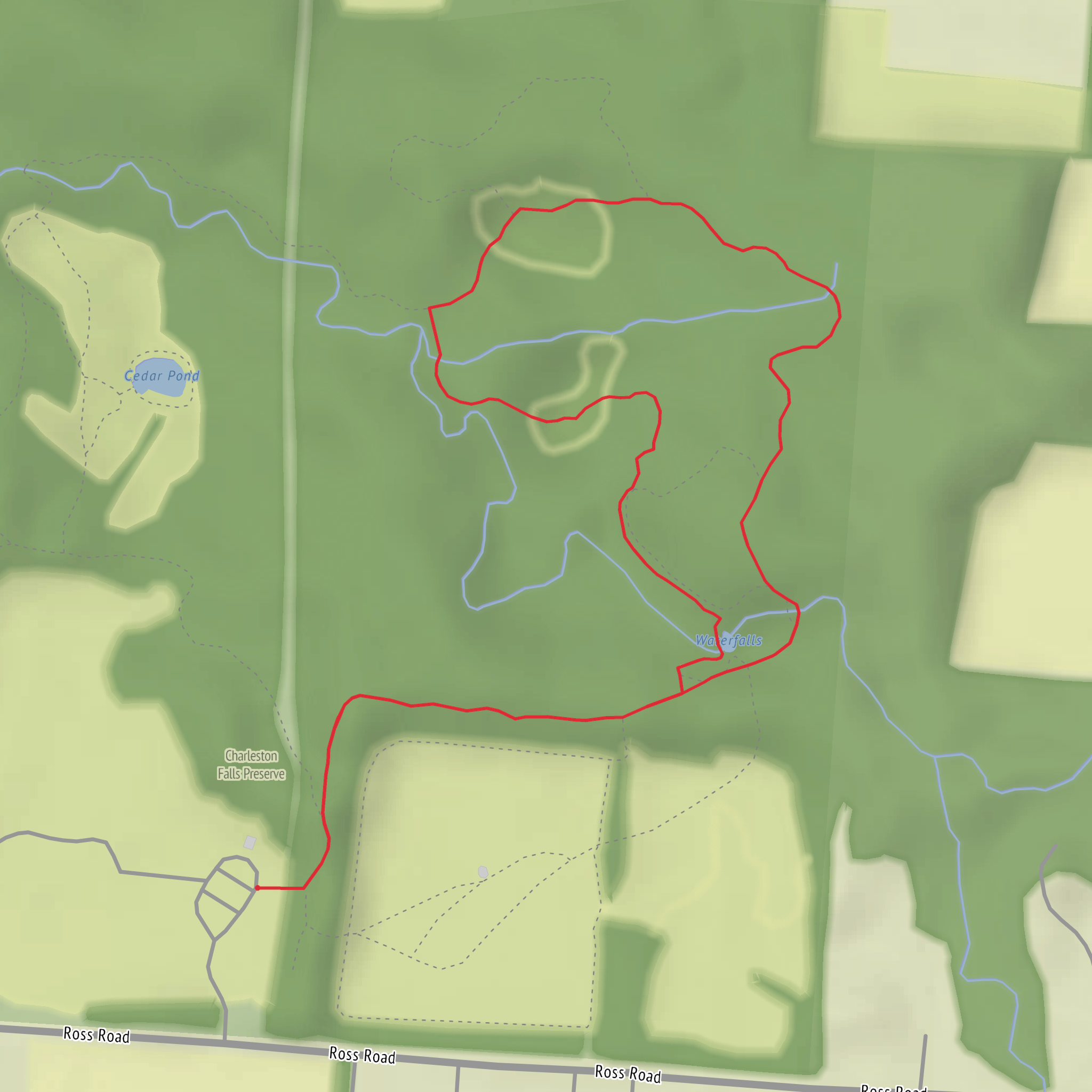
This is a short, mostly level out-and-back style walk of about 3 km (1.9 mi) with ~0 m (0 ft) of climbing overall, built around a scenic waterfall and a shaded creek corridor. It’s well-suited to families, casual walkers, and anyone looking for a nature break without committing to a long day.
Getting to the trailhead (car + public transport)
By car:
Aim for the main access at Charleston Falls Preserve, near 2535 Ross Rd, Tipp City, OH 45371 (the preserve’s primary parking area and trail access). From the Dayton area, you’ll typically approach via I‑75 and local roads toward Tipp City, then follow signs for Charleston Falls Preserve.
By public transport:
There isn’t reliable, direct public transit to the preserve itself. The most workable option is to get as close as you can by bus into Tipp City or Dayton (depending on where you’re coming from), then use a rideshare/taxi for the final leg to Charleston Falls Preserve on Ross Rd. If you’re planning this on a weekend or outside commuter hours, check schedules carefully and expect limited service.
What the walk is like underfoot
Expect a mix of packed dirt, short boardwalk/bridge sections, and potentially muddy patches after rain—especially near the creek and low-lying areas. Because the route is essentially flat, the “effort” comes more from trail conditions than from elevation. After wet weather, traction matters more than fitness: shoes with a bit of tread are helpful even on an easy trail.
Use HiiKER to confirm the exact loop/out-and-back option you’re taking inside the preserve, since there are a few connectors and spurs and it’s easy to accidentally add distance if you follow every side path.
Landmarks you’ll see (with approximate distances)
- 0.0 km / 0.0 mi – Trailhead & preserve entrance area: You’ll start from the main parking/trail access. Early on, the trail typically eases into woodland and follows the drainage toward the falls.
- ~0.8–1.5 km / ~0.5–0.9 mi – Creek corridor & shaded woods: The walk settles into a calm rhythm here. You’ll notice the temperature drop slightly under the canopy in warm months.
- ~1.5 km / ~0.9 mi – Charleston Falls viewpoint/area: The waterfall is the centerpiece. Flow varies a lot by season—often strongest after rain and during spring melt, and sometimes reduced to a trickle in dry spells. The area around the falls can be slick; take your time on any damp rock, roots, or viewing edges.
- ~3.0 km / ~1.9 mi – Return to trailhead: If you’re keeping it to ~3 km, you’ll likely turn around after the falls area or complete a short internal loop that brings you back without adding much distance.
Nature, wildlife, and what to look out for
This preserve is a classic southwestern Ohio woodland-and-stream setting. Depending on season, you can expect:
- Spring: Wildflowers and fresh leaf-out; the creek and falls are often at their most photogenic.
- Summer: Dense shade and thicker vegetation; mosquitoes can be present near water.
- Fall: Color in the canopy and clearer sightlines through the woods.
- Winter: Quiet trails and open views; icy patches can form near the falls and along shaded creek bends.
Common wildlife signs include songbirds, woodpeckers, squirrels, and deer. Near the water, you may spot frogs and other amphibians, especially in wetter months. In warm seasons, plan for ticks in grassy edges and leaf litter—long socks and a quick post-hike check go a long way.
Safety and practical planning
- Waterfall area hazards: The ground near the falls can be slick even when the rest of the trail is dry. Keep a little extra space from edges and step carefully on roots and wet rock.
- After rain: Expect mud and occasional standing water. If you want the easiest footing, go after a few dry days.
- What to bring (even for an easy 3 km / 1.9 mi):
- A small bottle of water
- Light layers (the creek corridor can feel cooler)
- Bug spray in warm months
- A basic first-aid item or blister care
- HiiKER for staying on the intended short route and avoiding extra spur mileage
- A small bottle of water
Historical significance of the area
Charleston Falls Preserve sits within a landscape shaped by glacial history that influenced southwestern Ohio’s stream valleys and drainage patterns. The falls and gorge-like creek setting are part of that broader story of water cutting through layered sediments and bedrock over time. The region around Tipp City also reflects Ohio’s long human history—first Indigenous presence and travel corridors, then later settlement and agricultural development—while preserves like this protect remaining pockets of native habitat and waterways that once would have been far more widespread.
If you share the exact lon/lat you have for the start point (or any waypoint), I can pin it to the nearest specific address or named landmark and tailor the directions and the on-trail sequence to match the exact access you’re using.
Comments and Reviews
User comments, reviews and discussions about the Charleston Falls, Ohio.
average rating out of 5
0 rating(s)



