
Download
3D Flyover
Add to list
More
4.3 km
~53 min
16 m
Loop
“Slip into French Creek’s shaded hush—soft paths, murmuring water, and seasonal wildlife, sometimes damp.”
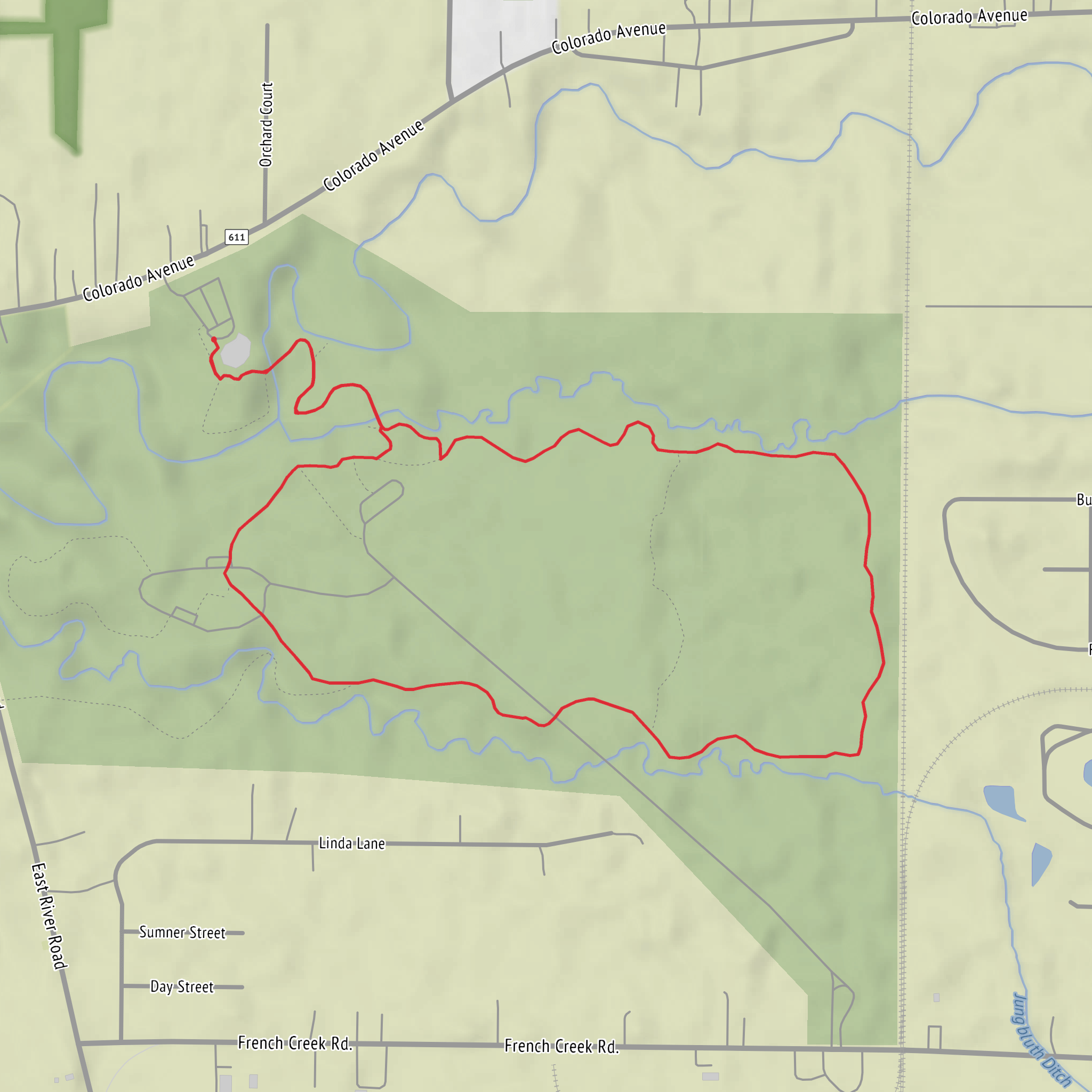
French Creek sits in a low-lying, wooded creek corridor, so this easy loop-style walk is mostly about quiet forest, water, and seasonal wildlife rather than climbing. At roughly 4 km (2.5 mi) with about 0 m (0 ft) of elevation gain, it’s well-suited to families, beginners, and anyone looking for a short nature-focused outing—expect gentle grades, a few potentially damp spots, and lots of shade.
Getting to the trailhead (car + public transport)
Because the hike head location is listed only as “near” (with no coordinates or place name), the best I can do is describe the typical access pattern for French Creek trailheads: they’re usually reached from a small parking area near a nature center, park entrance, or signed trail kiosk close to the creek.
- By car: Plan to park at the nearest signed trail lot for the Nature Trail/Big Woods Trail junction. If you share the longitude/latitude (or even a nearby town/park name), I can convert it to the nearest known address or landmark and give turn-by-turn approach guidance.
- By public transport: If there’s service, it’s typically bus to the nearest town center or park-adjacent stop, then a short rideshare or walk to the trailhead. Share the nearest city/stop you’re using and I’ll tailor the approach.
Before you go, pull the route up on HiiKER and download it for offline use—creekside woods can have patchy reception, and short connector paths can look similar.
What the route feels like underfoot
You’ll be moving through mixed woodland on well-defined paths, often with a soft surface (leaf litter, packed dirt) and occasional roots. With essentially no elevation change, the main “effort” variables are:
- Mud and wet footing: Creek-adjacent trails can hold water after rain or snowmelt. Even on an easy walk, slick leaves on hard-packed soil can be the most common slip hazard.
- Short boardwalks/bridges (where present): These can be slick when damp or frosty.
- Narrower singletrack sections: The Nature Trail portions are often narrower and more “interpretive,” while Big Woods Trail segments tend to feel like a steadier forest ramble.
If you’re aiming for a relaxed pace with time to look around, many hikers take 60–90 minutes for 4 km (2.5 mi) depending on stops.
Landmarks, nature, and wildlife to watch for
The standout feature is the creek corridor itself—look for subtle changes in vegetation as you move between slightly higher ground and the wetter floodplain edges.
- Creek views and riparian plants: Expect moisture-loving plants near the water and taller, older trees where the ground stays a bit drier. In spring and early summer, wildflowers can be most noticeable along trail edges where light filters through.
- Birdlife: Creek corridors are reliable for songbirds; early morning is usually best for activity. You may also see woodpeckers in mature forest sections.
- Amphibians and insects: After wet weather, watch for frogs/salamanders near puddled sections and listen for calls near still water pockets.
- Deer and small mammals: Quiet walking and pausing at bends near the creek increases your chances of spotting movement.
Practical wildlife cautions: - Ticks: Common in wooded, brushy edges—use repellent, wear long socks, and do a tick check afterward. - Mosquitoes/gnats: Especially near water in warm months; a light head net can be helpful if conditions are buggy. - Snakes: In many creek-and-woods systems, snakes are present but typically avoid people; watch where you place hands/feet near logs and sunny trail margins.
Navigation and planning notes (easy doesn’t mean “no prep”)
Even on a short route, it’s worth planning for small trail-network surprises: - Junctions: Nature trails often have spur loops and interpretive side paths. Confirm each turn on HiiKER at intersections so you don’t accidentally add distance. - High water: After heavy rain, low crossings can be muddy or briefly flooded. If the creek is out of its banks, turn around rather than forcing a crossing. - Footwear: Light hikers or trail runners are fine in dry conditions; after rain, consider shoes with better tread and bring a spare pair of socks.
What to pack for a 4 km (2.5 mi) easy walk: - Water (at least 0.5 L per person; more in heat) - Bug protection in warm months - A light layer (woods can feel cooler than nearby open areas) - Basic first aid + blister care - Offline map on HiiKER
Historical significance of the region (what “French Creek” often indicates)
Many places named French Creek in the U.S. sit in landscapes shaped by early travel corridors—creeks were natural routes for Indigenous peoples, later used by settlers for mills, small industry, and transport. In forested creek valleys, you’ll sometimes notice: - Old stonework or foundations near water (remnants of small mills/bridges) - Second-growth forest patterns where land was once cleared and later reforested - Historic road alignments that parallel waterways
If you tell me which state/park this French Creek is in (or provide coordinates), I can pin down the specific local history (Indigenous nations connected to the area, settlement era, and any documented mill/industry sites) and point out what to look for along this exact route.
Surfaces
Gravel
Ground
Unknown
Unpaved
Comments and Reviews
User comments, reviews and discussions about the French Creek via Nature Trail and Big Woods Trail, Ohio.
average rating out of 5
0 rating(s)

